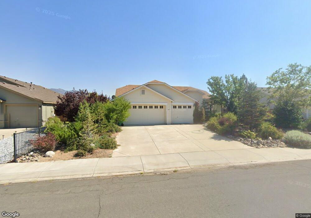
207 Bobcat Dr Dayton, NV 89403
Estimated Value: $461,600 - $492,000
3
Beds
2
Baths
1,724
Sq Ft
$275/Sq Ft
Est. Value
About This Home
This home is located at 207 Bobcat Dr, Dayton, NV 89403 and is currently estimated at $474,650, approximately $275 per square foot. 207 Bobcat Dr is a home located in Lyon County with nearby schools including Riverview Elementary School, Dayton Intermediate School, and Dayton High School.
Ownership History
Date
Name
Owned For
Owner Type
Purchase Details
Closed on
Aug 10, 2005
Sold by
Stout James E and Stout Denice A
Bought by
Turner Lisa N
Current Estimated Value
Home Financials for this Owner
Home Financials are based on the most recent Mortgage that was taken out on this home.
Original Mortgage
$99,900
Outstanding Balance
$52,141
Interest Rate
5.56%
Mortgage Type
New Conventional
Estimated Equity
$422,509
Create a Home Valuation Report for This Property
The Home Valuation Report is an in-depth analysis detailing your home's value as well as a comparison with similar homes in the area
Home Values in the Area
Average Home Value in this Area
Purchase History
| Date | Buyer | Sale Price | Title Company |
|---|---|---|---|
| Turner Lisa N | $339,900 | Western Title Company |
Source: Public Records
Mortgage History
| Date | Status | Borrower | Loan Amount |
|---|---|---|---|
| Open | Turner Lisa N | $99,900 |
Source: Public Records
Tax History Compared to Growth
Tax History
| Year | Tax Paid | Tax Assessment Tax Assessment Total Assessment is a certain percentage of the fair market value that is determined by local assessors to be the total taxable value of land and additions on the property. | Land | Improvement |
|---|---|---|---|---|
| 2025 | $2,108 | $121,420 | $52,500 | $68,920 |
| 2024 | $2,046 | $121,940 | $52,500 | $69,440 |
| 2023 | $2,046 | $117,427 | $52,500 | $64,927 |
| 2022 | $1,667 | $105,276 | $45,270 | $60,006 |
| 2021 | $1,618 | $99,786 | $41,160 | $58,626 |
| 2020 | $1,570 | $97,433 | $41,160 | $56,273 |
| 2019 | $1,524 | $79,812 | $25,730 | $54,082 |
| 2018 | $1,480 | $70,023 | $17,150 | $52,873 |
| 2017 | $1,437 | $61,515 | $8,580 | $52,935 |
| 2016 | $1,401 | $54,566 | $5,780 | $48,786 |
| 2015 | $1,398 | $46,060 | $5,780 | $40,280 |
| 2014 | $1,357 | $42,508 | $5,780 | $36,728 |
Source: Public Records
Map
Nearby Homes
- 306 Valley Vista Dr
- 606 Occidental Dr
- 131 Mcgill Ct
- 26 Kelsey Ct
- 677 Teakwood Rd
- 36 Kelsey Ct
- 20 Cedar Crest Ct
- 1440 Riverpark Pkwy
- 505 Yellow Jacket Rd
- 19 Sandefer Ln
- 915 Saltbrush Rd
- 917 Saltbrush Rd
- 520 Yellow Jacket Rd
- 103 Rio Grande Way
- 1145 Cheatgrass Dr
- 1232 Stratton Dr
- 1498 Riverpark Pkwy
- 1122 Ferretto Pkwy
- 125 Oakmont Dr
- 813 Camp Station Dr Unit Homesite 303
- 205 Bobcat Dr Unit 1A
- 209 Bobcat Dr
- 203 Bobcat Dr
- 606 Sunrise Dr
- 608 Sunrise Dr
- 604 Sunrise Dr
- 206 Bobcat Dr
- 201 Bobcat Dr
- 498 Occidental Dr
- 202 Bobcat Dr
- 496 Occidental Dr
- 602 Sunrise Dr
- 600 Sunrise Dr Unit 2
- 494 Occidental Dr
- 210 Bobcat Dr
- 200 Bobcat Dr
- 492 Occidental Dr
- 212 Bobcat Dr
- 317 Valley Vista Dr
- 607 Sunrise Dr