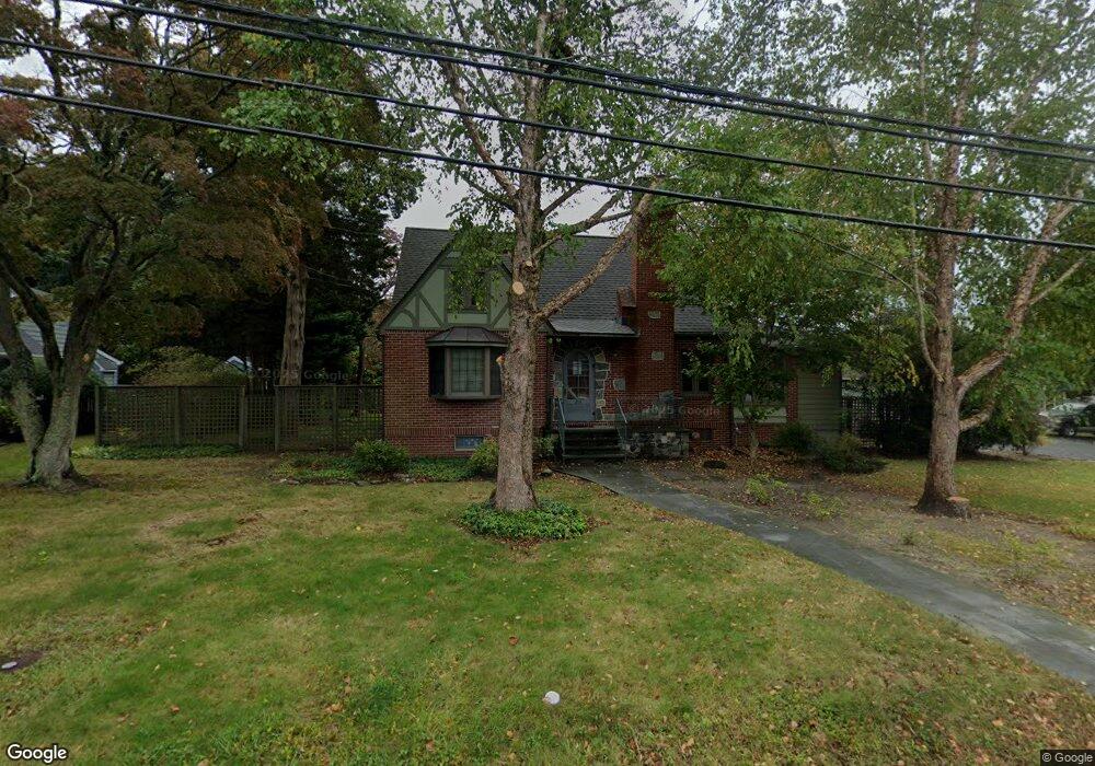
207 Brighton Rd Cape May Court House, NJ 08210
Estimated Value: $400,000
--
Bed
--
Bath
--
Sq Ft
10,019
Sq Ft Lot
About This Home
This home is located at 207 Brighton Rd, Cape May Court House, NJ 08210 and is currently estimated at $400,000. 207 Brighton Rd is a home with nearby schools including Middle Township Elementary No. 1, Middle Township Elementary No. 2, and Middle Township Middle School.
Ownership History
Date
Name
Owned For
Owner Type
Purchase Details
Closed on
Jan 16, 2023
Sold by
Amended Frances Longstreth Wallace 2016
Bought by
Grandchildren Trust and Frances Longstreth Wallace 2016 Amended & Res
Current Estimated Value
Purchase Details
Closed on
Sep 13, 2021
Sold by
Longstreth Frances Est
Bought by
Frances L Wallace T
Purchase Details
Closed on
Jul 30, 2004
Sold by
Seaboard Exchange Corp
Bought by
Wallace Frances Longstreth
Purchase Details
Closed on
Jul 15, 2004
Sold by
Hickok Troy
Bought by
Seaboard Exchange Corp
Create a Home Valuation Report for This Property
The Home Valuation Report is an in-depth analysis detailing your home's value as well as a comparison with similar homes in the area
Home Values in the Area
Average Home Value in this Area
Purchase History
| Date | Buyer | Sale Price | Title Company |
|---|---|---|---|
| Grandchildren Trust | -- | None Listed On Document | |
| Frances L Wallace T | -- | None Available | |
| Wallace Frances Longstreth | -- | -- | |
| Seaboard Exchange Corp | $139,000 | -- |
Source: Public Records
Tax History Compared to Growth
Tax History
| Year | Tax Paid | Tax Assessment Tax Assessment Total Assessment is a certain percentage of the fair market value that is determined by local assessors to be the total taxable value of land and additions on the property. | Land | Improvement |
|---|---|---|---|---|
| 2025 | $2,689 | $127,500 | $127,500 | -- |
| 2024 | $2,689 | $127,500 | $127,500 | $0 |
| 2023 | $2,621 | $127,500 | $127,500 | $0 |
| 2022 | $2,546 | $127,500 | $127,500 | $0 |
| 2021 | $2,485 | $127,500 | $127,500 | $0 |
| 2020 | $2,434 | $127,500 | $127,500 | $0 |
| 2019 | $2,372 | $127,500 | $127,500 | $0 |
| 2018 | $2,335 | $127,500 | $127,500 | $0 |
| 2017 | $2,287 | $127,500 | $127,500 | $0 |
| 2016 | $2,230 | $127,500 | $127,500 | $0 |
| 2015 | $2,213 | $127,500 | $127,500 | $0 |
| 2014 | $2,199 | $127,500 | $127,500 | $0 |
Source: Public Records
Map
Nearby Homes
- 26 Crest Rd
- 33 E Mechanic St
- 100 Osprey Dr Unit 100
- 308 Osprey Dr Unit 1003E1
- 530 Stone Harbor Blvd
- 3 Whimbrel Way Unit B1
- 3 Whimbrel Way Unit 3 Whimbrel
- 24 Church St
- 706 Bennett Rd
- 13 Poplar St
- 215 S Boyd St
- 105 E Atlantic Ave
- 306 3rd St
- 220 Hand Ave
- 430 Route 9 N
- 430 Route 9 N Unit 45
- 310 Front St
- 212 Shunpike Rd
- 211 Colonial Ave
- 300 Court House South Dennis Rd
- 211 Brighton Rd
- 202 Fairmont Rd
- 208 Fairmont Rd
- 215 Brighton Rd
- 219 Brighton Rd
- 214 Fairmont Rd
- 207 Fairmont Rd
- 200 Ormond Rd
- 211 Fairmont Rd
- 216 Fairmont Rd
- 213 Fairmont Rd
- 208 Highland Rd
- 32 Crest Rd
- 30 Crest Rd
- 215 Fairmont Rd
- 210 Highland Rd
- 218 Fairmont Rd
- 34 Crest Rd
- 217 Fairmont Rd
- 28 Crest Rd