207 Channel Marker Loop Swansboro, NC 28584
Estimated Value: $298,000 - $311,000
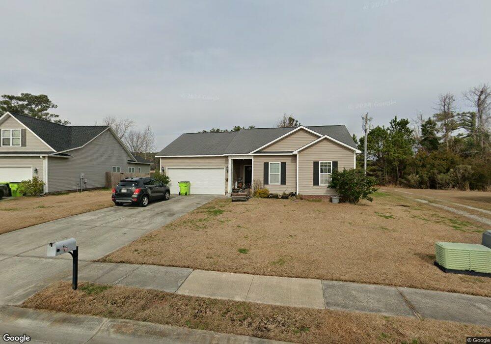
About This Home
This home is located at 207 Channel Marker Loop, Swansboro, NC 28584 and is currently estimated at $304,699, approximately $243 per square foot. 207 Channel Marker Loop is a home with nearby schools including Swansboro Elementary School, Swansboro Middle School, and Swansboro High School.
Ownership History
We collect this data history from publicly available records. To have your information removed, we recommend requesting removal directly through your county’s website.
Purchase Details
Home Financials for this Owner
Home Financials are based on the most recent Mortgage that was taken out on this home.Home Values in the Area
Average Home Value in this Area
Purchase History
We collect this data history from publicly available records. To have your information removed, we recommend requesting removal directly through your county’s website.
| Date | Buyer | Sale Price | Title Company |
|---|---|---|---|
| $129,500 | None Available |
Mortgage History
We collect this data history from publicly available records. To have your information removed, we recommend requesting removal directly through your county’s website.
| Date | Status | Borrower | Loan Amount |
|---|---|---|---|
| Open | $132,284 |
Tax History
We collect this data history from publicly available records. To have your information removed, we recommend requesting removal directly through your county’s website.
| Year | Tax Paid | Tax Assessment Tax Assessment Total Assessment is a certain percentage of the fair market value that is determined by local assessors to be the total taxable value of land and additions on the property. | Land | Improvement |
|---|---|---|---|---|
| 2025 | $1,999 | $198,865 | $45,000 | $153,865 |
| 2024 | $1,999 | $198,865 | $45,000 | $153,865 |
| 2023 | $1,999 | $198,865 | $45,000 | $153,865 |
| 2022 | $1,999 | $198,865 | $45,000 | $153,865 |
| 2021 | $1,602 | $151,830 | $36,000 | $115,830 |
| 2020 | $1,602 | $151,830 | $36,000 | $115,830 |
| 2019 | $1,602 | $151,830 | $36,000 | $115,830 |
| 2018 | $1,602 | $151,830 | $36,000 | $115,830 |
| 2017 | $1,555 | $151,740 | $38,000 | $113,740 |
| 2016 | $1,555 | $151,740 | $0 | $0 |
| 2015 | $1,555 | $151,740 | $0 | $0 |
| 2014 | $1,555 | $151,740 | $0 | $0 |
Map
- 102 Borough Nest Dr
- 552 Swansboro Loop Rd
- 161 Howard Ln
- 206 Low Country Ln
- 1223 W Corbett Ave
- 16 Outrigger Dr
- 21 Outrigger Dr
- 6 Outrigger Dr
- 68 Catalina Cir
- 14 Catalina Cir
- 14 Schooner Dr Unit 6
- 42 Catalina Cir
- 105 Forest Ln
- 79 Crush Ct
- 120 Plantation Dr
- 515 Shipyard Ct
- 209 Brittany Ln
- 306 Joans Ridge
- 252 Watercrest Landing Way
- 135 Otway Burns Dr
- 206 Channel Marker Loop
- 204 Channel Marker Loop
- 208 Channel Marker Loop
- 202 Channel Marker Loop
- 210 Channel Marker Loop
- 105 Borough Nest Dr
- 209 Channel Marker Loop
- 107 Borough Nest Dr
- 211 Channel Marker Loop
- 200 Channel Marker Loop
- 212 Channel Marker Loop
- 213 Channel Marker Loop
- 300 Bouy Ct
- 302 Buoy Ct
- 215 Channel Marker Loop
- 205 Channel Marker Loop
- 203 Channel Marker Loop
- 214 Channel Marker Loop
- 108 Borough Nest Dr
- 106 Borough Nest Dr
Ask me questions while you tour the home.