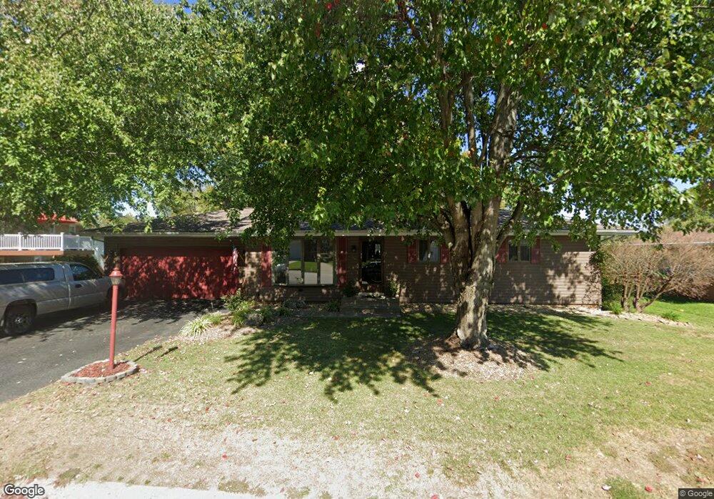
207 Chapel Dr Collinsville, IL 62234
Estimated Value: $227,000 - $262,000
3
Beds
1
Bath
1,164
Sq Ft
$213/Sq Ft
Est. Value
About This Home
This home is located at 207 Chapel Dr, Collinsville, IL 62234 and is currently estimated at $248,431, approximately $213 per square foot. 207 Chapel Dr is a home located in Madison County with nearby schools including John A Renfro Elementary School, Dorris Intermediate School, and Collinsville Middle School.
Ownership History
Date
Name
Owned For
Owner Type
Purchase Details
Closed on
Sep 28, 2011
Sold by
Woolard Richard G and Woolard Pamela S
Bought by
Sloan Leroy M
Current Estimated Value
Home Financials for this Owner
Home Financials are based on the most recent Mortgage that was taken out on this home.
Original Mortgage
$141,324
Outstanding Balance
$96,991
Interest Rate
4.23%
Mortgage Type
FHA
Estimated Equity
$151,440
Create a Home Valuation Report for This Property
The Home Valuation Report is an in-depth analysis detailing your home's value as well as a comparison with similar homes in the area
Home Values in the Area
Average Home Value in this Area
Purchase History
| Date | Buyer | Sale Price | Title Company |
|---|---|---|---|
| Sloan Leroy M | $145,000 | Abstracts & Titles Inc |
Source: Public Records
Mortgage History
| Date | Status | Borrower | Loan Amount |
|---|---|---|---|
| Open | Sloan Leroy M | $141,324 |
Source: Public Records
Tax History Compared to Growth
Tax History
| Year | Tax Paid | Tax Assessment Tax Assessment Total Assessment is a certain percentage of the fair market value that is determined by local assessors to be the total taxable value of land and additions on the property. | Land | Improvement |
|---|---|---|---|---|
| 2024 | $4,100 | $70,140 | $14,650 | $55,490 |
| 2023 | $4,100 | $63,950 | $13,330 | $50,620 |
| 2022 | $3,814 | $59,140 | $12,330 | $46,810 |
| 2021 | $3,423 | $55,560 | $11,580 | $43,980 |
| 2020 | $3,281 | $53,010 | $11,050 | $41,960 |
| 2019 | $3,063 | $49,540 | $10,310 | $39,230 |
| 2018 | $2,982 | $46,930 | $9,770 | $37,160 |
| 2017 | $2,976 | $46,000 | $9,580 | $36,420 |
| 2016 | $3,126 | $46,000 | $9,580 | $36,420 |
| 2015 | $2,664 | $44,800 | $9,330 | $35,470 |
| 2014 | $2,664 | $44,800 | $9,330 | $35,470 |
| 2013 | $2,664 | $44,800 | $9,330 | $35,470 |
Source: Public Records
Map
Nearby Homes
- 0 N Keebler Ave
- 414 Bunker Hill Dr
- 1224 Cedar Ridge Ct
- 203 Greenfield Dr
- 22 Brookwood Dr
- 10 White Lily Dr
- 5 Brookwood Dr
- 1120 Williams St
- 1210 Constance St
- 308 Brown Ave
- 617 N Morrison Ave
- 706 Illinois Ave
- 102 Toni Ct
- 0 Strong Ave
- 501 Spring
- 123 W Wickliffe Ave
- 123 Elliot St
- 1227 Ridge Ave
- 625 W Country Ln
- 2007 Belt Line Rd
- 205 Chapel Dr
- 111 Lexington Dr
- 109 Lexington Dr
- 203 Chapel Dr
- 208 Chapel Dr
- 107 Lexington Dr
- 110 Lexington Dr
- 1603 Saratoga Dr
- 210 Chapel Dr
- 204 Chapel Dr
- 1601 Saratoga Dr
- 104 Lexington Dr
- 212 Chapel Dr
- 7 Crestmont Dr
- 202 Chapel Dr
- 213 Chapel Dr
- 1605 Saratoga Dr
- 105 Lexington Dr
- 102 Lexington Dr
- 207 Yorktown Dr