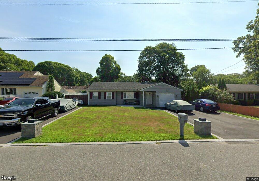
207 Concord Rd Shirley, NY 11967
Estimated Value: $432,000 - $513,000
3
Beds
1
Bath
1,133
Sq Ft
$411/Sq Ft
Est. Value
About This Home
This home is located at 207 Concord Rd, Shirley, NY 11967 and is currently estimated at $466,035, approximately $411 per square foot. 207 Concord Rd is a home located in Suffolk County with nearby schools including Nathaniel Woodhull Elementary School, William Paca Middle School, and William Floyd High School.
Ownership History
Date
Name
Owned For
Owner Type
Purchase Details
Closed on
Feb 2, 2005
Sold by
Desantis Andrew
Bought by
Kietsock Eric M
Current Estimated Value
Purchase Details
Closed on
May 28, 2002
Sold by
Miglino Gregory and Miglino Susan
Bought by
Desantis Andrew and Desantis Kathryn
Home Financials for this Owner
Home Financials are based on the most recent Mortgage that was taken out on this home.
Original Mortgage
$146,550
Interest Rate
6.8%
Mortgage Type
FHA
Create a Home Valuation Report for This Property
The Home Valuation Report is an in-depth analysis detailing your home's value as well as a comparison with similar homes in the area
Home Values in the Area
Average Home Value in this Area
Purchase History
| Date | Buyer | Sale Price | Title Company |
|---|---|---|---|
| Kietsock Eric M | $262,000 | Francis Bosco | |
| Desantis Andrew | $148,900 | -- |
Source: Public Records
Mortgage History
| Date | Status | Borrower | Loan Amount |
|---|---|---|---|
| Previous Owner | Desantis Andrew | $146,550 |
Source: Public Records
Tax History
| Year | Tax Paid | Tax Assessment Tax Assessment Total Assessment is a certain percentage of the fair market value that is determined by local assessors to be the total taxable value of land and additions on the property. | Land | Improvement |
|---|---|---|---|---|
| 2024 | $6,520 | $1,825 | $150 | $1,675 |
| 2023 | $6,520 | $1,825 | $150 | $1,675 |
| 2022 | $6,562 | $1,825 | $150 | $1,675 |
| 2021 | $6,562 | $1,825 | $150 | $1,675 |
| 2020 | $6,739 | $1,750 | $150 | $1,600 |
| 2019 | $6,739 | $0 | $0 | $0 |
| 2018 | $6,448 | $1,750 | $150 | $1,600 |
| 2017 | $6,448 | $1,750 | $150 | $1,600 |
| 2016 | $6,475 | $1,750 | $150 | $1,600 |
| 2015 | -- | $1,750 | $150 | $1,600 |
| 2014 | -- | $1,750 | $150 | $1,600 |
Source: Public Records
Map
Nearby Homes
- 199 Concord Rd
- 54 Beacon St
- 182 Lexington Rd
- 20 Beacon St
- 160 Hounslow Rd
- 39 Appel Dr E
- 70 Breston Dr E
- Vacant Lot The Green
- VL - (Sec 937 Lot 14 The Green
- 0 Amarr Dr Unit KEYL3493702
- 10 Amarr Dr
- Vacant Land Mastic Rd
- Lots 6-10.2 Mastic Rd
- 19 Appel Dr E
- 3 Windus Dr
- 94 Lakeside Ct
- 16 Market St
- 43 Adobe Dr
- 15 Cricket Ct
- 126 Floyd Rd
Your Personal Tour Guide
Ask me questions while you tour the home.