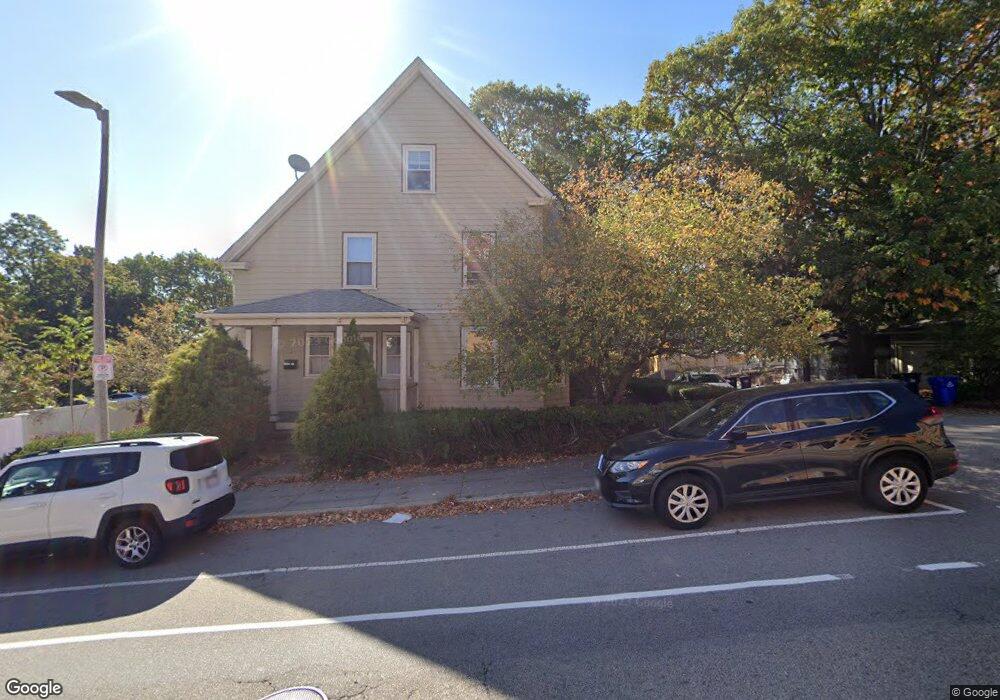
207 Cummins Hwy Unit 2 Roslindale, MA 02131
Roslindale NeighborhoodEstimated Value: $543,000 - $732,000
3
Beds
2
Baths
1,442
Sq Ft
$462/Sq Ft
Est. Value
About This Home
This home is located at 207 Cummins Hwy Unit 2, Roslindale, MA 02131 and is currently estimated at $666,088, approximately $461 per square foot. 207 Cummins Hwy Unit 2 is a home located in Suffolk County with nearby schools including Brooke Charter School Roslindale, Sacred Heart STEM School, and St. Clare High School.
Ownership History
Date
Name
Owned For
Owner Type
Purchase Details
Closed on
Mar 29, 2012
Sold by
Cardillo Domenico
Bought by
Gomez Elizabeth
Current Estimated Value
Purchase Details
Closed on
Jan 22, 2008
Sold by
Gomez Elizabeth
Bought by
Cardillo Domenico and Gomez Elizabeth
Purchase Details
Closed on
May 17, 2004
Sold by
Lydon Liam
Bought by
Gomez Elizabeth
Home Financials for this Owner
Home Financials are based on the most recent Mortgage that was taken out on this home.
Original Mortgage
$305,100
Interest Rate
5.47%
Mortgage Type
Purchase Money Mortgage
Create a Home Valuation Report for This Property
The Home Valuation Report is an in-depth analysis detailing your home's value as well as a comparison with similar homes in the area
Home Values in the Area
Average Home Value in this Area
Purchase History
| Date | Buyer | Sale Price | Title Company |
|---|---|---|---|
| Gomez Elizabeth | -- | -- | |
| Cardillo Domenico | -- | -- | |
| Gomez Elizabeth | $339,000 | -- |
Source: Public Records
Mortgage History
| Date | Status | Borrower | Loan Amount |
|---|---|---|---|
| Previous Owner | Gomez Elizabeth | $357,229 | |
| Previous Owner | Gomez Elizabeth | $305,100 |
Source: Public Records
Tax History Compared to Growth
Tax History
| Year | Tax Paid | Tax Assessment Tax Assessment Total Assessment is a certain percentage of the fair market value that is determined by local assessors to be the total taxable value of land and additions on the property. | Land | Improvement |
|---|---|---|---|---|
| 2025 | $7,367 | $636,200 | $0 | $636,200 |
| 2024 | $5,950 | $545,900 | $0 | $545,900 |
| 2023 | $5,581 | $519,600 | $0 | $519,600 |
| 2022 | $5,283 | $485,600 | $0 | $485,600 |
| 2021 | $4,842 | $453,800 | $0 | $453,800 |
| 2020 | $4,839 | $458,200 | $0 | $458,200 |
| 2019 | $4,599 | $436,300 | $0 | $436,300 |
| 2018 | $4,572 | $436,300 | $0 | $436,300 |
| 2017 | $4,400 | $415,500 | $0 | $415,500 |
| 2016 | $4,155 | $377,700 | $0 | $377,700 |
| 2015 | $3,658 | $302,100 | $0 | $302,100 |
| 2014 | $3,548 | $282,000 | $0 | $282,000 |
Source: Public Records
Map
Nearby Homes
- 16 Hilburn Place
- 4 Rowe Ct
- 543 Hyde Park Ave Unit 1
- 250 Poplar St Unit 1
- 2 Pinedale Rd Unit 3
- 27 Rowe St
- 650 Hyde Park Ave Unit 2
- 61 Whitford St
- 472 Hyde Park Ave Unit 472
- 117 Sycamore St Unit 1
- 41 Hawthorne St Unit 2
- 19-21 Augustus Ave
- 28-30 Mount Hope St
- 67 Cummins Hwy Unit 101
- 67 Cummins Hwy Unit 304
- 886 Canterbury St
- 42 Wilmot St
- 32 Jewett St
- 87 Clare Ave
- 3 Whitford St
- 207 Cummins Hwy Unit 3
- 207 Cummins Hwy Unit 1R
- 207 Cummins Hwy Unit 1F
- 207 Cummins Hwy
- 4 Ada St Unit 1R
- 4 Ada St Unit 2
- 4 Ada St Unit 3
- 16 Ada St Unit 18
- 16-18 Ada St
- 18 Ada St Unit 1
- 16 Ada St Unit 2
- 16 Ada St Unit 1
- 55 Brown Ave
- 195 Cummins Hwy
- 49 Brown Ave Unit 51
- 51 Brown Ave Unit 51
- 10 Delore Cir
- 20 Ada St
- 45 Brown Ave
- 223 Cummins Hwy