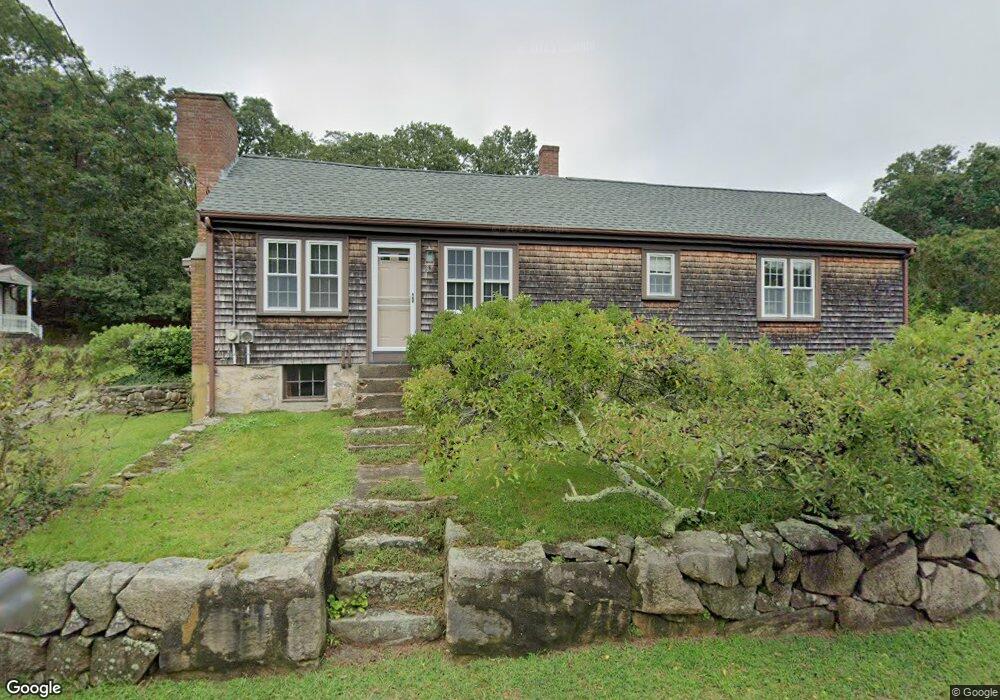
207 Drift Rd Westport, MA 02790
Head of Westport NeighborhoodEstimated Value: $533,000 - $668,000
2
Beds
2
Baths
1,790
Sq Ft
$339/Sq Ft
Est. Value
About This Home
This home is located at 207 Drift Rd, Westport, MA 02790 and is currently estimated at $607,060, approximately $339 per square foot. 207 Drift Rd is a home located in Bristol County with nearby schools including Alice A. Macomber Primary School, Westport Elementary School, and Westport Middle-High School.
Ownership History
Date
Name
Owned For
Owner Type
Purchase Details
Closed on
Sep 6, 2019
Sold by
Burbank Lillian and Burbank Howard N
Bought by
Burbank Karen M and Barbank Anthony H
Current Estimated Value
Purchase Details
Closed on
Jun 2, 1970
Bought by
Burbank Howard N and Burbank Lillian
Create a Home Valuation Report for This Property
The Home Valuation Report is an in-depth analysis detailing your home's value as well as a comparison with similar homes in the area
Home Values in the Area
Average Home Value in this Area
Purchase History
| Date | Buyer | Sale Price | Title Company |
|---|---|---|---|
| Burbank Karen M | -- | -- | |
| Burbank Howard N | -- | -- |
Source: Public Records
Mortgage History
| Date | Status | Borrower | Loan Amount |
|---|---|---|---|
| Previous Owner | Burbank Howard N | $70,000 | |
| Previous Owner | Burbank Howard N | $60,000 | |
| Previous Owner | Burbank Howard N | $50,000 |
Source: Public Records
Tax History Compared to Growth
Tax History
| Year | Tax Paid | Tax Assessment Tax Assessment Total Assessment is a certain percentage of the fair market value that is determined by local assessors to be the total taxable value of land and additions on the property. | Land | Improvement |
|---|---|---|---|---|
| 2025 | $3,315 | $444,900 | $222,100 | $222,800 |
| 2024 | $3,317 | $429,100 | $206,700 | $222,400 |
| 2023 | $2,818 | $345,400 | $197,400 | $148,000 |
| 2022 | $2,838 | $356,300 | $197,400 | $158,900 |
| 2021 | $4,484 | $329,200 | $180,500 | $148,700 |
| 2020 | $2,664 | $316,000 | $167,300 | $148,700 |
| 2019 | $2,434 | $294,300 | $154,500 | $139,800 |
| 2018 | $2,651 | $324,500 | $174,000 | $150,500 |
| 2017 | $2,551 | $320,100 | $174,000 | $146,100 |
| 2016 | $2,480 | $313,500 | $174,000 | $139,500 |
| 2015 | $2,366 | $298,300 | $177,800 | $120,500 |
Source: Public Records
Map
Nearby Homes
- 47 Fallon Dr
- Lot 0 Marcotte
- 0 Hidden Glen Ln
- 118 Charlotte White Rd Extension
- 4 Main Rd
- 118 Charlotte White Rd
- 8 Strawberry Ln
- 27 Dias Ave
- 73 White Oak Run
- 96 Forge Rd
- 3 Roller Coaster Way Unit Lot 1
- 29 Union Ave
- 461 Reed Rd
- 6 Angel Ct
- 7 Village Way
- 15 Village Way
- 8 Village Way
- 978 Sodom Rd
- 837 Main Rd
- 9 Kyle Jacob Rd