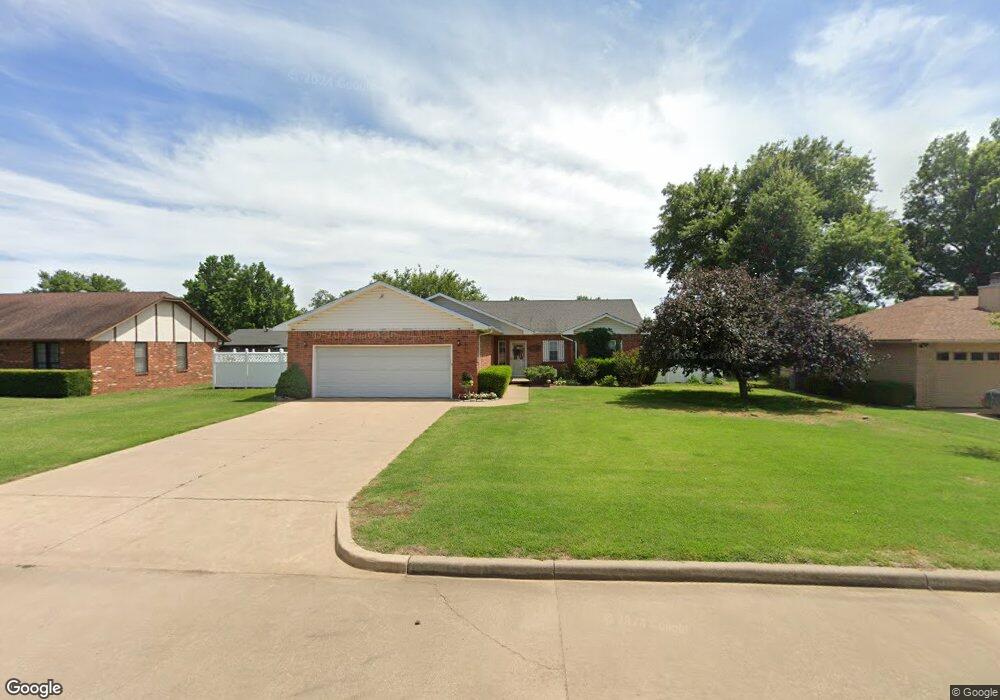
207 Jester Rd Tonkawa, OK 74653
Estimated Value: $172,000 - $235,774
3
Beds
2
Baths
1,931
Sq Ft
$109/Sq Ft
Est. Value
About This Home
This home is located at 207 Jester Rd, Tonkawa, OK 74653 and is currently estimated at $210,944, approximately $109 per square foot. 207 Jester Rd is a home located in Kay County with nearby schools including Tonkawa Elementary School, Tonkawa Middle School, and Tonkawa High School.
Ownership History
Date
Name
Owned For
Owner Type
Purchase Details
Closed on
Mar 5, 2010
Sold by
Deihi Lois M and Caughlin Cecella R
Bought by
London Robert P
Current Estimated Value
Home Financials for this Owner
Home Financials are based on the most recent Mortgage that was taken out on this home.
Original Mortgage
$92,800
Interest Rate
4.98%
Mortgage Type
New Conventional
Purchase Details
Closed on
Dec 17, 2003
Sold by
Linda David J and Linda Williams
Bought by
Lois Diehl and Lois Caughlin C
Purchase Details
Closed on
Jun 18, 2002
Sold by
Kay Holding Co
Bought by
Linda David J and Linda Williams
Create a Home Valuation Report for This Property
The Home Valuation Report is an in-depth analysis detailing your home's value as well as a comparison with similar homes in the area
Home Values in the Area
Average Home Value in this Area
Purchase History
| Date | Buyer | Sale Price | Title Company |
|---|---|---|---|
| London Robert P | $125,000 | -- | |
| Lois Diehl | $115,000 | -- | |
| Linda David J | $5,000 | -- |
Source: Public Records
Mortgage History
| Date | Status | Borrower | Loan Amount |
|---|---|---|---|
| Closed | London Robert P | $92,800 |
Source: Public Records
Tax History Compared to Growth
Tax History
| Year | Tax Paid | Tax Assessment Tax Assessment Total Assessment is a certain percentage of the fair market value that is determined by local assessors to be the total taxable value of land and additions on the property. | Land | Improvement |
|---|---|---|---|---|
| 2024 | $1,321 | $14,477 | $1,381 | $13,096 |
| 2023 | $1,321 | $14,056 | $1,381 | $12,675 |
| 2022 | $1,223 | $13,646 | $1,381 | $12,265 |
| 2021 | $1,231 | $13,646 | $1,381 | $12,265 |
| 2020 | $1,194 | $13,452 | $1,381 | $12,071 |
| 2019 | $1,105 | $13,061 | $1,381 | $11,680 |
| 2018 | $1,100 | $13,196 | $1,381 | $11,815 |
| 2017 | $1,180 | $13,468 | $1,381 | $12,087 |
| 2016 | $1,158 | $13,604 | $1,381 | $12,223 |
| 2015 | $1,156 | $13,606 | $1,381 | $12,225 |
| 2014 | $1,234 | $13,620 | $1,381 | $12,239 |
Source: Public Records
Map
Nearby Homes
- 112 Wheatheart Dr
- 1200 N Main St
- 1110 N Main St
- 1008 N 10th St
- 1110 N 6th St
- 1009 N 6th St
- 810 N Main St
- 1005 N 5th St
- 1102 N 5th St
- 206 W Grand Ave
- 302 N Barnes St
- 109 S 10th St
- 1004 E North Ave
- 316 N Jenkins St
- 501 E Grand Ave
- 103 S 4th St
- 1208 E Allen Ave
- 305 S 4th St
- 1409 E North Ave
- 207 S Barnes St
- 209 Jester Rd
- 205 Jester Rd
- 206 Carrousel Dr
- 208 Carrousel Dr
- 204 Carrousel Dr
- 203 Jester Rd
- 204 Jester Rd
- 206 Jester Rd
- 202 Carrousel Dr
- 200 Jester Rd
- 208 Jester Rd
- 201 Jester Rd
- 207 Carrousel Dr
- 200 Carrousel Dr
- 209 Carrousel Dr
- 205 Carrousel Dr
- 203 Carrousel Dr
- 201 Carrousel Dr
- 116 Mill Rd
- 118 Mill Rd