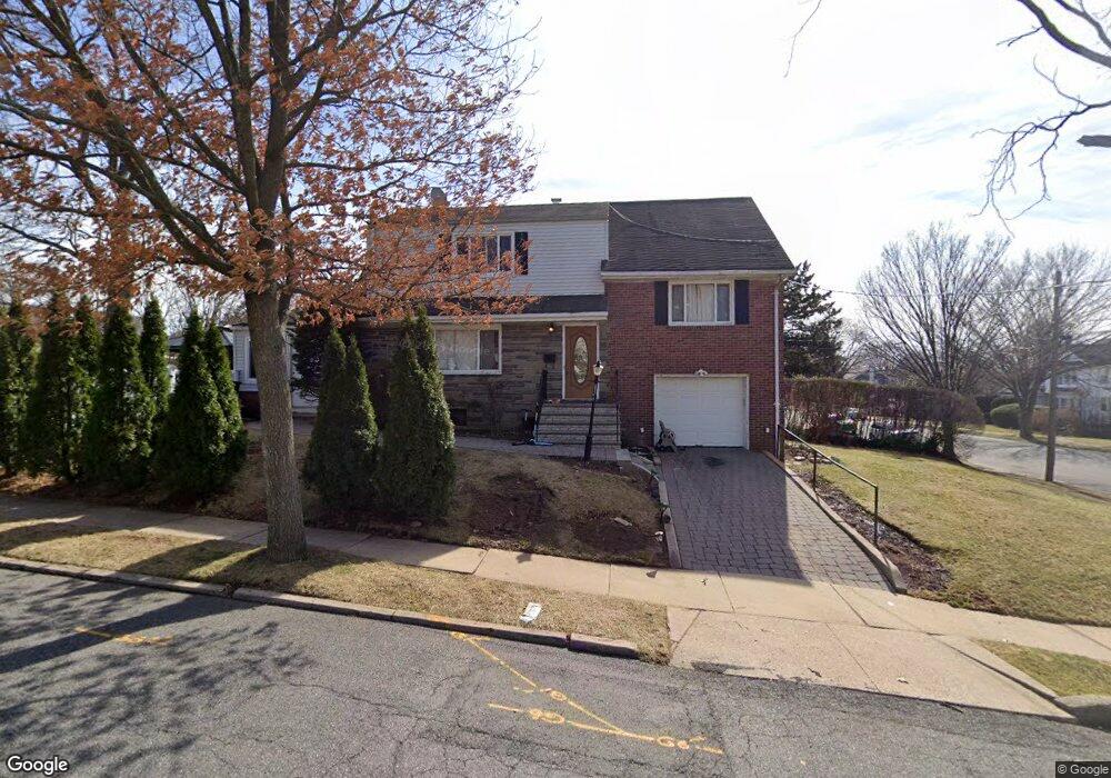
207 Larch Ave Teaneck, NJ 07666
Estimated Value: $571,620 - $706,000
Studio
--
Bath
1,516
Sq Ft
$429/Sq Ft
Est. Value
About This Home
This home is located at 207 Larch Ave, Teaneck, NJ 07666 and is currently estimated at $650,155, approximately $428 per square foot. 207 Larch Ave is a home located in Bergen County with nearby schools including Teaneck Senior High School, Teaneck Community Charter School, and Bergen County Christian Academy.
Ownership History
Date
Name
Owned For
Owner Type
Purchase Details
Closed on
Jul 8, 2003
Sold by
Dingler Edward
Bought by
Statella Frank
Current Estimated Value
Home Financials for this Owner
Home Financials are based on the most recent Mortgage that was taken out on this home.
Original Mortgage
$260,000
Outstanding Balance
$112,121
Interest Rate
5.45%
Estimated Equity
$538,035
Create a Home Valuation Report for This Property
The Home Valuation Report is an in-depth analysis detailing your home's value as well as a comparison with similar homes in the area
Home Values in the Area
Average Home Value in this Area
Purchase History
| Date | Buyer | Sale Price | Title Company |
|---|---|---|---|
| Statella Frank | $325,000 | -- |
Source: Public Records
Mortgage History
| Date | Status | Borrower | Loan Amount |
|---|---|---|---|
| Open | Statella Frank | $260,000 |
Source: Public Records
Tax History
| Year | Tax Paid | Tax Assessment Tax Assessment Total Assessment is a certain percentage of the fair market value that is determined by local assessors to be the total taxable value of land and additions on the property. | Land | Improvement |
|---|---|---|---|---|
| 2025 | $11,307 | $517,700 | $301,300 | $216,400 |
| 2024 | $10,335 | $517,700 | $301,300 | $216,400 |
| 2023 | $10,132 | $313,000 | $183,800 | $129,200 |
| 2022 | $10,132 | $313,000 | $183,800 | $129,200 |
| 2021 | $10,191 | $313,000 | $183,800 | $129,200 |
| 2020 | $10,122 | $313,000 | $183,800 | $129,200 |
| 2019 | $10,007 | $313,000 | $183,800 | $129,200 |
| 2018 | $9,931 | $313,000 | $183,800 | $129,200 |
| 2017 | $9,838 | $313,000 | $183,800 | $129,200 |
| 2016 | $9,690 | $313,000 | $183,800 | $129,200 |
| 2015 | $9,537 | $313,000 | $183,800 | $129,200 |
| 2014 | $8,677 | $337,500 | $254,400 | $83,100 |
Source: Public Records
Map
Nearby Homes
Your Personal Tour Guide
Ask me questions while you tour the home.