Estimated Value: $126,000 - $158,428
3
Beds
1
Bath
912
Sq Ft
$154/Sq Ft
Est. Value
About This Home
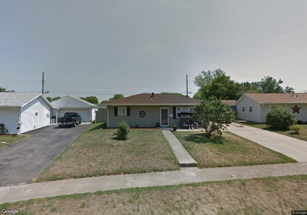
This home is located at 207 Lowell Rd, Xenia, OH 45385 and is currently estimated at $140,857, approximately $154 per square foot. 207 Lowell Rd is a home located in Greene County with nearby schools including Xenia High School, Summit Academy Community School for Alternative Learners - Xenia, and Legacy Christian Academy.
Ownership History
Date
Name
Owned For
Owner Type
Purchase Details
Closed on
Sep 30, 2009
Sold by
Caudill Henry and Caudill Pamela
Bought by
Vanzant Marsha L
Current Estimated Value
Home Financials for this Owner
Home Financials are based on the most recent Mortgage that was taken out on this home.
Original Mortgage
$71,677
Outstanding Balance
$47,066
Interest Rate
5.19%
Mortgage Type
FHA
Estimated Equity
$93,791
Purchase Details
Closed on
Mar 27, 2009
Sold by
Citimortgage Inc
Bought by
Caudill Henry and Caudill Pamela
Purchase Details
Closed on
Jan 22, 2009
Sold by
Massie Michael T and Massie Amie L
Bought by
Citimortgage Inc
Purchase Details
Closed on
Jul 23, 1998
Sold by
Madelans Rex A and Madelans Susan
Bought by
Massie Michael T and Massie Amie L
Home Financials for this Owner
Home Financials are based on the most recent Mortgage that was taken out on this home.
Original Mortgage
$68,791
Interest Rate
7.13%
Mortgage Type
FHA
Create a Home Valuation Report for This Property
The Home Valuation Report is an in-depth analysis detailing your home's value as well as a comparison with similar homes in the area
Home Values in the Area
Average Home Value in this Area
Purchase History
| Date | Buyer | Sale Price | Title Company |
|---|---|---|---|
| Vanzant Marsha L | $73,000 | Hallmark Title | |
| Caudill Henry | $40,450 | None Available | |
| Citimortgage Inc | $48,000 | None Available | |
| Massie Michael T | $69,900 | -- |
Source: Public Records
Mortgage History
| Date | Status | Borrower | Loan Amount |
|---|---|---|---|
| Open | Vanzant Marsha L | $71,677 | |
| Previous Owner | Massie Michael T | $68,791 |
Source: Public Records
Tax History Compared to Growth
Tax History
| Year | Tax Paid | Tax Assessment Tax Assessment Total Assessment is a certain percentage of the fair market value that is determined by local assessors to be the total taxable value of land and additions on the property. | Land | Improvement |
|---|---|---|---|---|
| 2024 | $1,511 | $35,320 | $7,830 | $27,490 |
| 2023 | $1,511 | $35,320 | $7,830 | $27,490 |
| 2022 | $1,251 | $24,940 | $5,590 | $19,350 |
| 2021 | $1,268 | $24,940 | $5,590 | $19,350 |
| 2020 | $1,215 | $24,940 | $5,590 | $19,350 |
| 2019 | $1,122 | $21,680 | $4,240 | $17,440 |
| 2018 | $1,126 | $21,680 | $4,240 | $17,440 |
| 2017 | $1,077 | $21,680 | $4,240 | $17,440 |
| 2016 | $1,077 | $20,350 | $4,240 | $16,110 |
| 2015 | $1,080 | $20,350 | $4,240 | $16,110 |
| 2014 | $1,034 | $20,350 | $4,240 | $16,110 |
Source: Public Records
Map
Nearby Homes
- 1391 June Dr
- 1351 Omard Dr
- 1283 June Dr
- 1233 June Dr
- 1223 June Dr
- 343 Sheelin Rd
- 1342 Kylemore Dr
- 912 Omard Dr
- 883 Omard Dr
- 121 S Progress Dr
- 509 Antrim Rd
- 1144 Rockwell Dr
- 1568 Cheyenne Dr
- 305-325 Bellbrook Ave
- 1618 Navajo Dr
- 1208 Bellbrook Ave
- 613 N West St
- 1272 Bellbrook Ave
- 453 Walnut St
- 1653 Seneca Dr