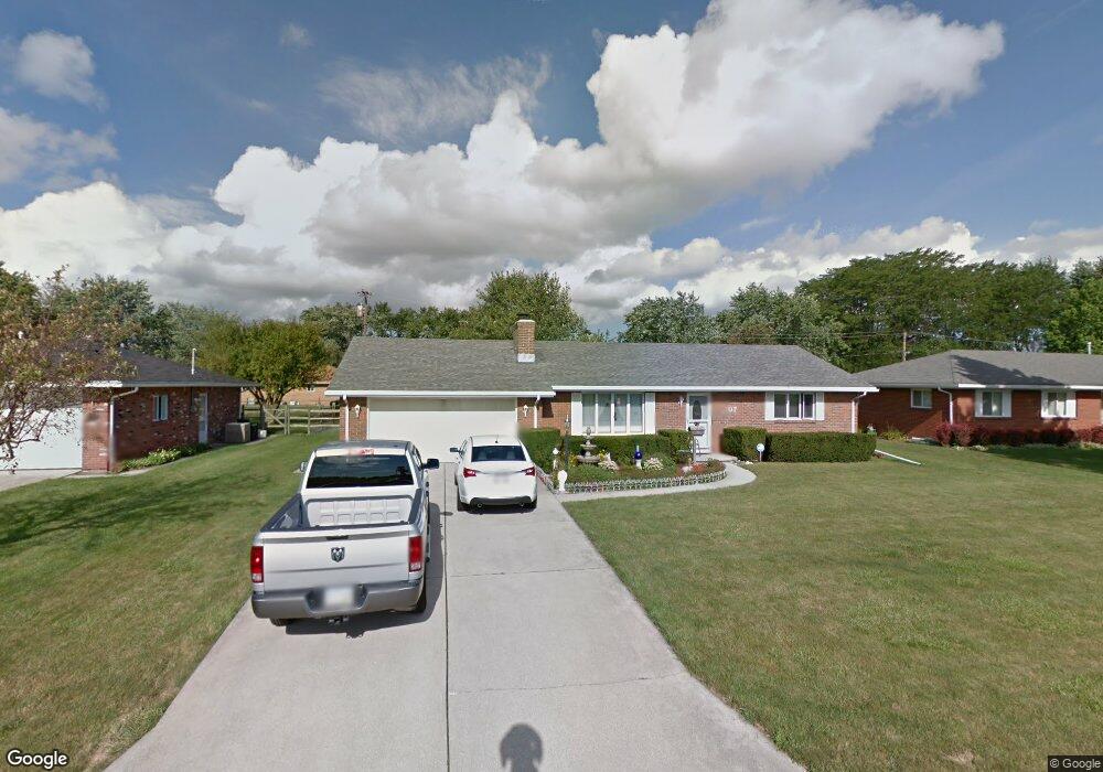
207 Martendale Place Walbridge, OH 43465
Estimated Value: $198,419 - $234,000
2
Beds
1
Bath
1,176
Sq Ft
$178/Sq Ft
Est. Value
About This Home
This home is located at 207 Martendale Place, Walbridge, OH 43465 and is currently estimated at $209,355, approximately $178 per square foot. 207 Martendale Place is a home located in Wood County with nearby schools including Lake Elementary School, Lake Middle School, and Lake High School.
Ownership History
Date
Name
Owned For
Owner Type
Purchase Details
Closed on
Feb 27, 2015
Sold by
Hamilton Anna Rose M
Bought by
Boose Calder and Boose Terry
Current Estimated Value
Purchase Details
Closed on
Sep 24, 2008
Sold by
Hamilton Anna Rose M
Bought by
Hamilton Anna Rose M and Anna Rose M Hamilton Trust
Purchase Details
Closed on
Mar 20, 2008
Sold by
Melms Donald C
Bought by
Hamilton Anna Rosa M
Purchase Details
Closed on
Aug 1, 2000
Sold by
Billings Dorothy B
Bought by
Melms Donald C and Melms Alice
Purchase Details
Closed on
Sep 18, 1986
Bought by
Billings Dorothy B
Create a Home Valuation Report for This Property
The Home Valuation Report is an in-depth analysis detailing your home's value as well as a comparison with similar homes in the area
Home Values in the Area
Average Home Value in this Area
Purchase History
| Date | Buyer | Sale Price | Title Company |
|---|---|---|---|
| Boose Calder | $108,000 | Louisville Title | |
| Hamilton Anna Rose M | -- | Attorney | |
| Hamilton Anna Rosa M | $121,900 | Louisville Title | |
| Melms Donald C | $123,900 | Louisville Title Agency For | |
| Billings Dorothy B | -- | -- |
Source: Public Records
Tax History Compared to Growth
Tax History
| Year | Tax Paid | Tax Assessment Tax Assessment Total Assessment is a certain percentage of the fair market value that is determined by local assessors to be the total taxable value of land and additions on the property. | Land | Improvement |
|---|---|---|---|---|
| 2024 | $2,414 | $54,460 | $13,300 | $41,160 |
| 2023 | $2,414 | $54,460 | $13,300 | $41,160 |
| 2021 | $2,405 | $46,240 | $13,160 | $33,080 |
| 2020 | $2,310 | $46,240 | $13,160 | $33,080 |
| 2019 | $2,158 | $39,800 | $13,160 | $26,640 |
| 2018 | $2,153 | $39,800 | $13,160 | $26,640 |
| 2017 | $1,903 | $39,800 | $13,160 | $26,640 |
| 2016 | $2,065 | $39,270 | $13,160 | $26,110 |
| 2015 | $2,065 | $39,270 | $13,160 | $26,110 |
| 2014 | $1,704 | $39,270 | $13,160 | $26,110 |
| 2013 | $889 | $39,270 | $13,160 | $26,110 |
Source: Public Records
Map
Nearby Homes
- 225 E Union St
- 215 Earl St
- 242 S Bridge Rd
- 241 S Bridge Rd
- 237 S Bridge Rd
- 238 S Bridge Rd
- 236 S Bridge Rd
- 232 S Bridge Rd
- 224 S Bridge Rd
- 112 Guy St
- 104 Revere Rd
- 121 N Main St
- 119 N Main St
- 117 N Main St
- 507 N Main St
- 103 W Union St
- 0 Drouillard Rd Lot 6 Unit 6136601
- 3610 Plumey Rd
- 315 Clayton St
- 30643 Drouillard Rd