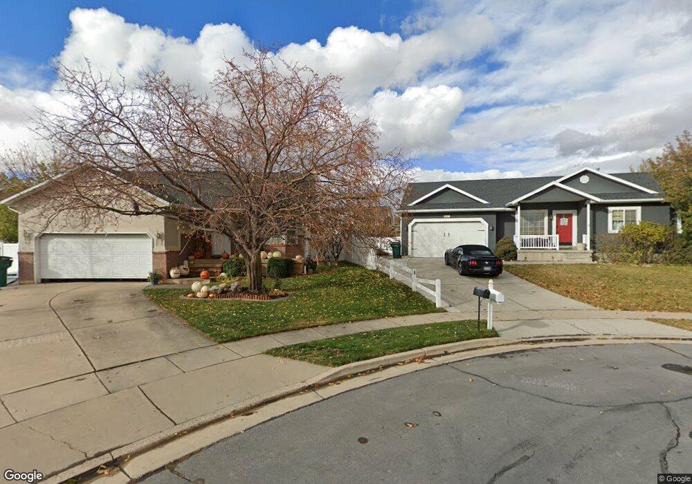
207 N 700 W Layton, UT 84041
Estimated Value: $549,000 - $607,699
5
Beds
3
Baths
3,108
Sq Ft
$187/Sq Ft
Est. Value
About This Home
This home is located at 207 N 700 W, Layton, UT 84041 and is currently estimated at $580,925, approximately $186 per square foot. 207 N 700 W is a home located in Davis County with nearby schools including Layton Elementary School, Fairfield Junior High School, and Layton High School.
Ownership History
Date
Name
Owned For
Owner Type
Purchase Details
Closed on
Nov 20, 2019
Sold by
Babinsky Paul J and Babinsky Rachel
Bought by
Babinsky Paul J and Babinsky Rachel
Current Estimated Value
Home Financials for this Owner
Home Financials are based on the most recent Mortgage that was taken out on this home.
Original Mortgage
$292,354
Outstanding Balance
$257,196
Interest Rate
3.6%
Estimated Equity
$323,729
Purchase Details
Closed on
Sep 12, 2006
Sold by
Babinsky Paul J and Babinsky Rachel E
Bought by
Babinsky Paul J and Babinsky Rachel
Home Financials for this Owner
Home Financials are based on the most recent Mortgage that was taken out on this home.
Original Mortgage
$20,000
Interest Rate
6.56%
Mortgage Type
New Conventional
Purchase Details
Closed on
Aug 16, 2005
Sold by
Detzner Joseph A and Detzner Lorene
Bought by
Babinsky Paul J and Babinsky Rachel E
Home Financials for this Owner
Home Financials are based on the most recent Mortgage that was taken out on this home.
Original Mortgage
$191,939
Interest Rate
5.56%
Mortgage Type
VA
Purchase Details
Closed on
May 15, 2003
Sold by
Steele Steven E and Steele Cynthia L
Bought by
Detzner Joseph A and Detzner Lorene
Home Financials for this Owner
Home Financials are based on the most recent Mortgage that was taken out on this home.
Original Mortgage
$167,373
Interest Rate
5.71%
Mortgage Type
Purchase Money Mortgage
Purchase Details
Closed on
May 23, 2001
Sold by
Holder Richard and Holder Deborah
Bought by
Steele Steven E and Steele Cynthia L
Home Financials for this Owner
Home Financials are based on the most recent Mortgage that was taken out on this home.
Original Mortgage
$112,400
Interest Rate
9%
Purchase Details
Closed on
Aug 8, 1997
Sold by
Alpine Homes Inc
Bought by
Holder Richard and Holder Deborah
Home Financials for this Owner
Home Financials are based on the most recent Mortgage that was taken out on this home.
Original Mortgage
$139,500
Interest Rate
7.61%
Create a Home Valuation Report for This Property
The Home Valuation Report is an in-depth analysis detailing your home's value as well as a comparison with similar homes in the area
Home Values in the Area
Average Home Value in this Area
Purchase History
| Date | Buyer | Sale Price | Title Company |
|---|---|---|---|
| Babinsky Paul J | -- | Servicelink | |
| Babinsky Paul J | -- | Mountain View Title & Escrow | |
| Babinsky Paul J | -- | Mountain View Title & Escrow | |
| Detzner Joseph A | -- | Heritage West Title Insuranc | |
| Steele Steven E | -- | Bonneville Title Company Inc | |
| Holder Richard | -- | First American Title Co |
Source: Public Records
Mortgage History
| Date | Status | Borrower | Loan Amount |
|---|---|---|---|
| Open | Babinsky Paul J | $292,354 | |
| Previous Owner | Babinsky Paul J | $20,000 | |
| Previous Owner | Babinsky Paul J | $191,939 | |
| Previous Owner | Detzner Joseph A | $167,373 | |
| Previous Owner | Steele Steven E | $112,400 | |
| Previous Owner | Holder Richard | $139,500 |
Source: Public Records
Tax History Compared to Growth
Tax History
| Year | Tax Paid | Tax Assessment Tax Assessment Total Assessment is a certain percentage of the fair market value that is determined by local assessors to be the total taxable value of land and additions on the property. | Land | Improvement |
|---|---|---|---|---|
| 2025 | $1,841 | $297,550 | $125,107 | $172,443 |
| 2024 | $2,752 | $290,950 | $136,544 | $154,406 |
| 2023 | $2,516 | $469,000 | $132,225 | $336,775 |
| 2022 | $2,760 | $279,400 | $80,300 | $199,100 |
| 2021 | $2,577 | $389,000 | $120,458 | $268,542 |
| 2020 | $2,348 | $340,000 | $101,969 | $238,031 |
| 2019 | $2,291 | $325,000 | $103,173 | $221,827 |
| 2018 | $2,086 | $297,000 | $90,651 | $206,349 |
| 2016 | $1,677 | $123,145 | $36,354 | $86,791 |
| 2015 | $1,536 | $107,140 | $36,354 | $70,786 |
| 2014 | $1,689 | $120,412 | $36,354 | $84,058 |
| 2013 | -- | $117,669 | $28,952 | $88,717 |
Source: Public Records
Map
Nearby Homes
- 65 Ronald Ave
- 750 W Gentile St
- 485 W 100 N
- 933 W Gentile St
- 526 King St Unit 2
- 356 W 25 N
- 355 W Gentile St
- 6 Grover St
- 296 S 950 W
- 362 S 950 W
- 267 S Melody St
- 1677 N 1600 W Unit 134
- 480 Spurlock St
- 298 Amber Ln
- 316 Amber Ln
- Browning Plan at Amber Fields
- Rhapsody Plan at Amber Fields
- Accord Plan at Amber Fields
- Timpani Plan at Amber Fields
- Octave Plan at Amber Fields