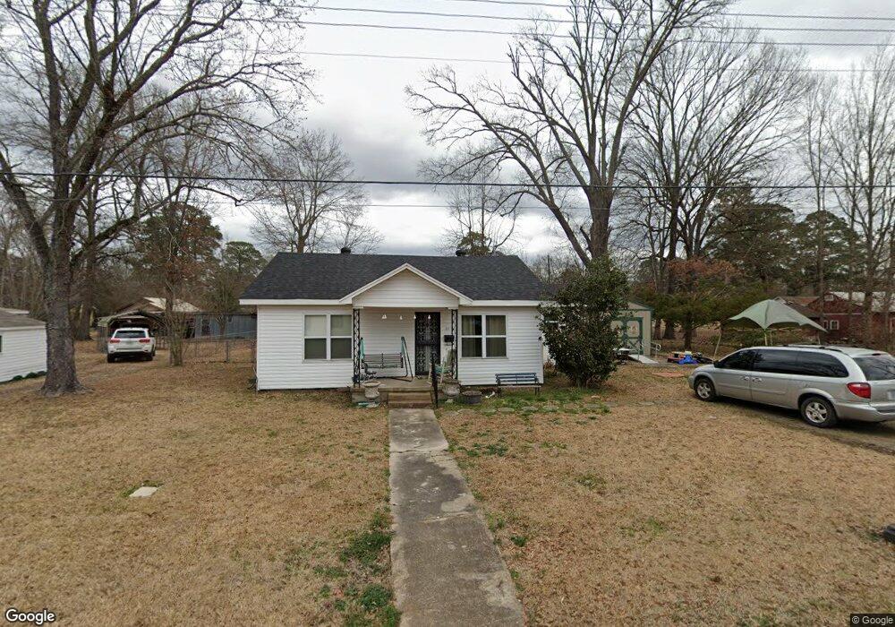
207 N 7th St Gurdon, AR 71743
Estimated Value: $70,000 - $79,000
2
Beds
1
Bath
1,392
Sq Ft
$53/Sq Ft
Est. Value
About This Home
This home is located at 207 N 7th St, Gurdon, AR 71743 and is currently estimated at $74,191, approximately $53 per square foot. 207 N 7th St is a home located in Clark County with nearby schools including Gurdon Primary School, Cabe Middle School, and Gurdon High School.
Ownership History
Date
Name
Owned For
Owner Type
Purchase Details
Closed on
Oct 13, 2010
Sold by
Calley Richard
Bought by
Yancey Jerry and Yancey Deborah
Current Estimated Value
Purchase Details
Closed on
Jun 25, 2010
Sold by
Yancey Jerry and Yancey Deborah
Bought by
Paull Joan R
Home Financials for this Owner
Home Financials are based on the most recent Mortgage that was taken out on this home.
Original Mortgage
$5,427
Interest Rate
4.77%
Purchase Details
Closed on
Jan 18, 2002
Bought by
Spradlin Kay L
Purchase Details
Closed on
Feb 20, 2001
Bought by
Calley, Margaret Revocable Trust
Purchase Details
Closed on
Feb 9, 2001
Bought by
Calley, Margaret,Life Est Ret
Purchase Details
Closed on
Jan 1, 1901
Bought by
Calley Raymond
Create a Home Valuation Report for This Property
The Home Valuation Report is an in-depth analysis detailing your home's value as well as a comparison with similar homes in the area
Home Values in the Area
Average Home Value in this Area
Purchase History
| Date | Buyer | Sale Price | Title Company |
|---|---|---|---|
| Yancey Jerry | -- | -- | |
| Paull Joan R | -- | -- | |
| Spradlin Kay L | $40,000 | -- | |
| Calley, Margaret Revocable Trust | -- | -- | |
| Calley, Margaret,Life Est Ret | -- | -- | |
| Calley Raymond | -- | -- |
Source: Public Records
Mortgage History
| Date | Status | Borrower | Loan Amount |
|---|---|---|---|
| Previous Owner | Paull Joan R | $5,427 | |
| Previous Owner | Paull Joan R | $43,415 |
Source: Public Records
Tax History Compared to Growth
Tax History
| Year | Tax Paid | Tax Assessment Tax Assessment Total Assessment is a certain percentage of the fair market value that is determined by local assessors to be the total taxable value of land and additions on the property. | Land | Improvement |
|---|---|---|---|---|
| 2025 | -- | $11,230 | $820 | $10,410 |
| 2024 | -- | $7,900 | $730 | $7,170 |
| 2023 | $0 | $7,900 | $730 | $7,170 |
| 2022 | $0 | $7,900 | $730 | $7,170 |
| 2021 | $0 | $7,900 | $730 | $7,170 |
| 2020 | $0 | $7,900 | $730 | $7,170 |
| 2019 | $0 | $7,960 | $730 | $7,230 |
| 2018 | $0 | $7,960 | $730 | $7,230 |
| 2017 | $0 | $7,960 | $730 | $7,230 |
| 2016 | -- | $7,960 | $730 | $7,230 |
| 2015 | -- | $7,960 | $730 | $7,230 |
| 2014 | -- | $6,750 | $730 | $6,020 |
Source: Public Records
Map
Nearby Homes
- 109 N 7th St
- 326 Arkansas 53
- 0000 Arkansas 53
- 110 S 10th St
- 705 N 9th St
- 103 Stonegate Ct
- 51 South St
- 313 W Miller St
- TBD Kansas Rd
- 000 Kansas Rd
- 7104 Highway 67 S
- 1795 Bowen Hill Rd
- TBD Hwy 67 S
- 1414 Arkansas 53
- TBD Hwy 67
- 58 Dodgen Rd
- County Road 12
- 845 Stevenson Rd
- 602 Stevenson Rd
- 196 Stevenson Rd