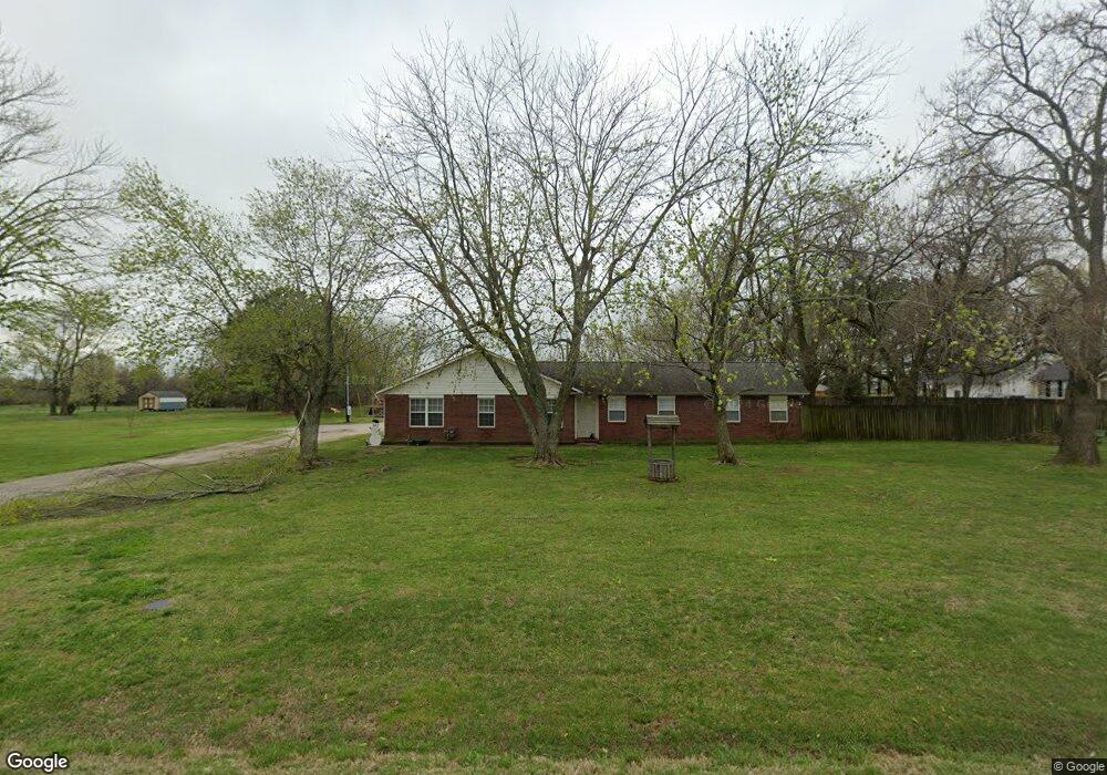
207 N Colt Ave Lincoln, AR 72744
Estimated Value: $273,000 - $292,243
--
Bed
3
Baths
1,964
Sq Ft
$144/Sq Ft
Est. Value
About This Home
This home is located at 207 N Colt Ave, Lincoln, AR 72744 and is currently estimated at $283,311, approximately $144 per square foot. 207 N Colt Ave is a home located in Washington County with nearby schools including Lincoln Elementary School and Lincoln High School.
Ownership History
Date
Name
Owned For
Owner Type
Purchase Details
Closed on
Oct 8, 2007
Sold by
Johnson Randy Lee
Bought by
Johnson Karen Lou
Current Estimated Value
Purchase Details
Closed on
Nov 14, 1997
Bought by
Johnson Randy and Johnson Karen
Purchase Details
Closed on
Aug 22, 1997
Bought by
White Alice M
Purchase Details
Closed on
Dec 2, 1993
Bought by
White Alice and Weaver Conrad
Purchase Details
Closed on
Apr 29, 1988
Bought by
Relay Mary
Purchase Details
Closed on
Jan 1, 1985
Bought by
Gebauer Albert W and Gebauer Janice C
Create a Home Valuation Report for This Property
The Home Valuation Report is an in-depth analysis detailing your home's value as well as a comparison with similar homes in the area
Home Values in the Area
Average Home Value in this Area
Purchase History
| Date | Buyer | Sale Price | Title Company |
|---|---|---|---|
| Johnson Karen Lou | -- | None Available | |
| Johnson Randy | $6,000 | -- | |
| White Alice M | -- | -- | |
| White Alice | $62,000 | -- | |
| Relay Mary | $53,000 | -- | |
| Gebauer Albert W | -- | -- |
Source: Public Records
Tax History Compared to Growth
Tax History
| Year | Tax Paid | Tax Assessment Tax Assessment Total Assessment is a certain percentage of the fair market value that is determined by local assessors to be the total taxable value of land and additions on the property. | Land | Improvement |
|---|---|---|---|---|
| 2025 | $1,559 | $61,540 | $12,030 | $49,510 |
| 2024 | $1,566 | $61,540 | $12,030 | $49,510 |
| 2023 | $1,576 | $61,540 | $12,030 | $49,510 |
| 2022 | $1,531 | $38,630 | $4,410 | $34,220 |
| 2021 | $1,448 | $38,630 | $4,410 | $34,220 |
| 2020 | $1,366 | $38,630 | $4,410 | $34,220 |
| 2019 | $1,280 | $30,540 | $3,680 | $26,860 |
| 2018 | $1,305 | $30,540 | $3,680 | $26,860 |
| 2017 | $1,290 | $30,540 | $3,680 | $26,860 |
| 2016 | $1,290 | $30,540 | $3,680 | $26,860 |
| 2015 | $1,290 | $30,540 | $3,680 | $26,860 |
| 2014 | $1,257 | $29,920 | $4,450 | $25,470 |
Source: Public Records
Map
Nearby Homes
- 17948 W Highway 62
- 304 Shady St
- 523 & 525 W North St
- 511 W North St
- 0 Shady St
- 603 Sugar Hill Rd
- 108 Short Ave
- 0 W Bean St
- 301 W Bean St
- 116 N West Ave
- 204 N Starr Ave
- 711 Applegate Ln
- 733 Applegate Ln
- 724 Applegate Ln
- 210 N Main Ave
- 108 N Main Ave
- 924 West Ave
- 608 W Holt Rd
- 506 S West Ave
- 313 E North St
- 127 N Colt Ave
- 810 W Pridemore Dr
- 904 W Pridemore Dr
- 121 N Colt Ave
- 806 W Pridemore Dr
- 6 AC Highway 62
- 120 N Colt Ave
- 115 N Colt Ave
- 800 W Pridemore Dr
- 1004 W Pridemore Dr
- 111 N Colt Ave
- 734 W Pridemore Dr
- 0 W Highway 62
- 1025 W Pridemore Dr
- 905 W Pridemore Dr
- 718 W Pridemore Dr
- 0 Colt Ave Unit 1051965
- 903 Sunnyvale Place
- 811 Sunnyvale Place
- 1008 W Pridemore Dr