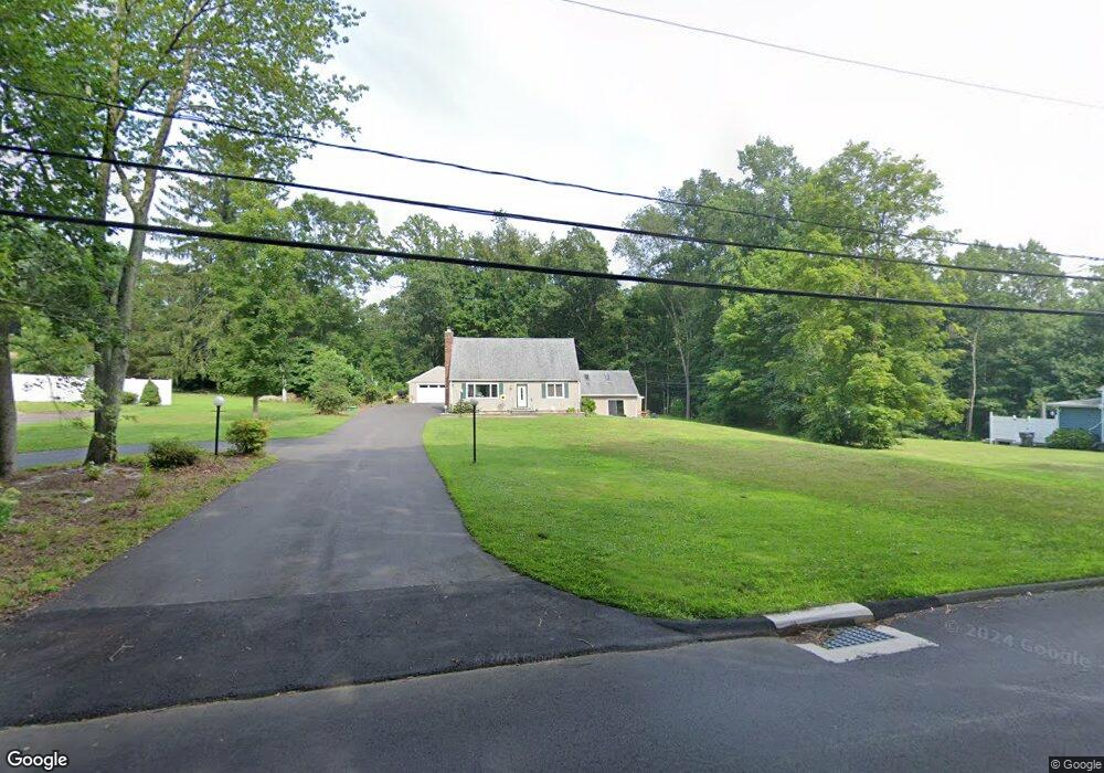
207 New England Rd Guilford, CT 06437
Estimated Value: $498,000 - $588,000
3
Beds
2
Baths
1,037
Sq Ft
$513/Sq Ft
Est. Value
About This Home
This home is located at 207 New England Rd, Guilford, CT 06437 and is currently estimated at $531,879, approximately $512 per square foot. 207 New England Rd is a home located in New Haven County with nearby schools including A. Baldwin Middle School, E.C. Adams Middle School, and Guilford High School.
Ownership History
Date
Name
Owned For
Owner Type
Purchase Details
Closed on
Jul 26, 1983
Bought by
Mason Charles R and Mason Rose C
Current Estimated Value
Create a Home Valuation Report for This Property
The Home Valuation Report is an in-depth analysis detailing your home's value as well as a comparison with similar homes in the area
Home Values in the Area
Average Home Value in this Area
Purchase History
| Date | Buyer | Sale Price | Title Company |
|---|---|---|---|
| Mason Charles R | -- | -- |
Source: Public Records
Mortgage History
| Date | Status | Borrower | Loan Amount |
|---|---|---|---|
| Open | Mason Charles R | $40,000 | |
| Closed | Mason Charles R | $80,000 |
Source: Public Records
Tax History Compared to Growth
Tax History
| Year | Tax Paid | Tax Assessment Tax Assessment Total Assessment is a certain percentage of the fair market value that is determined by local assessors to be the total taxable value of land and additions on the property. | Land | Improvement |
|---|---|---|---|---|
| 2025 | $8,592 | $310,730 | $161,280 | $149,450 |
| 2024 | $8,259 | $310,730 | $161,280 | $149,450 |
| 2023 | $8,042 | $310,730 | $161,280 | $149,450 |
| 2022 | $7,836 | $235,660 | $124,020 | $111,640 |
| 2021 | $7,687 | $235,660 | $124,020 | $111,640 |
| 2020 | $7,614 | $235,660 | $124,020 | $111,640 |
| 2019 | $7,548 | $235,660 | $124,020 | $111,640 |
| 2018 | $7,371 | $235,660 | $124,020 | $111,640 |
| 2017 | $7,375 | $251,200 | $132,420 | $118,780 |
| 2016 | $7,202 | $251,200 | $132,420 | $118,780 |
| 2015 | $7,094 | $251,200 | $132,420 | $118,780 |
| 2014 | $6,888 | $251,200 | $132,420 | $118,780 |
Source: Public Records
Map
Nearby Homes
- 15 Briarwood Dr
- 1066 Long Hill Rd
- 241 Jefferson Dr
- 37 Long Hill Farm
- 288 Jefferson Dr
- 360 Jefferson Dr
- 2805 Boston Post Rd
- 249 Wilderwood Dr
- LOT #22 Kenneth Cir Unit MAP 77
- LOT 28B Bruce Ln Unit MAP 83
- 54 Coachlamp Ln
- 173 Highwoods Dr
- 42 Copper Hill Dr
- 77 Pinebrook Cir
- 604 W Lake Ave
- 24 Copper Hill Dr
- 20 Copper Hill Dr Unit 20
- 18 Copper Hill Dr
- 1270 Durham Rd
- 102 N Mill Cir
- 199 New England Rd
- 231 New England Rd
- 219 New England Rd
- 243 New England Rd
- 255 New England Rd
- 177 New England Rd
- 235 New England Rd
- 253 New England Rd
- 164 New England Rd
- 403 New England Rd
- 40 Brookwood Rd
- 399 New England Rd
- 265 New England Rd
- 345 New England Rd
- 155 New England Rd
- 381 New England Rd
- 23 Brookwood Rd
- 363 New England Rd
- 41 Brookwood Rd
- 65 Robin Ln