Estimated Value: $316,522 - $362,000
3
Beds
1
Bath
1,116
Sq Ft
$300/Sq Ft
Est. Value
About This Home
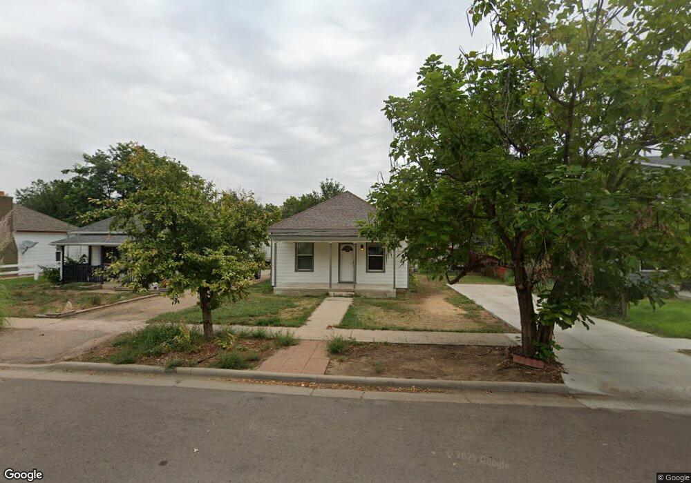
This home is located at 207 Park Ave, Eaton, CO 80615 and is currently estimated at $334,881, approximately $300 per square foot. 207 Park Ave is a home located in Weld County with nearby schools including Eaton High School and Northern Colorado Christian Academy.
Ownership History
Date
Name
Owned For
Owner Type
Purchase Details
Closed on
May 11, 2018
Sold by
Tin Can Limited Parnership
Bought by
Walker Rex W and Walker Reynolds Candice M
Current Estimated Value
Purchase Details
Closed on
Feb 27, 2003
Sold by
Stow Claribelle
Bought by
Walker Ethel
Home Financials for this Owner
Home Financials are based on the most recent Mortgage that was taken out on this home.
Original Mortgage
$86,400
Interest Rate
5.75%
Purchase Details
Closed on
May 1, 2002
Sold by
Walker Ethel M
Bought by
The Tin Can Lp
Purchase Details
Closed on
May 29, 1998
Sold by
Griffiths Christopher M and Griffiths Tonya L
Bought by
Yannutz Dennis L and Yannutz Alice E
Home Financials for this Owner
Home Financials are based on the most recent Mortgage that was taken out on this home.
Original Mortgage
$78,900
Interest Rate
7.22%
Create a Home Valuation Report for This Property
The Home Valuation Report is an in-depth analysis detailing your home's value as well as a comparison with similar homes in the area
Home Values in the Area
Average Home Value in this Area
Purchase History
| Date | Buyer | Sale Price | Title Company |
|---|---|---|---|
| Walker Rex W | -- | None Available | |
| Walker Ethel | $107,500 | Stewart Title | |
| The Tin Can Lp | -- | -- | |
| Yannutz Dennis L | $114,000 | -- |
Source: Public Records
Mortgage History
| Date | Status | Borrower | Loan Amount |
|---|---|---|---|
| Previous Owner | Walker Ethel | $86,400 | |
| Previous Owner | Yannutz Dennis L | $78,900 |
Source: Public Records
Tax History Compared to Growth
Tax History
| Year | Tax Paid | Tax Assessment Tax Assessment Total Assessment is a certain percentage of the fair market value that is determined by local assessors to be the total taxable value of land and additions on the property. | Land | Improvement |
|---|---|---|---|---|
| 2025 | $1,465 | $20,460 | $3,310 | $17,150 |
| 2024 | $1,465 | $20,460 | $3,310 | $17,150 |
| 2023 | $1,307 | $21,470 | $4,030 | $17,440 |
| 2022 | $1,286 | $16,010 | $3,160 | $12,850 |
| 2021 | $1,489 | $16,470 | $3,250 | $13,220 |
| 2020 | $1,231 | $15,260 | $2,300 | $12,960 |
| 2019 | $1,295 | $15,260 | $2,300 | $12,960 |
| 2018 | $847 | $11,680 | $1,860 | $9,820 |
| 2017 | $874 | $11,680 | $1,860 | $9,820 |
| 2016 | $691 | $9,340 | $1,890 | $7,450 |
| 2015 | $645 | $9,340 | $1,890 | $7,450 |
| 2014 | $616 | $9,160 | $1,290 | $7,870 |
Source: Public Records
Map
Nearby Homes
- 410 Cottonwood Ave
- 121 Elm Ave
- 435 Birch Ave
- 516 Elm Ave
- 425 Spruce Ave
- 1135 Huckleberry Ln Unit 2
- 1240 3rd St
- 105 Walnut Ave
- 1250 5th St
- 1330 3rd St
- 1344 Sage Dr
- 29 Pioneer Place
- 356 Sycamore Ave
- 1344 Cimarron Cir
- 910 E 3rd St
- 735 S Mountain View Dr
- 1155 Black Hawk Rd
- 20801 County Road 72
- 1230 Swainson Rd
- 1220 Swainson Rd