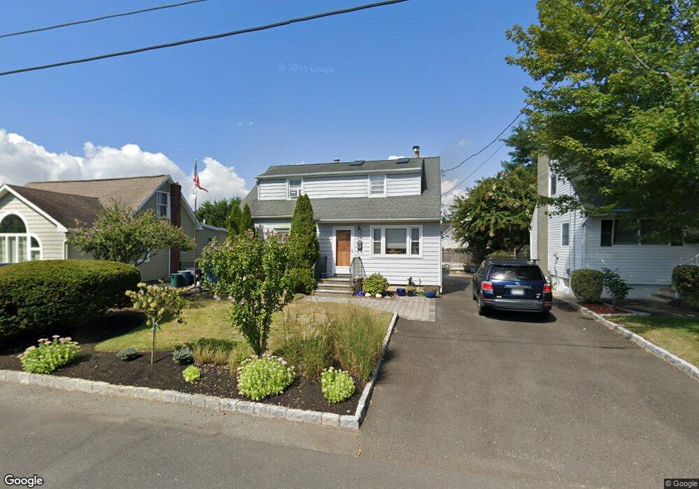
207 Paulison Ave Point Pleasant Boro, NJ 08742
Estimated Value: $518,000 - $747,000
2
Beds
2
Baths
2,080
Sq Ft
$301/Sq Ft
Est. Value
About This Home
This home is located at 207 Paulison Ave, Point Pleasant Boro, NJ 08742 and is currently estimated at $626,178, approximately $301 per square foot. 207 Paulison Ave is a home located in Ocean County with nearby schools including Point Pleasant High School, St Dominic School, and St. Peter School.
Ownership History
Date
Name
Owned For
Owner Type
Purchase Details
Closed on
Mar 24, 2004
Sold by
Mclean Craig P and Mclean Leal Ann
Bought by
Mclean Craig P
Current Estimated Value
Home Financials for this Owner
Home Financials are based on the most recent Mortgage that was taken out on this home.
Original Mortgage
$245,000
Outstanding Balance
$119,687
Interest Rate
6.32%
Mortgage Type
New Conventional
Estimated Equity
$506,491
Purchase Details
Closed on
Sep 22, 2000
Sold by
Itak Frank
Bought by
Mclean Craig and Mc Lean Lael
Home Financials for this Owner
Home Financials are based on the most recent Mortgage that was taken out on this home.
Original Mortgage
$142,400
Interest Rate
7.94%
Create a Home Valuation Report for This Property
The Home Valuation Report is an in-depth analysis detailing your home's value as well as a comparison with similar homes in the area
Home Values in the Area
Average Home Value in this Area
Purchase History
| Date | Buyer | Sale Price | Title Company |
|---|---|---|---|
| Mclean Craig P | -- | None Available | |
| Mclean Craig | $149,900 | -- | |
| Mclean Craig | $149,900 | -- |
Source: Public Records
Mortgage History
| Date | Status | Borrower | Loan Amount |
|---|---|---|---|
| Open | Mclean Craig P | $245,000 | |
| Closed | Mclean Craig | $142,400 |
Source: Public Records
Tax History Compared to Growth
Tax History
| Year | Tax Paid | Tax Assessment Tax Assessment Total Assessment is a certain percentage of the fair market value that is determined by local assessors to be the total taxable value of land and additions on the property. | Land | Improvement |
|---|---|---|---|---|
| 2025 | $6,795 | $297,100 | $171,800 | $125,300 |
| 2024 | $6,495 | $297,100 | $171,800 | $125,300 |
| 2023 | $6,361 | $297,100 | $171,800 | $125,300 |
| 2022 | $6,361 | $297,100 | $171,800 | $125,300 |
| 2021 | $6,263 | $297,100 | $171,800 | $125,300 |
| 2020 | $6,198 | $297,100 | $171,800 | $125,300 |
| 2019 | $6,114 | $297,100 | $171,800 | $125,300 |
| 2018 | $5,933 | $297,100 | $171,800 | $125,300 |
| 2017 | $5,802 | $297,100 | $171,800 | $125,300 |
| 2016 | $5,758 | $297,100 | $171,800 | $125,300 |
| 2015 | $5,689 | $297,100 | $171,800 | $125,300 |
| 2014 | $5,559 | $297,100 | $171,800 | $125,300 |
Source: Public Records
Map
Nearby Homes
- 208 Giese Ln
- 223 Pinetree Place
- 506 Crestview Terrace
- 3000 River Rd Unit 3000 & 3000A
- 3006 Herbertsville Rd
- 531 Oak Terrace
- 305 Barbara Dr
- 550 Crestview Terrace
- 103 River Ave
- 1012 Brainard Place
- 602 Boulton Ave
- 1015 Forrest Rd
- 519 Curtis Ave
- 611 Boulton Ave
- 3431 Bridge Ave Unit 9
- 2704 Route 88
- 619 Mistletoe Ave
- 3105 Pocahontas Ave
- 2607 Spruce St
- 17 Cedar Village Blvd
- 205 Paulison Ave
- 209 Paulison Ave
- 203 Paulison Ave
- 211 Paulison Ave
- 214 Pearce Ave
- 208 Pearce Ave
- 206 Paulison Ave
- 208 Paulison Ave
- 216 Pearce Ave
- 3502 River Rd
- 213 Paulison Ave
- 3500 River Rd
- 210 Paulison Ave
- 206 Pearce Ave
- 218 Pearce Ave
- 205 Passaic Ave
- 207 Passaic Ave
- 212 Paulison Ave
- 215 Paulison Ave
- 209 Passaic Ave