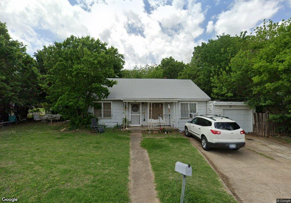
207 S 12th St Duncan, OK 73533
Estimated Value: $54,000 - $89,000
2
Beds
2
Baths
1,124
Sq Ft
$58/Sq Ft
Est. Value
About This Home
This home is located at 207 S 12th St, Duncan, OK 73533 and is currently estimated at $65,708, approximately $58 per square foot. 207 S 12th St is a home located in Stephens County with nearby schools including Emerson Elementary School, Duncan Middle School, and Duncan High School.
Ownership History
Date
Name
Owned For
Owner Type
Purchase Details
Closed on
May 13, 2021
Sold by
Clark Dhlen and Clark Hazel
Bought by
Garden Stephanie
Current Estimated Value
Purchase Details
Closed on
Mar 19, 2019
Sold by
Jones Larry D
Bought by
Clark Owen and Clark Hazel
Purchase Details
Closed on
May 2, 2008
Sold by
Brown John E
Bought by
Jones Larry D
Purchase Details
Closed on
Dec 2, 1998
Sold by
Bankfirst
Bought by
Jones Larry D
Purchase Details
Closed on
Sep 22, 1998
Sold by
Sheriff Stephens County
Purchase Details
Closed on
Aug 31, 1995
Sold by
Crook Teresa K
Purchase Details
Closed on
Mar 15, 1994
Sold by
Lovelady John V
Create a Home Valuation Report for This Property
The Home Valuation Report is an in-depth analysis detailing your home's value as well as a comparison with similar homes in the area
Home Values in the Area
Average Home Value in this Area
Purchase History
| Date | Buyer | Sale Price | Title Company |
|---|---|---|---|
| Garden Stephanie | -- | None Available | |
| Clark Owen | $26,500 | None Available | |
| Jones Larry D | $18,000 | None Available | |
| Jones Larry D | -- | -- | |
| -- | -- | -- | |
| -- | $19,000 | -- | |
| -- | $15,000 | -- |
Source: Public Records
Tax History Compared to Growth
Tax History
| Year | Tax Paid | Tax Assessment Tax Assessment Total Assessment is a certain percentage of the fair market value that is determined by local assessors to be the total taxable value of land and additions on the property. | Land | Improvement |
|---|---|---|---|---|
| 2025 | $131 | $2,554 | $279 | $2,275 |
| 2024 | $128 | $2,499 | $279 | $2,220 |
| 2023 | $128 | $2,426 | $279 | $2,147 |
| 2022 | $195 | $3,290 | $279 | $3,011 |
| 2021 | $276 | $3,241 | $279 | $2,962 |
| 2020 | $254 | $2,940 | $279 | $2,661 |
| 2019 | $217 | $2,512 | $279 | $2,233 |
| 2018 | $233 | $2,620 | $279 | $2,341 |
| 2017 | $233 | $2,717 | $279 | $2,438 |
| 2016 | $252 | $2,970 | $279 | $2,691 |
| 2015 | $234 | $2,829 | $279 | $2,550 |
| 2014 | $234 | $2,694 | $440 | $2,254 |
Source: Public Records
Map
Nearby Homes
- 273787 E 1720 Rd
- 507 S 13th St
- 1203 W Walnut Ave
- 27 N 14th St
- 713 713 W Elm Ave
- 708 W Pecan Ave
- 711 711 S 12th
- 123 N Highway 81
- 1240 S 9th St
- 0 W Mulberry Ave
- 1007 S 8th St
- 1109 W Stephens Ave
- 1105 W Beech Ave
- 0 W Stephens Ave
- 1309 W Beech Ave
- 1009 W Duncan Ave
- 451 S 11th St
- 2 5th St Unit Dr
- 512 W Oak Ave
- 174831 N 2844 Rd