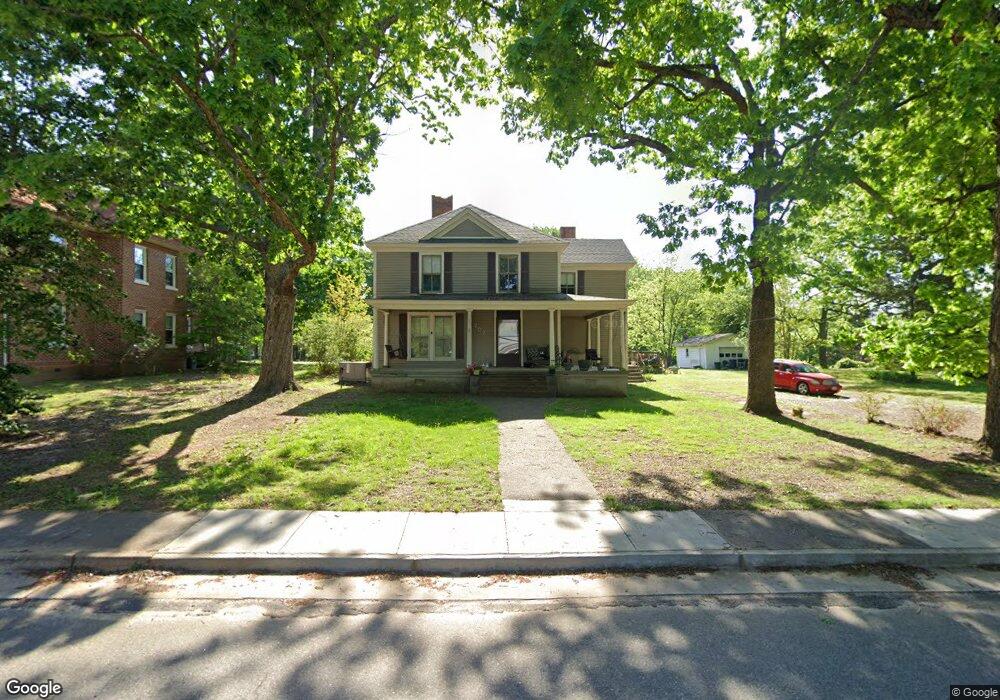
207 S Carter St La Crosse, VA 23950
Estimated Value: $169,134 - $297,000
4
Beds
3
Baths
3,056
Sq Ft
$79/Sq Ft
Est. Value
About This Home
This home is located at 207 S Carter St, La Crosse, VA 23950 and is currently estimated at $241,034, approximately $78 per square foot. 207 S Carter St is a home located in Mecklenburg County with nearby schools including First Christian School.
Ownership History
Date
Name
Owned For
Owner Type
Purchase Details
Closed on
Jan 21, 2014
Sold by
Church Joseph F
Bought by
Munford Lillie B
Current Estimated Value
Purchase Details
Closed on
Sep 21, 2009
Sold by
Aurora Loan Services Llc
Bought by
Church Joseph F and Church Karen A
Home Financials for this Owner
Home Financials are based on the most recent Mortgage that was taken out on this home.
Original Mortgage
$40,500
Interest Rate
5.28%
Mortgage Type
Land Contract Argmt. Of Sale
Purchase Details
Closed on
Oct 14, 2008
Sold by
Nectar Projects Inc and Price Sandy K
Bought by
Aurora Loan Services Llc
Create a Home Valuation Report for This Property
The Home Valuation Report is an in-depth analysis detailing your home's value as well as a comparison with similar homes in the area
Home Values in the Area
Average Home Value in this Area
Purchase History
| Date | Buyer | Sale Price | Title Company |
|---|---|---|---|
| Munford Lillie B | $130,000 | -- | |
| Church Joseph F | $45,000 | -- | |
| Aurora Loan Services Llc | $74,900 | -- |
Source: Public Records
Mortgage History
| Date | Status | Borrower | Loan Amount |
|---|---|---|---|
| Previous Owner | Aurora Loan Services Llc | $40,500 |
Source: Public Records
Tax History Compared to Growth
Tax History
| Year | Tax Paid | Tax Assessment Tax Assessment Total Assessment is a certain percentage of the fair market value that is determined by local assessors to be the total taxable value of land and additions on the property. | Land | Improvement |
|---|---|---|---|---|
| 2024 | $586 | $162,700 | $5,000 | $157,700 |
| 2023 | $557 | $139,300 | $5,000 | $134,300 |
| 2022 | $557 | $139,300 | $5,000 | $134,300 |
| 2021 | $543 | $129,200 | $5,000 | $124,200 |
| 2020 | $543 | $129,200 | $5,000 | $124,200 |
| 2019 | $51 | $122,500 | $5,000 | $117,500 |
| 2018 | $515 | $122,500 | $5,000 | $117,500 |
| 2017 | $515 | $122,500 | $5,000 | $117,500 |
| 2016 | $515 | $122,500 | $5,000 | $117,500 |
| 2015 | -- | $78,200 | $5,000 | $73,200 |
| 2013 | -- | $81,900 | $5,000 | $76,900 |
Source: Public Records
Map
Nearby Homes
- 305 S Carter St
- 0 Highway Fifty-Eight Unit 68721
- 0 Highway 58 Unit 128994
- 820 Country Ln
- 860 Country Ln
- 168 Country Ln
- 821 Northington St
- 404 Benton St
- 726 E Northington St
- 816 Marrow St
- 10.6 Highway 58w
- 729 Marrow St
- 00 Maple Ln
- 0 Maple Lane (8 9 Acres) Unit 135621
- TBD E Main St
- 00 E Main St
- 603 Franklin St
- 000 Brown Town Rd
- TBD Brown Town Rd
- 0 E Ferrell St Unit 136133
- 207 N Carter St
- 209 S Carter St
- 206 S Carter St
- 217 College St
- 205 S Carter St
- 301 S Carter St
- 215 College St
- 206 Virginia St
- 202 S Carter St
- 204 Virginia St
- 202 N Carter St
- 208 Walker St
- 120 Virginia St
- 214 College St
- 103 Harrison St
- 208 Virginia St
- 211 College St
- 101 S Carter St
- 102 Harrison St
- 208 College St