Estimated Value: $119,175 - $157,000
--
Bed
--
Bath
--
Sq Ft
7,841
Sq Ft Lot
About This Home
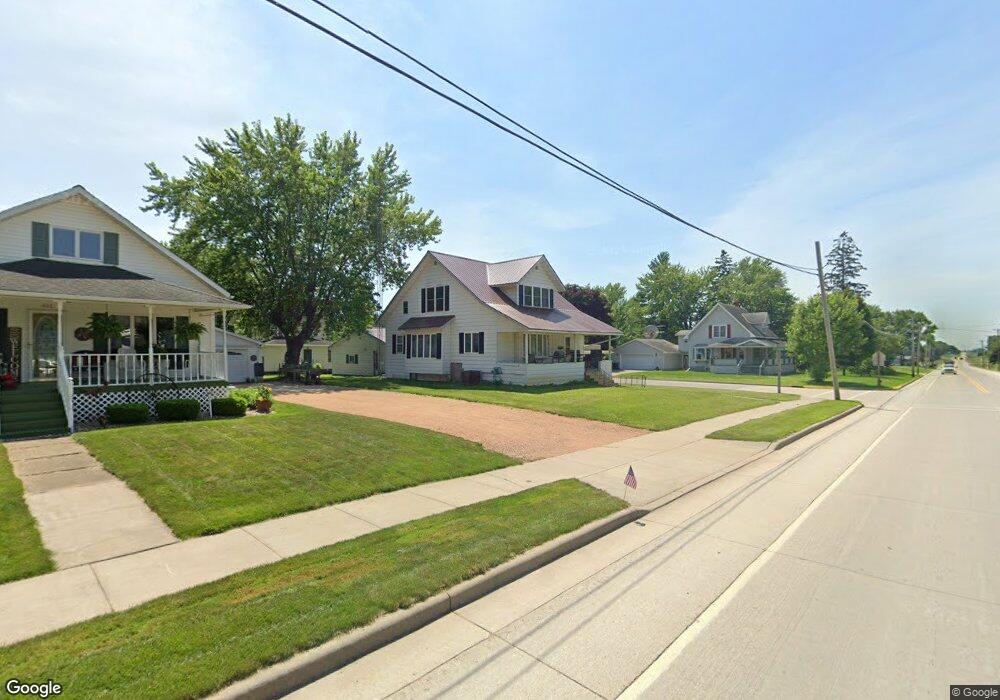
This home is located at 207 S Gwinn St, Loyal, WI 54446 and is currently estimated at $143,044. 207 S Gwinn St is a home located in Clark County with nearby schools including Loyal Elementary School, Loyal Middle School, and Loyal High School.
Ownership History
Date
Name
Owned For
Owner Type
Purchase Details
Closed on
Nov 9, 2017
Sold by
Clark County Sheriff
Bought by
Ditech Financial Llc
Current Estimated Value
Purchase Details
Closed on
Jul 27, 2007
Sold by
Berg Matthew J and Berg Tammy L
Bought by
Lord Dylan and Lord Rachel
Home Financials for this Owner
Home Financials are based on the most recent Mortgage that was taken out on this home.
Original Mortgage
$76,950
Interest Rate
6.71%
Mortgage Type
Purchase Money Mortgage
Create a Home Valuation Report for This Property
The Home Valuation Report is an in-depth analysis detailing your home's value as well as a comparison with similar homes in the area
Home Values in the Area
Average Home Value in this Area
Purchase History
| Date | Buyer | Sale Price | Title Company |
|---|---|---|---|
| Ditech Financial Llc | -- | None Available | |
| Lord Dylan | -- | Schuster Campman Abstract An |
Source: Public Records
Mortgage History
| Date | Status | Borrower | Loan Amount |
|---|---|---|---|
| Previous Owner | Lord Dylan | $76,950 |
Source: Public Records
Tax History Compared to Growth
Tax History
| Year | Tax Paid | Tax Assessment Tax Assessment Total Assessment is a certain percentage of the fair market value that is determined by local assessors to be the total taxable value of land and additions on the property. | Land | Improvement |
|---|---|---|---|---|
| 2024 | $1,987 | $75,900 | $4,500 | $71,400 |
| 2023 | $1,830 | $75,900 | $4,500 | $71,400 |
| 2022 | $1,623 | $75,900 | $4,500 | $71,400 |
| 2021 | $1,570 | $57,600 | $4,200 | $53,400 |
| 2020 | $1,677 | $57,600 | $4,200 | $53,400 |
| 2019 | $1,670 | $57,600 | $4,200 | $53,400 |
| 2018 | $1,669 | $57,600 | $4,200 | $53,400 |
| 2017 | $119 | $57,600 | $4,200 | $53,400 |
| 2016 | $1,465 | $67,900 | $5,400 | $62,500 |
| 2015 | -- | $67,900 | $5,400 | $62,500 |
| 2014 | -- | $67,900 | $5,400 | $62,500 |
| 2013 | -- | $67,900 | $5,400 | $62,500 |
| 2011 | -- | $67,900 | $5,400 | $62,500 |
Source: Public Records
Map
Nearby Homes
- 508 W South St
- 311 W South St
- 309 S West St
- 210 S Division St
- 400 W Mill St
- 501 S Main St
- 314 N Division St
- 0 Chickadee Rd Unit 22505635
- N10160 Sparrow Ave
- 609 E Schofield Ave
- N6695 Pelsdorf Ave
- 203 S Crocker Ave
- 311 S Eaton Ave Unit 1-12
- 300 E Division St
- 300 E Miller St
- 212 N Main St
- 219 N Main St
- 104 W Begley St
- 315 W Begley St
- N8296 River Ave
- 211 S Gwinn St
- 210 S Gwinn St
- 206 S Gwinn St
- 501 W Clark St
- 411 W South St
- 520 W South St
- 407 W South St
- 216 S Gwinn St
- 506 W South St
- 207 S Thomas St
- 500 W South St
- 213 S Thomas St
- 111 S Gwinn St
- 217 S Thomas St
- 401 W South St
- 512 W South St
- 221 S Thomas St
- 410 W Draper St
- 207 S Pope St
- 201 S Pope St