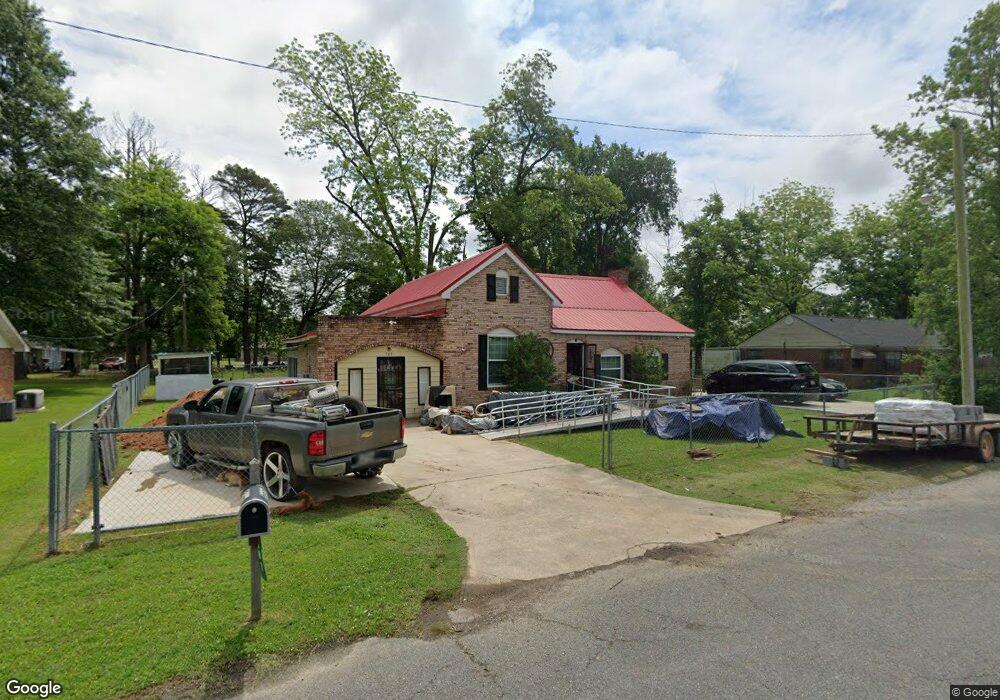
207 S Knox St Dermott, AR 71638
Estimated Value: $68,000 - $81,477
Studio
1
Bath
2,770
Sq Ft
$26/Sq Ft
Est. Value
About This Home
This home is located at 207 S Knox St, Dermott, AR 71638 and is currently estimated at $72,619, approximately $26 per square foot. 207 S Knox St is a home located in Chicot County with nearby schools including Dermott Elementary School and Dermott High School.
Ownership History
Date
Name
Owned For
Owner Type
Purchase Details
Closed on
Jan 4, 2018
Sold by
Robinson Tommie and Robinson Sarah
Bought by
Robinson Tommie and Robinson Sarah
Current Estimated Value
Purchase Details
Closed on
Mar 26, 2014
Sold by
Tommie Tommie and Robinson Tommie
Bought by
Robinson Tommie and Robinson Sarah
Purchase Details
Closed on
Apr 5, 2002
Bought by
Robinson Tommie
Purchase Details
Closed on
Dec 1, 1987
Bought by
From
Purchase Details
Closed on
Oct 1, 1986
Bought by
From
Purchase Details
Closed on
Jan 1, 1981
Bought by
From
Create a Home Valuation Report for This Property
The Home Valuation Report is an in-depth analysis detailing your home's value as well as a comparison with similar homes in the area
Home Values in the Area
Average Home Value in this Area
Purchase History
| Date | Buyer | Sale Price | Title Company |
|---|---|---|---|
| Robinson Tommie | -- | Southeast Arkansas Title & E | |
| Robinson Tommie | -- | -- | |
| Robinson Tommie | $53,000 | -- | |
| From | -- | -- | |
| From | -- | -- | |
| From | -- | -- |
Source: Public Records
Tax History
| Year | Tax Paid | Tax Assessment Tax Assessment Total Assessment is a certain percentage of the fair market value that is determined by local assessors to be the total taxable value of land and additions on the property. | Land | Improvement |
|---|---|---|---|---|
| 2025 | $439 | $11,600 | $380 | $11,220 |
| 2024 | $439 | $11,600 | $380 | $11,220 |
| 2023 | $439 | $7,780 | $380 | $7,400 |
| 2022 | $133 | $7,780 | $380 | $7,400 |
| 2021 | $439 | $7,780 | $380 | $7,400 |
| 2020 | $439 | $7,780 | $380 | $7,400 |
| 2019 | $439 | $7,780 | $380 | $7,400 |
| 2018 | $509 | $9,600 | $320 | $9,280 |
| 2017 | $509 | $9,600 | $320 | $9,280 |
| 2016 | $509 | $9,600 | $320 | $9,280 |
| 2015 | -- | $9,020 | $320 | $8,700 |
| 2014 | -- | $9,020 | $320 | $8,700 |
| 2013 | -- | $9,020 | $320 | $8,700 |
Source: Public Records
Map
Nearby Homes
- 0 0 Unit N Norwood St
- Lot 7 W Ash St
- 221 School Dr
- 15 Maulding Dr
- 1104 Chicot Dr
- Lot 6 N Knox St
- 0 N Trotter St
- 604 E Howard St
- Lot 1 N Hardy St
- Lot 6 N Alma St
- 407 N Shepherd St
- 0 N Main St
- 0 E Hickory St
- 0 Wolfe St
- Lots 10-11 Wolfe St
- Lot 12 W Mulberry St
- 0 W Mulberry St
- 1009 N Trotter St
- Lot 7 N Wolf St
- Lot 5 Deer St
- 205 S Knox St
- 209 S Knox St
- 206 S Knox St
- 208 S Norwood St
- 208 S Knox St
- 204 S Norwood St
- 210 S Knox St
- 210 S Norwood St
- 415 W Speedway St
- 501 W Speedway St
- 503 W Speedway St
- 200 S Norwood St
- 301 S Knox St
- 501 W Daniels St
- 134 S Strickland St
- 207 S Hardy St
- 205 S Hardy St
- 211 S Hardy St
- 414 W Speedway St
- 308 S Knox St
Your Personal Tour Guide
Ask me questions while you tour the home.