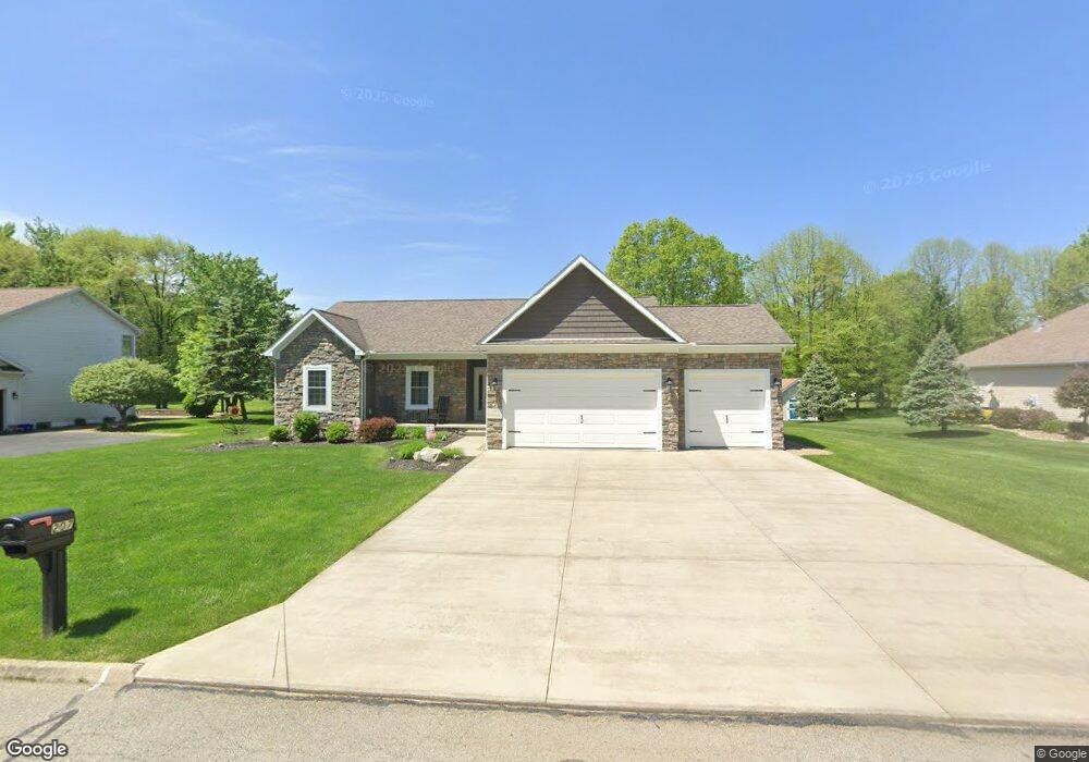
207 Saint Andrews Cortland, OH 44410
Estimated Value: $345,184 - $400,000
3
Beds
2
Baths
1,676
Sq Ft
$218/Sq Ft
Est. Value
About This Home
This home is located at 207 Saint Andrews, Cortland, OH 44410 and is currently estimated at $365,796, approximately $218 per square foot. 207 Saint Andrews is a home with nearby schools including Currie Elementary School, Baker Elementary School, and Mathews High School.
Ownership History
Date
Name
Owned For
Owner Type
Purchase Details
Closed on
Mar 25, 2014
Sold by
Haynam Harvey H and Haynam Christine M
Bought by
Gross Danny and Klaric Renee
Current Estimated Value
Purchase Details
Closed on
Sep 26, 2012
Sold by
Haymam Family Partnership Ltd
Bought by
Haynamn Harvey H and Haynamn Chrsitine M
Purchase Details
Closed on
Dec 15, 2005
Sold by
Walnut Run Land Co
Bought by
Haynam Ltd
Purchase Details
Closed on
Jul 8, 1997
Sold by
Walnut Run Land Co
Bought by
Haynam Ltd
Create a Home Valuation Report for This Property
The Home Valuation Report is an in-depth analysis detailing your home's value as well as a comparison with similar homes in the area
Home Values in the Area
Average Home Value in this Area
Purchase History
| Date | Buyer | Sale Price | Title Company |
|---|---|---|---|
| Gross Danny | $28,500 | None Available | |
| Haynamn Harvey H | $98,750 | None Available | |
| Haynam Ltd | $34,125 | -- | |
| Haynam Ltd | $34,125 | -- |
Source: Public Records
Tax History Compared to Growth
Tax History
| Year | Tax Paid | Tax Assessment Tax Assessment Total Assessment is a certain percentage of the fair market value that is determined by local assessors to be the total taxable value of land and additions on the property. | Land | Improvement |
|---|---|---|---|---|
| 2024 | $4,295 | $99,370 | $12,250 | $87,120 |
| 2023 | $4,775 | $99,370 | $12,250 | $87,120 |
| 2022 | $5,349 | $88,030 | $12,250 | $75,780 |
| 2021 | $5,362 | $88,030 | $12,250 | $75,780 |
| 2020 | $5,379 | $88,030 | $12,250 | $75,780 |
| 2019 | $4,984 | $78,160 | $12,250 | $65,910 |
| 2018 | $4,948 | $78,160 | $12,250 | $65,910 |
| 2017 | $4,934 | $78,160 | $12,250 | $65,910 |
| 2016 | $5,281 | $81,280 | $15,720 | $65,560 |
| 2015 | $4,227 | $65,560 | $15,720 | $49,840 |
| 2014 | -- | $14,140 | $14,140 | $0 |
| 2013 | $897 | $14,140 | $14,140 | $0 |
Source: Public Records
Map
Nearby Homes
- 0 St Andrews Unit 5113795
- 160 Saint Andrews
- 428 Cherry Hill Ln
- 404 Cherry Hill Ln
- 121 Fairway Dr
- 525 Sycamore Trail
- 507 Tournament Trail
- 124 Saint Andrews
- 400 Tournament Trail Unit 400
- 155 Heritage Ln
- 3461 Everett Hull Rd
- 4400 Ridge Rd
- 101 Elizabeth Ct
- 278 Rosewae Ave
- 0 N High St
- 4869 Phillips Rice Rd
- 20 Harneds Landing Unit 20
- 408 S Colonial Dr
- 151 Cedar Cir
- 163 N Mecca St Unit 167
- 211 Saint Andrews
- 208 Saint Andrews
- 204 Saint Andrews
- 2391 Andrews
- 199 Saint Andrews
- 215 Saint Andrews
- 216 Saint Andrews
- 196 Saint Andrews
- 200 Saint Andrews
- 0 St Andrews Unit 4010620
- 0 St Andrews Unit 4010637
- 0 St Andrews Unit 4010602
- 0 St Andrews Unit 3034913
- 0 St Andrews Unit 3889805
- 0 St Andrews Unit 1 4472664
- 0 St Andrews Unit 4348355
- 0 St Andrews Unit 4344565
- 0 St Andrews Unit 4344558
- 0 St Andrews Unit 4264118
- 0 St Andrews Unit 4176268