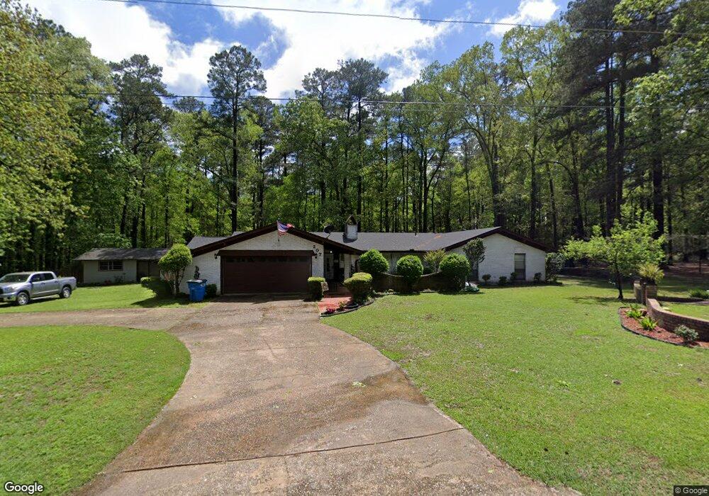
207 W 15th St SMacKover, AR 71762
Estimated Value: $246,000 - $304,000
--
Bed
3
Baths
2,475
Sq Ft
$113/Sq Ft
Est. Value
About This Home
This home is located at 207 W 15th St, SMacKover, AR 71762 and is currently estimated at $279,976, approximately $113 per square foot. 207 W 15th St is a home located in Union County with nearby schools including Smackover Elementary School, Norphlet Middle School, and Smackover High School.
Ownership History
Date
Name
Owned For
Owner Type
Purchase Details
Closed on
Sep 21, 2021
Sold by
Barker John S and Barker Sonia E
Bought by
Pauley Jeremy S and Pauley Melissa R
Current Estimated Value
Home Financials for this Owner
Home Financials are based on the most recent Mortgage that was taken out on this home.
Original Mortgage
$269,360
Outstanding Balance
$245,098
Interest Rate
2.8%
Mortgage Type
VA
Estimated Equity
$34,878
Purchase Details
Closed on
Mar 8, 2005
Sold by
Fraser Steven G and Abbott Charon Fraser
Bought by
Jameson J R and Jameson Sue Childers
Purchase Details
Closed on
Aug 30, 2004
Bought by
Abbott Charon Fraser and Fraser % Steve G
Create a Home Valuation Report for This Property
The Home Valuation Report is an in-depth analysis detailing your home's value as well as a comparison with similar homes in the area
Home Values in the Area
Average Home Value in this Area
Purchase History
| Date | Buyer | Sale Price | Title Company |
|---|---|---|---|
| Pauley Jeremy S | $260,000 | None Available | |
| Jameson J R | $119,000 | None Available | |
| Abbott Charon Fraser | -- | -- |
Source: Public Records
Mortgage History
| Date | Status | Borrower | Loan Amount |
|---|---|---|---|
| Open | Pauley Jeremy S | $269,360 |
Source: Public Records
Tax History Compared to Growth
Tax History
| Year | Tax Paid | Tax Assessment Tax Assessment Total Assessment is a certain percentage of the fair market value that is determined by local assessors to be the total taxable value of land and additions on the property. | Land | Improvement |
|---|---|---|---|---|
| 2024 | $2,088 | $56,050 | $4,500 | $51,550 |
| 2023 | $1,837 | $52,850 | $4,500 | $48,350 |
| 2022 | $1,779 | $39,970 | $4,500 | $35,470 |
| 2021 | $1,779 | $39,970 | $4,500 | $35,470 |
| 2020 | $1,779 | $39,970 | $4,500 | $35,470 |
| 2019 | $1,804 | $39,970 | $4,500 | $35,470 |
| 2018 | $1,804 | $39,970 | $4,500 | $35,470 |
| 2017 | $1,681 | $38,330 | $4,500 | $33,830 |
| 2016 | $1,681 | $38,330 | $4,500 | $33,830 |
| 2014 | $1,681 | $38,330 | $4,500 | $33,830 |
Source: Public Records
Map
Nearby Homes
- 1203 Pine Cir
- 103 E 13th St
- Lot 1 E 13th St
- 0 Poplar
- 1000 S Broadway St
- Lots 2-3 Poplar St
- 172 Lisbon Rd
- 902 Mount Holly Rd
- 106 Poplar St
- 0000 Hayes St
- 544 N Tate Rd
- 5022 Highway 7 S
- 5 acres Dumas City Rd
- 0 4-17s-15w Unit 25004308
- 0 Highway 75-20 Unit 24032576
- 430 O'Rear Rd
- 526 Meadow Ln
- 208 Mockingbird Ln
- 604 Robin Rd
- 109 Agnes Rd