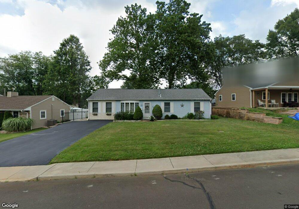
207 Waltham Rd Fairless Hills, PA 19030
Estimated Value: $375,575 - $399,000
2
Beds
1
Bath
1,272
Sq Ft
$303/Sq Ft
Est. Value
About This Home
This home is located at 207 Waltham Rd, Fairless Hills, PA 19030 and is currently estimated at $385,644, approximately $303 per square foot. 207 Waltham Rd is a home located in Bucks County with nearby schools including Oxford Valley Elementary School, William Penn Middle School, and Pennsbury High School.
Ownership History
Date
Name
Owned For
Owner Type
Purchase Details
Closed on
Jan 28, 2005
Sold by
Bissol Joseph
Bought by
Lavin Phyllis R
Current Estimated Value
Home Financials for this Owner
Home Financials are based on the most recent Mortgage that was taken out on this home.
Original Mortgage
$140,000
Interest Rate
5.64%
Mortgage Type
Fannie Mae Freddie Mac
Purchase Details
Closed on
Nov 7, 2002
Sold by
Bissol Joseph and Bissol Margaret
Bought by
Bissol Joseph
Purchase Details
Closed on
Mar 15, 2000
Sold by
Visnesky Paul D and Vonsydow Karen A
Bought by
Bissol Joseph and Bissol Margaret
Create a Home Valuation Report for This Property
The Home Valuation Report is an in-depth analysis detailing your home's value as well as a comparison with similar homes in the area
Home Values in the Area
Average Home Value in this Area
Purchase History
| Date | Buyer | Sale Price | Title Company |
|---|---|---|---|
| Lavin Phyllis R | $217,900 | -- | |
| Bissol Joseph | -- | -- | |
| Bissol Joseph | $90,000 | -- |
Source: Public Records
Mortgage History
| Date | Status | Borrower | Loan Amount |
|---|---|---|---|
| Previous Owner | Lavin Phyllis R | $140,000 |
Source: Public Records
Tax History Compared to Growth
Tax History
| Year | Tax Paid | Tax Assessment Tax Assessment Total Assessment is a certain percentage of the fair market value that is determined by local assessors to be the total taxable value of land and additions on the property. | Land | Improvement |
|---|---|---|---|---|
| 2025 | $3,893 | $17,480 | $5,120 | $12,360 |
| 2024 | $3,893 | $17,480 | $5,120 | $12,360 |
| 2023 | $3,730 | $17,480 | $5,120 | $12,360 |
| 2022 | $3,614 | $17,480 | $5,120 | $12,360 |
| 2021 | $3,544 | $17,480 | $5,120 | $12,360 |
| 2020 | $3,544 | $17,480 | $5,120 | $12,360 |
| 2019 | $3,482 | $17,480 | $5,120 | $12,360 |
| 2018 | $3,439 | $17,480 | $5,120 | $12,360 |
| 2017 | $3,352 | $17,480 | $5,120 | $12,360 |
| 2016 | $3,352 | $17,480 | $5,120 | $12,360 |
| 2015 | $2,981 | $17,480 | $5,120 | $12,360 |
| 2014 | $2,981 | $17,480 | $5,120 | $12,360 |
Source: Public Records
Map
Nearby Homes
- 208 Suffolk Rd
- 402 Stanford Rd
- 20 Trellis Rd
- 59 Liberty Dr
- 61 Liberty Dr
- 180 Andover Rd Unit A
- 248 N Oxford Valley Rd
- 10 Thistle Rd
- 212 Apple St
- 125 Nursery Ave
- 134 Lincoln Hwy Unit 11
- 01 Kyle Ln
- 0000000 Kyle Ln
- 0 Kyle Ln Unit PABU2095588
- 000000 Kyle Ln
- 0000 Kyle Ln
- 000 Kyle Ln
- 657 S Queen Anne Dr
- 53 Crestwood Rd
- 78 Harmony Rd
- 209 Waltham Rd
- 205 Waltham Rd
- 211 Waltham Rd
- 204 Tewksbury Rd
- 202 Tewksbury Rd
- 118 Blough Rd
- 206 Tewksbury Rd
- 120 Blough Rd
- 206 Waltham Rd
- 208 Waltham Rd
- 204 Waltham Rd
- 116 Blough Rd
- 213 Waltham Rd
- 210 Waltham Rd
- 202 Waltham Rd
- 208 Tewksbury Rd
- 212 Waltham Rd
- 215 Waltham Rd
- 205 Tewksbury Rd
- 207 Wyandotte Rd