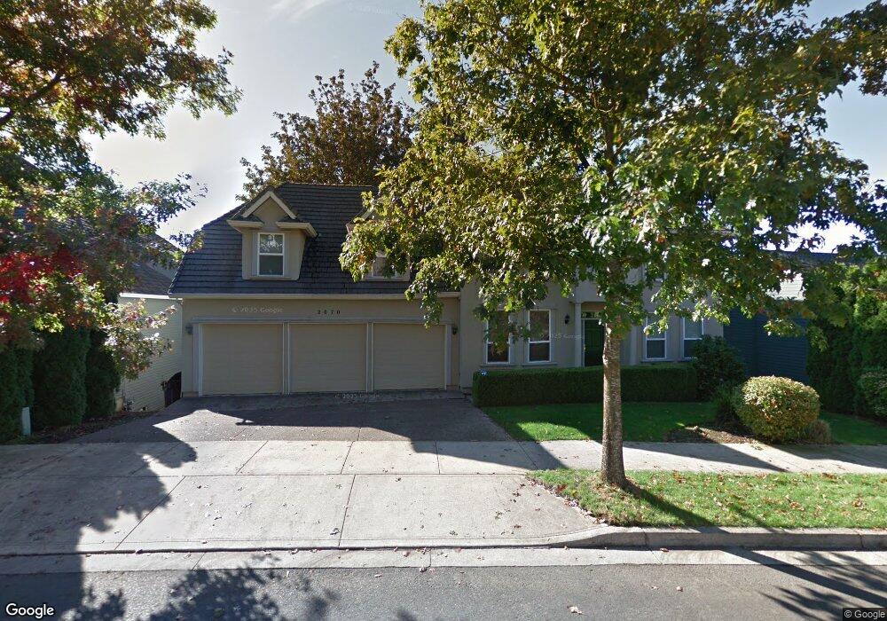
2070 Alpine Dr West Linn, OR 97068
Willamette NeighborhoodEstimated Value: $1,163,000 - $1,714,000
4
Beds
4
Baths
4,370
Sq Ft
$311/Sq Ft
Est. Value
About This Home
This home is located at 2070 Alpine Dr, West Linn, OR 97068 and is currently estimated at $1,357,068, approximately $310 per square foot. 2070 Alpine Dr is a home located in Clackamas County with nearby schools including Trillium Creek Primary School, Rosemont Ridge Middle School, and West Linn High School.
Ownership History
Date
Name
Owned For
Owner Type
Purchase Details
Closed on
Jan 14, 2021
Sold by
Evans Lorette H and Evans Matthew L
Bought by
Evans Family Trust and Evans
Current Estimated Value
Home Financials for this Owner
Home Financials are based on the most recent Mortgage that was taken out on this home.
Original Mortgage
$418,000
Outstanding Balance
$337,892
Interest Rate
2.67%
Mortgage Type
New Conventional
Estimated Equity
$1,019,176
Purchase Details
Closed on
Oct 25, 2019
Sold by
Evans Matthew L and Evans Lorette H
Bought by
Evans Lorette H and Evans Matthew L
Purchase Details
Closed on
Aug 27, 1998
Sold by
Renaissance Development Corp
Bought by
Evans Matthew L and Evans Lorette H
Home Financials for this Owner
Home Financials are based on the most recent Mortgage that was taken out on this home.
Original Mortgage
$352,000
Interest Rate
6.91%
Create a Home Valuation Report for This Property
The Home Valuation Report is an in-depth analysis detailing your home's value as well as a comparison with similar homes in the area
Home Values in the Area
Average Home Value in this Area
Purchase History
| Date | Buyer | Sale Price | Title Company |
|---|---|---|---|
| Evans Family Trust | -- | Amrock | |
| Evans Lorette H | -- | Amrock | |
| Evans Lorette H | -- | None Available | |
| Evans Matthew L | $440,000 | Oregon Title Insurance Co |
Source: Public Records
Mortgage History
| Date | Status | Borrower | Loan Amount |
|---|---|---|---|
| Open | Evans Lorette H | $418,000 | |
| Previous Owner | Evans Matthew L | $352,000 |
Source: Public Records
Tax History Compared to Growth
Tax History
| Year | Tax Paid | Tax Assessment Tax Assessment Total Assessment is a certain percentage of the fair market value that is determined by local assessors to be the total taxable value of land and additions on the property. | Land | Improvement |
|---|---|---|---|---|
| 2025 | $14,465 | $750,607 | -- | -- |
| 2024 | $13,924 | $728,745 | -- | -- |
| 2023 | $13,924 | $707,520 | $0 | $0 |
| 2022 | $13,143 | $686,913 | $0 | $0 |
| 2021 | $12,250 | $666,906 | $0 | $0 |
| 2020 | $12,164 | $647,482 | $0 | $0 |
| 2019 | $11,630 | $628,624 | $0 | $0 |
| 2018 | $11,085 | $610,315 | $0 | $0 |
| 2017 | $10,546 | $592,539 | $0 | $0 |
| 2016 | $10,094 | $575,281 | $0 | $0 |
| 2015 | $9,716 | $558,525 | $0 | $0 |
| 2014 | $9,192 | $542,257 | $0 | $0 |
Source: Public Records
Map
Nearby Homes
- 2050 Alpine Dr
- 2155 Alpine Dr
- 2485 Tipperary Ct
- 2540 Kilkenny Ct
- 6735 Summerlinn Way Unit 87
- 6840 Summerlinn Way Unit 93
- 23019 Bland Cir
- 3135 Summerlinn Dr Unit 40
- 23073 Bland Cir
- 1640 Village Park Place
- 6505 Summerlinn Way Unit 79
- 3395 Summerlinn Dr Unit 24
- 2134 Eleanor Rd
- 2240 Snowberry Ridge Ct Unit 2240
- 1618 Village Park Place
- Allstone Plan at Savannah Summit
- Milton Plan at Savannah Summit
- 22998 Bland Cir
- 22994 Bland Cir
- 22990 Bland Cir
- 2060 Alpine Dr
- 2080 Alpine Dr
- 2082 Alpine Dr
- 2075 Alpine Dr
- 2085 Alpine Dr
- 2065 Alpine Dr
- 2084 Alpine Dr
- 2090 Alpine Dr
- 2055 Alpine Dr
- 2086 Alpine Dr
- 2040 Alpine Dr
- 2098 Alpine Dr
- 2180 Alpine Dr
- 1655 Killarney Dr
- 2045 Alpine Dr
- 2195 Alpine Dr
- 2170 Alpine Dr
- 2088 Alpine Dr
- 2160 Alpine Dr
- 1667 Killarney Dr