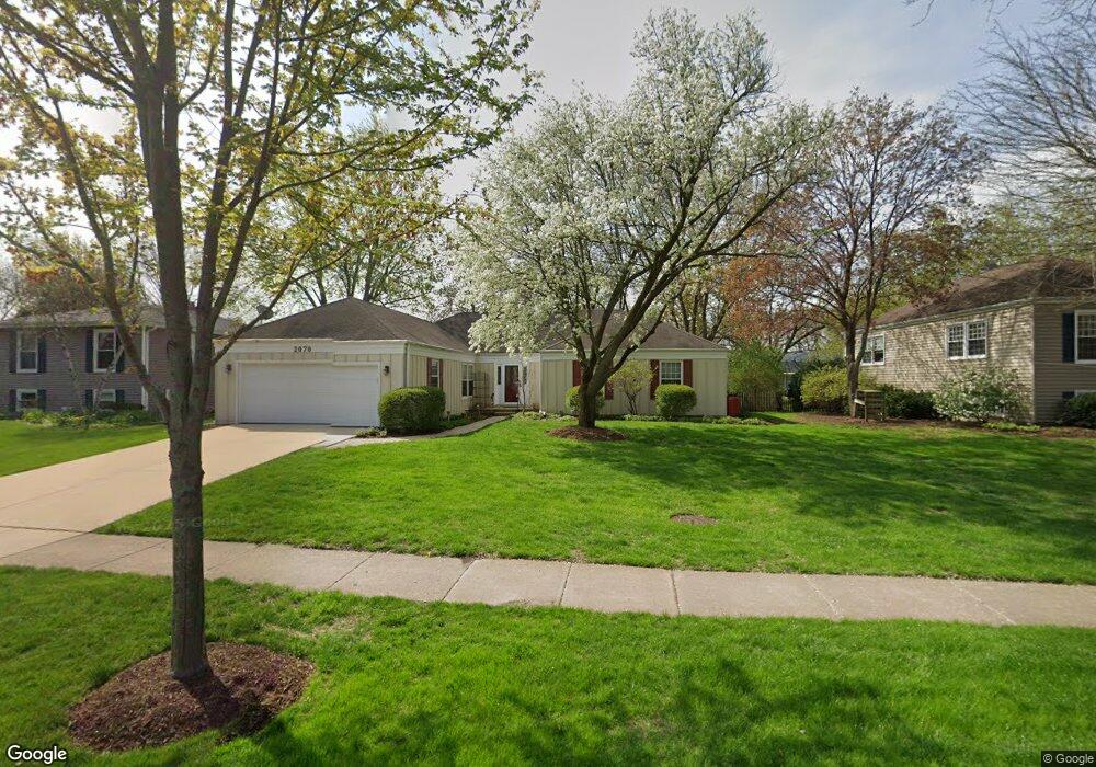
2070 Spring Green Dr Wheaton, IL 60189
West Wheaton NeighborhoodEstimated Value: $583,629 - $669,000
4
Beds
2
Baths
2,180
Sq Ft
$290/Sq Ft
Est. Value
About This Home
This home is located at 2070 Spring Green Dr, Wheaton, IL 60189 and is currently estimated at $632,157, approximately $289 per square foot. 2070 Spring Green Dr is a home located in DuPage County with nearby schools including Madison Elementary School, Edison Middle School, and Wheaton Warrenville South High School.
Ownership History
Date
Name
Owned For
Owner Type
Purchase Details
Closed on
Jun 8, 2004
Sold by
Landamerica Onestop Inc
Bought by
Kenworthy Sharon L
Current Estimated Value
Home Financials for this Owner
Home Financials are based on the most recent Mortgage that was taken out on this home.
Original Mortgage
$244,985
Interest Rate
6.4%
Mortgage Type
Purchase Money Mortgage
Purchase Details
Closed on
Apr 20, 2004
Sold by
Laplaca Robert H and Laplaca Debrah L
Bought by
Landamerica Onestop Inc and Executive Relocation Corp
Home Financials for this Owner
Home Financials are based on the most recent Mortgage that was taken out on this home.
Original Mortgage
$244,985
Interest Rate
6.4%
Mortgage Type
Purchase Money Mortgage
Purchase Details
Closed on
Jul 27, 1996
Sold by
Laplaca Robert H
Bought by
Laplaca Robert H and Laplaca Debrah L
Create a Home Valuation Report for This Property
The Home Valuation Report is an in-depth analysis detailing your home's value as well as a comparison with similar homes in the area
Home Values in the Area
Average Home Value in this Area
Purchase History
| Date | Buyer | Sale Price | Title Company |
|---|---|---|---|
| Kenworthy Sharon L | $377,000 | -- | |
| Landamerica Onestop Inc | $377,000 | -- | |
| Laplaca Robert H | -- | -- |
Source: Public Records
Mortgage History
| Date | Status | Borrower | Loan Amount |
|---|---|---|---|
| Previous Owner | Kenworthy Sharon L | $244,985 |
Source: Public Records
Tax History
| Year | Tax Paid | Tax Assessment Tax Assessment Total Assessment is a certain percentage of the fair market value that is determined by local assessors to be the total taxable value of land and additions on the property. | Land | Improvement |
|---|---|---|---|---|
| 2024 | $10,343 | $176,051 | $36,579 | $139,472 |
| 2023 | $9,897 | $162,050 | $33,670 | $128,380 |
| 2022 | $9,262 | $147,850 | $31,820 | $116,030 |
| 2021 | $9,465 | $144,340 | $31,060 | $113,280 |
| 2020 | $9,432 | $142,990 | $30,770 | $112,220 |
| 2019 | $9,208 | $139,220 | $29,960 | $109,260 |
| 2018 | $9,234 | $138,090 | $28,540 | $109,550 |
| 2017 | $9,084 | $133,000 | $27,490 | $105,510 |
| 2016 | $8,948 | $127,690 | $26,390 | $101,300 |
| 2015 | $8,340 | $115,300 | $25,180 | $90,120 |
| 2014 | $7,844 | $107,440 | $25,020 | $82,420 |
| 2013 | $7,645 | $107,760 | $25,090 | $82,670 |
Source: Public Records
Map
Nearby Homes
- 2043 Spring Green Dr
- 1440 Stonebridge Cir Unit J7
- 1442 Stonebridge Cir Unit I8
- 1484 Stonebridge Cir Unit B6
- 2105 Timber Ln
- 1122 Creekside Dr
- 1605 Burning Trail
- 1601 W Wiesbrook Rd
- 1862 W Wiesbrook Rd
- 1519 Foothill Dr
- 1S710 Shaffner Rd
- 1S728 Shaffner Rd
- 870 S Kilkenny Dr Unit D
- 1675 Grosvenor Cir Unit C
- 1s050 Shaffner Rd
- 1478 Timber Trail Unit 15C
- 615 Polo Dr
- 1474 Timber Trail Unit D
- 0S725 East St
- 1028 Lodalia Ct
- 2064 Spring Green Dr
- 2076 Spring Green Dr
- 2058 Spring Green Dr
- 1465 Stonebridge Trail
- 1477 Stonebridge Trail
- 1471 Stonebridge Trail
- 1474 Sandy Hook St
- 1459 Stonebridge Trail
- 2069 Spring Green Dr
- 2073 Spring Green Dr
- 2063 Spring Green Dr
- 2077 Spring Green Dr
- 2059 Spring Green Dr
- 1466 Sandy Hook St
- 2050 Spring Green Dr
- 1481 Stonebridge Trail
- 1488 Sandy Hook St
- 2085 Spring Green Dr
- 2051 Spring Green Dr
- 2091 Spring Green Dr
Your Personal Tour Guide
Ask me questions while you tour the home.