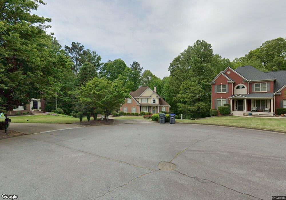
2070 Thorncliff Trace Cumming, GA 30040
Estimated Value: $571,000 - $633,000
5
Beds
3
Baths
2,404
Sq Ft
$251/Sq Ft
Est. Value
About This Home
This home is located at 2070 Thorncliff Trace, Cumming, GA 30040 and is currently estimated at $604,423, approximately $251 per square foot. 2070 Thorncliff Trace is a home located in Forsyth County with nearby schools including Kelly Mill Elementary School and Forsyth Central High School.
Ownership History
Date
Name
Owned For
Owner Type
Purchase Details
Closed on
Jan 17, 2006
Sold by
Rubino Phillip B and Rubino Laura L
Bought by
Baracz Timothy R and Baracz Betsie
Current Estimated Value
Home Financials for this Owner
Home Financials are based on the most recent Mortgage that was taken out on this home.
Original Mortgage
$233,600
Outstanding Balance
$130,834
Interest Rate
6.21%
Mortgage Type
New Conventional
Estimated Equity
$473,589
Purchase Details
Closed on
Sep 9, 1998
Sold by
Sharp Devel
Bought by
Rubino Phillip B and Rubino Laura L
Home Financials for this Owner
Home Financials are based on the most recent Mortgage that was taken out on this home.
Original Mortgage
$188,370
Interest Rate
6.99%
Mortgage Type
New Conventional
Create a Home Valuation Report for This Property
The Home Valuation Report is an in-depth analysis detailing your home's value as well as a comparison with similar homes in the area
Home Values in the Area
Average Home Value in this Area
Purchase History
| Date | Buyer | Sale Price | Title Company |
|---|---|---|---|
| Baracz Timothy R | $292,000 | -- | |
| Rubino Phillip B | $209,400 | -- |
Source: Public Records
Mortgage History
| Date | Status | Borrower | Loan Amount |
|---|---|---|---|
| Open | Baracz Timothy R | $233,600 | |
| Previous Owner | Rubino Phillip B | $188,370 |
Source: Public Records
Tax History Compared to Growth
Tax History
| Year | Tax Paid | Tax Assessment Tax Assessment Total Assessment is a certain percentage of the fair market value that is determined by local assessors to be the total taxable value of land and additions on the property. | Land | Improvement |
|---|---|---|---|---|
| 2025 | $5,698 | $240,572 | $64,000 | $176,572 |
| 2024 | $5,698 | $232,364 | $60,000 | $172,364 |
| 2023 | $5,351 | $217,392 | $60,000 | $157,392 |
| 2022 | $4,772 | $150,820 | $32,000 | $118,820 |
| 2021 | $4,165 | $150,820 | $32,000 | $118,820 |
| 2020 | $3,587 | $129,884 | $30,000 | $99,884 |
| 2019 | $3,684 | $133,228 | $28,000 | $105,228 |
| 2018 | $3,563 | $128,848 | $28,000 | $100,848 |
| 2017 | $3,330 | $119,988 | $28,000 | $91,988 |
| 2016 | $3,219 | $115,988 | $24,000 | $91,988 |
| 2015 | $3,114 | $111,988 | $20,000 | $91,988 |
| 2014 | $2,753 | $103,972 | $0 | $0 |
Source: Public Records
Map
Nearby Homes
- 2045 Crossover Dr
- 2145 Eagle Trace
- 1905 Barrett Dr
- 2185 Creole Cir
- 5540 Keithwood Ct
- 4540 Natchez Ln
- 5540 Castlebrooke Glen Ct
- Valley Plan at Silverwood
- Waterstone Plan at Silverwood
- Richmond Plan at Silverwood
- Ward Plan at Silverwood
- 2110 Kelly Mill Rd
- 1930 Stardust Trail
- 4660 Luke Dr
- 4510 Natchez Ln
- 4410 Natchez Ln
- 1755 Dawn Valley Trail
- 2421 Pittman Cir
- 4840 Luke Dr
- 4830 Northridge Dr
- 2080 Thorncliff Trace
- 2060 Thorncliff Trace
- 1925 Barrett Downs Dr
- 1935 Barrett Downs Dr
- 2035 Crossover Dr
- 2025 Crossover Dr
- 2050 Thorncliff Trace
- 1915 Barrett Downs Dr
- 1915 Barrett Downs Dr Unit 68
- 1945 Barrett Downs Dr
- 2075 Thorncliff Trace
- 2105 Crossover Dr
- 2065 Thorncliff Trace
- 1895 Barrett Downs Dr
- 2015 Crossover Dr
- 2040 Thorncliff Trace
- 2055 Thorncliff Trace
- 2115 Crossover Dr
- 1885 Barrett Downs Dr
- 2045 Thorncliff Trace