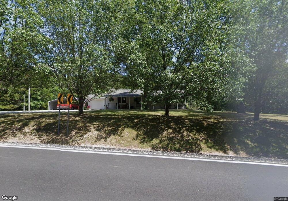
20700 State Highway 86 Cassville, MO 65625
Estimated Value: $166,623 - $349,000
3
Beds
1
Bath
1,236
Sq Ft
$205/Sq Ft
Est. Value
About This Home
This home is located at 20700 State Highway 86, Cassville, MO 65625 and is currently estimated at $253,656, approximately $205 per square foot. 20700 State Highway 86 is a home with nearby schools including Eunice Thomas Elementary School, Cassville Intermediate School, and Cassville Middle School.
Ownership History
Date
Name
Owned For
Owner Type
Purchase Details
Closed on
Aug 6, 2025
Sold by
Av Investments Llc
Bought by
H And H Real Estate Llc
Current Estimated Value
Purchase Details
Closed on
Jul 8, 2025
Sold by
Vaughn Alyssa and Vaughn Jacob
Bought by
Av Investments Llc
Purchase Details
Closed on
Jun 9, 2023
Sold by
Durossette Jess and Durossette Kimberly
Bought by
Durossette Jess and Durossette Kimberly
Create a Home Valuation Report for This Property
The Home Valuation Report is an in-depth analysis detailing your home's value as well as a comparison with similar homes in the area
Home Values in the Area
Average Home Value in this Area
Purchase History
| Date | Buyer | Sale Price | Title Company |
|---|---|---|---|
| H And H Real Estate Llc | -- | Great American Title | |
| Av Investments Llc | -- | Great American Title | |
| Av Investments Llc | -- | Great American Title | |
| Durossette Jess | -- | Barry County Abstract & Title |
Source: Public Records
Tax History Compared to Growth
Tax History
| Year | Tax Paid | Tax Assessment Tax Assessment Total Assessment is a certain percentage of the fair market value that is determined by local assessors to be the total taxable value of land and additions on the property. | Land | Improvement |
|---|---|---|---|---|
| 2025 | $488 | $12,160 | $3,116 | $9,044 |
| 2024 | $488 | $11,381 | $3,116 | $8,265 |
| 2023 | $488 | $11,381 | $3,116 | $8,265 |
| 2022 | $470 | $10,944 | $2,679 | $8,265 |
| 2021 | $446 | $10,355 | $2,090 | $8,265 |
| 2020 | $446 | $10,355 | $2,090 | $8,265 |
| 2018 | $435 | $10,355 | $2,090 | $8,265 |
| 2017 | $418 | $9,975 | $1,710 | $8,265 |
| 2016 | $418 | $9,842 | $1,710 | $8,132 |
| 2015 | -- | $9,842 | $1,710 | $8,132 |
| 2014 | -- | $9,557 | $1,710 | $7,847 |
| 2012 | -- | $0 | $0 | $0 |
Source: Public Records
Map
Nearby Homes
- 20793 Farm Road 1150
- 18008 State Highway 76
- 12655 Farm Road 2205 Cir
- 000 Coyote Ridge Rd
- 000 Coyote Ridge Rd Unit Lot 20
- 13580 State Highway Aa
- 000 Twin Springs Dr
- 0000 Farm Road 1135
- 17370 Farm Road 1150
- 16257 Farm Road 2175
- 16478 Farm Road 1170
- 20302 Farm Road 1120
- 19295 Hillcrest Ln
- 14497 Farm Road 1145
- 16329 State Highway 76
- 22281 Farm Road 2180
- 000 State Highway 76
- 000 State Highway Aa
- Lot 4 State Highway 112
- Lot 2 State Highway 112
- 20740 State Highway 86
- 20893 State Highway 86
- 15417 Private Road 2202
- 20415 State Highway 86
- 21033 State Highway 86
- 21033 State Highway 86
- 2102 Main St
- 20449 State Highway 86
- 21652 State Highway 86
- 20207 State Highway 86
- 21366 State Highway 86
- 20117 State Highway 86
- 20080 State Highway 86
- 21417 State Highway 86
- 21532 State Highway 86
- 15315 Private Road 2199
- 15136 Private Road 2199
- 14093 Farm Road 2200
- 21810 State Highway 86
- 19771 State Highway 86