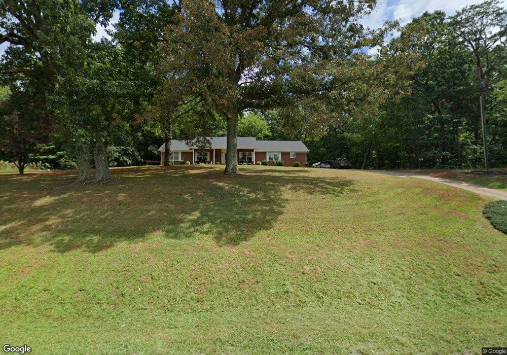
20700 Us Highway 29 Chatham, VA 24531
Estimated Value: $286,000 - $391,490
3
Beds
4
Baths
2,576
Sq Ft
$130/Sq Ft
Est. Value
About This Home
This home is located at 20700 Us Highway 29, Chatham, VA 24531 and is currently estimated at $335,123, approximately $130 per square foot. 20700 Us Highway 29 is a home located in Pittsylvania County with nearby schools including Chatham Elementary School, Chatham Middle School, and Chatham High School.
Ownership History
Date
Name
Owned For
Owner Type
Purchase Details
Closed on
Apr 30, 2015
Sold by
Bennett Phyllis M
Bought by
Mitchell Gregory A
Current Estimated Value
Home Financials for this Owner
Home Financials are based on the most recent Mortgage that was taken out on this home.
Original Mortgage
$152,192
Outstanding Balance
$118,046
Interest Rate
3.87%
Mortgage Type
FHA
Estimated Equity
$217,077
Create a Home Valuation Report for This Property
The Home Valuation Report is an in-depth analysis detailing your home's value as well as a comparison with similar homes in the area
Home Values in the Area
Average Home Value in this Area
Purchase History
| Date | Buyer | Sale Price | Title Company |
|---|---|---|---|
| Mitchell Gregory A | $155,000 | -- |
Source: Public Records
Mortgage History
| Date | Status | Borrower | Loan Amount |
|---|---|---|---|
| Open | Mitchell Gregory A | $152,192 |
Source: Public Records
Tax History Compared to Growth
Tax History
| Year | Tax Paid | Tax Assessment Tax Assessment Total Assessment is a certain percentage of the fair market value that is determined by local assessors to be the total taxable value of land and additions on the property. | Land | Improvement |
|---|---|---|---|---|
| 2025 | $1,871 | $334,100 | $24,000 | $310,100 |
| 2024 | $1,871 | $334,100 | $24,000 | $310,100 |
| 2023 | $1,871 | $334,100 | $24,000 | $310,100 |
| 2022 | $1,487 | $220,500 | $24,000 | $196,500 |
| 2021 | $1,367 | $220,500 | $24,000 | $196,500 |
| 2020 | $1,367 | $220,500 | $24,000 | $196,500 |
| 2019 | $1,367 | $220,500 | $24,000 | $196,500 |
| 2018 | $1,367 | $220,500 | $24,000 | $196,500 |
| 2017 | $1,253 | $220,500 | $24,000 | $196,500 |
| 2016 | $1,253 | $212,300 | $20,000 | $192,300 |
| 2015 | $1,253 | $212,300 | $20,000 | $192,300 |
| 2011 | -- | $212,300 | $20,000 | $192,300 |
Source: Public Records
Map
Nearby Homes
- 1953 Anderson Mill Rd
- 000 N Main St
- 00 N Main St
- 12.93 AC Brandon Rd
- 42.9 AC Brandon Rd
- lot 8 Cherrystone Lake Rd
- lot 7 Cherrystone Lake Rd
- lot 4 Cherrystone Lake Rd
- lot 2 Cherrystone Lake Rd
- lot 3 Cherrystone Lake Rd
- 00 4A Hodnetts Mill Rd
- 000 Roaring Fork Lake Rd
- 439 Peach St
- 280 Hurt St
- 238 N Main St
- 243 Catalpa Dr
- 132 Main St
- 127 N Main St
- 111 N Main St
- 65 N Main St
- 20700 U S Hwy 29
- 20800 Us Highway 29
- 20560 Us Highway 29
- 20669 Us Highway 29
- 12433 U S Hwy 29 N
- 20868 Us Highway 29
- 20540 Us Highway 29
- 20932 U S 29
- 20385 Us Highway 29
- 20385 U S Hwy 29 N
- 21060 Us Highway 29
- 21140 U S Highway No 29
- 400 Hawkins Rd
- 448 Hawkins Rd
- 360 Hawkins Rd
- 00 Us 29 S
- 340 Hawkins Rd
- 758 Hawkins Rd
- 21348 Us Highway 29
- 3493 Old Mine Rd