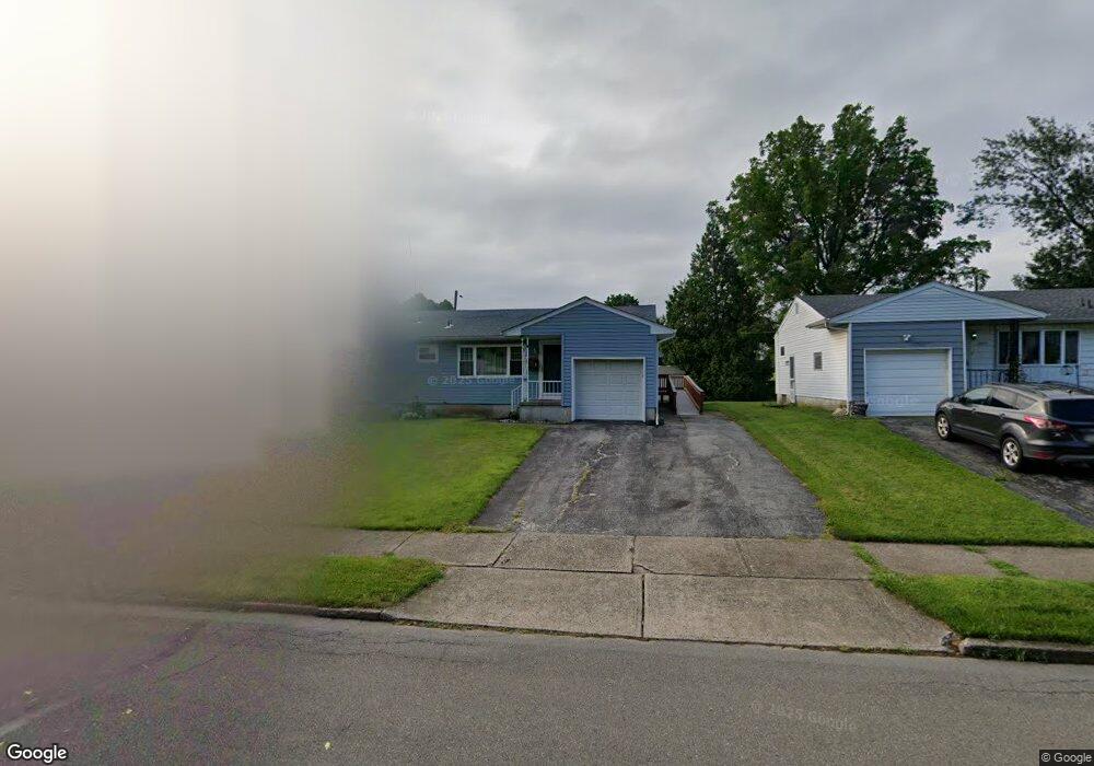
2071 Aster Rd Bethlehem, PA 18018
West Bethlehem NeighborhoodEstimated Value: $340,000 - $386,000
2
Beds
2
Baths
1,526
Sq Ft
$235/Sq Ft
Est. Value
About This Home
This home is located at 2071 Aster Rd, Bethlehem, PA 18018 and is currently estimated at $358,895, approximately $235 per square foot. 2071 Aster Rd is a home located in Lehigh County with nearby schools including Clearview Elementary School, Nitschmann Middle School, and Liberty High School.
Ownership History
Date
Name
Owned For
Owner Type
Purchase Details
Closed on
Apr 14, 1986
Bought by
Wonderly Larry R and Wonderly Wendi L
Current Estimated Value
Purchase Details
Closed on
Apr 27, 1984
Bought by
Karlberg Dorothy R
Create a Home Valuation Report for This Property
The Home Valuation Report is an in-depth analysis detailing your home's value as well as a comparison with similar homes in the area
Home Values in the Area
Average Home Value in this Area
Purchase History
We collect this data history from publicly available records. To have your information removed, we recommend requesting removal directly through your county’s website.
| Date | Buyer | Sale Price | Title Company |
|---|---|---|---|
| Wonderly Larry R | $65,200 | -- | |
| Karlberg Dorothy R | $64,900 | -- |
Source: Public Records
Tax History
| Year | Tax Paid | Tax Assessment Tax Assessment Total Assessment is a certain percentage of the fair market value that is determined by local assessors to be the total taxable value of land and additions on the property. | Land | Improvement |
|---|---|---|---|---|
| 2026 | $5,406 | $183,800 | $28,900 | $154,900 |
| 2025 | $5,281 | $183,800 | $28,900 | $154,900 |
| 2024 | $5,220 | $183,800 | $28,900 | $154,900 |
| 2023 | $5,174 | $183,800 | $28,900 | $154,900 |
| 2022 | $5,259 | $183,800 | $154,900 | $28,900 |
| 2021 | $5,235 | $183,800 | $28,900 | $154,900 |
| 2020 | $5,067 | $183,800 | $28,900 | $154,900 |
| 2019 | $5,104 | $183,800 | $28,900 | $154,900 |
| 2018 | $5,005 | $183,800 | $28,900 | $154,900 |
| 2017 | $4,782 | $183,800 | $28,900 | $154,900 |
| 2016 | -- | $183,800 | $28,900 | $154,900 |
| 2015 | -- | $183,800 | $28,900 | $154,900 |
| 2014 | -- | $183,800 | $28,900 | $154,900 |
Source: Public Records
Map
Nearby Homes
- 1923 Catasauqua Rd
- 2035 Drury Ln
- 2273 Vista Dr
- 1556 Bayberry Ln
- 1920 Ravenwood Dr
- 1961 Ravenwood Dr
- 1936 Kingsley Dr
- 1455 Wynnewood Dr
- 3350 5 Airport Rd
- 1368 Club Ave
- 3350 Airport Rd
- 3350 Airport Rd Unit 5
- 2114 Fireside Dr
- 1548 Dale Ln
- 1332 N Ulster St
- 1534 Eastwood Dr
- 1535 Ciara Dr
- 2640 Belaire Rd
- 1800 Eastman Ave
- 1930 E Columbia St
- 2066 Aster Rd
- 2080 Aster Rd
- 2073 Blossom Ln
- 2227 Allwood Dr
- 2079 Blossom Ln
- 2077 Aster Rd
- 2244 Allwood Dr
- 2230 Allwood Dr
- 2250 Allwood Dr
- 2101 Aster Rd
- 2274 Barrington Rd
- 2215 Allwood Dr
- 2106 Aster Rd
- 2341 Eden Ln
- 2078 Blossom Ln
- 2105 Aster Rd
- 2103 Blossom Ln
- 2336 Eden Ln
- 2266 Barrington Rd
- 2209 Allwood Dr
Your Personal Tour Guide
Ask me questions while you tour the home.