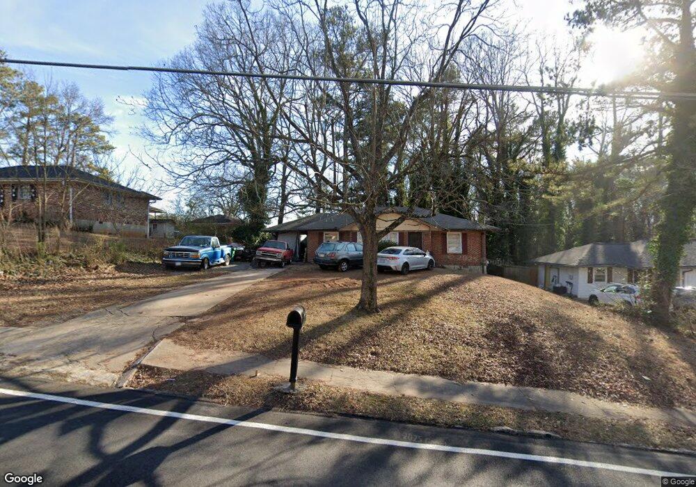
2071 Brannen Rd SE Atlanta, GA 30316
Gresham Park NeighborhoodEstimated Value: $216,000 - $297,000
3
Beds
1
Bath
1,126
Sq Ft
$222/Sq Ft
Est. Value
About This Home
This home is located at 2071 Brannen Rd SE, Atlanta, GA 30316 and is currently estimated at $249,607, approximately $221 per square foot. 2071 Brannen Rd SE is a home located in DeKalb County with nearby schools including McNair Middle School, McNair High School, and Genesis Innovation Academy for Girls.
Ownership History
Date
Name
Owned For
Owner Type
Purchase Details
Closed on
Dec 21, 2018
Sold by
Hamm Patrick
Bought by
Turner Cedrick and Hamm Patrick
Current Estimated Value
Purchase Details
Closed on
May 13, 2004
Sold by
Hamm John W
Bought by
Hamm Patrick L
Home Financials for this Owner
Home Financials are based on the most recent Mortgage that was taken out on this home.
Original Mortgage
$28,500
Interest Rate
5.88%
Mortgage Type
Stand Alone Second
Create a Home Valuation Report for This Property
The Home Valuation Report is an in-depth analysis detailing your home's value as well as a comparison with similar homes in the area
Home Values in the Area
Average Home Value in this Area
Purchase History
| Date | Buyer | Sale Price | Title Company |
|---|---|---|---|
| Turner Cedrick | $1,000 | -- | |
| Hamm Patrick L | $30,000 | -- |
Source: Public Records
Mortgage History
| Date | Status | Borrower | Loan Amount |
|---|---|---|---|
| Previous Owner | Hamm Patrick L | $28,500 |
Source: Public Records
Tax History Compared to Growth
Tax History
| Year | Tax Paid | Tax Assessment Tax Assessment Total Assessment is a certain percentage of the fair market value that is determined by local assessors to be the total taxable value of land and additions on the property. | Land | Improvement |
|---|---|---|---|---|
| 2024 | $4,250 | $87,600 | $32,000 | $55,600 |
| 2023 | $4,250 | $77,400 | $27,800 | $49,600 |
| 2022 | $3,032 | $61,960 | $14,000 | $47,960 |
| 2021 | $2,755 | $55,640 | $14,000 | $41,640 |
| 2020 | $2,263 | $44,440 | $14,000 | $30,440 |
| 2019 | $2,414 | $47,880 | $14,000 | $33,880 |
| 2018 | $1,659 | $37,200 | $14,000 | $23,200 |
| 2017 | $1,662 | $30,600 | $4,160 | $26,440 |
| 2016 | $1,405 | $24,720 | $4,160 | $20,560 |
| 2014 | $1,293 | $21,640 | $4,160 | $17,480 |
Source: Public Records
Map
Nearby Homes
- 2052 Brannen Rd SE
- 2037 Brannen Rd SE
- 2555 Flagstone Dr SE
- 2311 Boulder Rd SE
- 2608 Rockcliff Rd SE
- 2634 Rockcliff Rd SE
- 1951 Brannen Rd SE
- 2646 Rockcliff Rd SE
- 2636 Flagstone Dr SE
- 1662 Flintwood Dr SE
- 1808 Arkose Dr SE
- 1625 Flintwood Dr SE
- 2683 Rockcliff Rd SE
- 2373 Bouldercliff Way SE
- 1620 Flintwood Dr SE
- 1564 Boulderwoods Dr SE
- 1558 Boulderwoods Dr SE
- 2065 Brannen Rd SE
- 2065 Brannen Rd SE Unit Acres
- 2079 Brannen Rd SE
- 2543 Rockcliff Rd SE
- 2059 Brannen Rd SE
- 2549 Rockcliff Rd SE
- 2064 Brannen Rd SE
- 2064 Brannen Rd SE Unit 2064
- 2064 Brannen Rd SE
- 2076 Brannen Rd SE
- 2053 Brannen Rd SE
- 2089 Brannen Rd SE Unit 1
- 2555 Rockcliff Rd SE Unit 2
- 2058 Brannen Rd SE
- 0 Rockcliff Rd SE Unit 10576742
- 0 Rockcliff Rd SE Unit 7368241
- 0 Rockcliff Rd SE Unit 8659158
- 0 Rockcliff Rd SE Unit 8632940
- 0 Rockcliff Rd SE Unit 8583363
- 0 Rockcliff Rd SE Unit 8530090