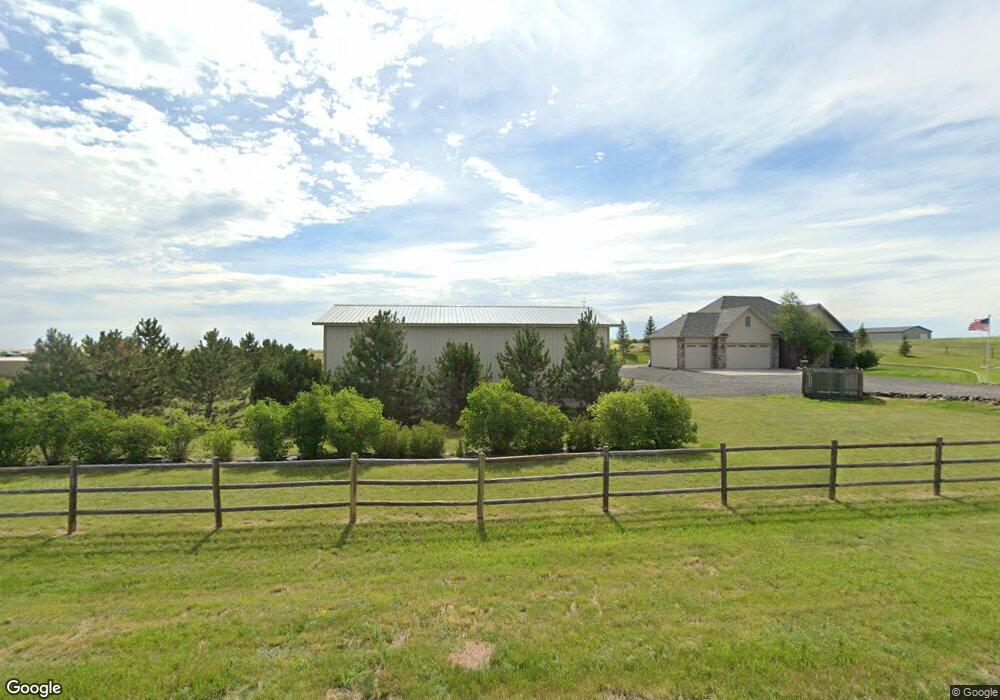
2071 Lacy Dr Cheyenne, WY 82009
Estimated Value: $528,000 - $834,000
--
Bed
1
Bath
1,809
Sq Ft
$381/Sq Ft
Est. Value
About This Home
This home is located at 2071 Lacy Dr, Cheyenne, WY 82009 and is currently estimated at $689,746, approximately $381 per square foot. 2071 Lacy Dr is a home located in Laramie County with nearby schools including Prairie Wind Elementary School, McCormick Junior High School, and Central High School.
Ownership History
Date
Name
Owned For
Owner Type
Purchase Details
Closed on
Oct 11, 2017
Sold by
Sindelir Randall L
Bought by
Sindelir Randall L and Sindelir Peggy Jan
Current Estimated Value
Purchase Details
Closed on
Oct 10, 2017
Sold by
Sindelir Randall L
Bought by
Sindleir Randall L and Sindleir Peggy Jan
Purchase Details
Closed on
Mar 23, 2007
Sold by
4 Quarters Land & Livestock Llc
Bought by
Sindelir Randall L
Home Financials for this Owner
Home Financials are based on the most recent Mortgage that was taken out on this home.
Original Mortgage
$206,000
Interest Rate
6.26%
Mortgage Type
Purchase Money Mortgage
Create a Home Valuation Report for This Property
The Home Valuation Report is an in-depth analysis detailing your home's value as well as a comparison with similar homes in the area
Home Values in the Area
Average Home Value in this Area
Purchase History
| Date | Buyer | Sale Price | Title Company |
|---|---|---|---|
| Sindelir Randall L | -- | None Available | |
| Sindleir Randall L | -- | None Available | |
| Sindelir Randall L | -- | None Available | |
| Sindelir Randall L | -- | None Available |
Source: Public Records
Mortgage History
| Date | Status | Borrower | Loan Amount |
|---|---|---|---|
| Previous Owner | Sindelir Randall L | $206,000 |
Source: Public Records
Tax History Compared to Growth
Tax History
| Year | Tax Paid | Tax Assessment Tax Assessment Total Assessment is a certain percentage of the fair market value that is determined by local assessors to be the total taxable value of land and additions on the property. | Land | Improvement |
|---|---|---|---|---|
| 2025 | $3,923 | $47,813 | $5,631 | $42,182 |
| 2024 | $3,923 | $61,369 | $7,508 | $53,861 |
| 2023 | $3,840 | $61,437 | $7,508 | $53,929 |
| 2022 | $3,467 | $54,603 | $6,837 | $47,766 |
| 2021 | $3,524 | $55,335 | $6,002 | $49,333 |
| 2020 | $3,345 | $52,819 | $6,002 | $46,817 |
| 2019 | $3,151 | $49,897 | $5,656 | $44,241 |
| 2018 | $2,838 | $45,657 | $5,656 | $40,001 |
| 2017 | $2,770 | $44,238 | $5,656 | $38,582 |
| 2016 | $2,551 | $40,967 | $3,684 | $37,283 |
| 2015 | $2,584 | $41,429 | $3,684 | $37,745 |
| 2014 | $2,782 | $41,098 | $3,551 | $37,547 |
Source: Public Records
Map
Nearby Homes
- 2076 Lacy Dr
- 2091 Lacy Dr
- 2070 Mammoth Rd
- 2076 Painted Sky Rd
- Tract 3 Mugho Rd
- 2245 Rainbow Ridge
- Lot 19 Old Faithful Way
- 2269 Carina Ct
- TRACT 14 Old Faithful Way
- 2309 Silver Gate Way
- 2390 Old Faithful Way
- 2265 Hugh Glass Trail
- 2269 Hugh Glass Trail
- 2387 Silver Gate Way
- Lot 21 Telephone Rd
- 1982 Chugwater Dr
- Tract 7 Susie Ct
- 1948 Federal Blvd
- Lot 9 Sunrise Hills Dr
- TBD Road 217
- 2254 Iriquois Dr
- 2077 Lacy Dr
- 2258 Iriquois Dr
- 2083 Lacy Dr
- 2257 Iriquois Dr
- TR 36 Iriquois Dr
- 2253 Iriquois Dr
- TR 34 Iriquois Dr
- TR 31 Iriquois Dr
- 2236 Iriquois Dr
- 2247 Iriquois Dr
- TR 26 Iriquois Dr
- TR 28 Iriquois Dr
- TR 33 Iriquois Dr
- 2088 Lacy Dr
- TR 25 Iriquois Dr
- Lot 29 Iriquois Dr
- TR 20 Lacy Dr
- Tract 21 Lacy Dr
- 2241 Iriquois Dr