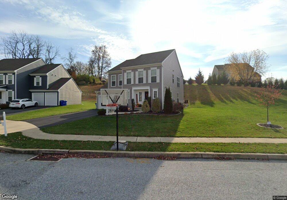
2071 Parson Ct Red Lion, PA 17356
Estimated Value: $437,000 - $494,000
3
Beds
3
Baths
1,683
Sq Ft
$272/Sq Ft
Est. Value
About This Home
This home is located at 2071 Parson Ct, Red Lion, PA 17356 and is currently estimated at $457,664, approximately $271 per square foot. 2071 Parson Ct is a home located in York County with nearby schools including Ore Valley Elementary School, Dallastown Area Middle School, and Dallastown Area High School.
Ownership History
Date
Name
Owned For
Owner Type
Purchase Details
Closed on
Nov 7, 2017
Sold by
Charter Homes At Sage Hill Inc
Bought by
Bloom Robert C and Bloom Erin A
Current Estimated Value
Home Financials for this Owner
Home Financials are based on the most recent Mortgage that was taken out on this home.
Original Mortgage
$269,788
Outstanding Balance
$225,469
Interest Rate
3.75%
Mortgage Type
FHA
Estimated Equity
$232,195
Create a Home Valuation Report for This Property
The Home Valuation Report is an in-depth analysis detailing your home's value as well as a comparison with similar homes in the area
Home Values in the Area
Average Home Value in this Area
Purchase History
| Date | Buyer | Sale Price | Title Company |
|---|---|---|---|
| Bloom Robert C | $274,765 | None Available |
Source: Public Records
Mortgage History
| Date | Status | Borrower | Loan Amount |
|---|---|---|---|
| Open | Bloom Robert C | $269,788 |
Source: Public Records
Tax History Compared to Growth
Tax History
| Year | Tax Paid | Tax Assessment Tax Assessment Total Assessment is a certain percentage of the fair market value that is determined by local assessors to be the total taxable value of land and additions on the property. | Land | Improvement |
|---|---|---|---|---|
| 2025 | $8,871 | $258,420 | $65,400 | $193,020 |
| 2024 | $8,741 | $258,420 | $65,400 | $193,020 |
| 2023 | $8,741 | $258,420 | $65,400 | $193,020 |
| 2022 | $8,456 | $258,420 | $65,400 | $193,020 |
| 2021 | $8,055 | $258,420 | $65,400 | $193,020 |
| 2020 | $8,055 | $258,420 | $65,400 | $193,020 |
| 2019 | $8,029 | $258,420 | $65,400 | $193,020 |
| 2018 | $1,508 | $48,870 | $48,870 | $0 |
| 2017 | $1,448 | $48,870 | $48,870 | $0 |
| 2016 | $0 | $48,870 | $48,870 | $0 |
| 2015 | -- | $48,870 | $48,870 | $0 |
| 2014 | -- | $48,870 | $48,870 | $0 |
Source: Public Records
Map
Nearby Homes
- 2740 Cape Horn Rd
- 2540 Cape Horn Rd
- 2793 Heather Dr
- 445 Steinfelt Rd
- 2932 Cape Horn Rd
- 2757 Primrose Ln
- 2768 Meadow Cross Way
- 2410 Cape Horn Rd
- 2730 Woodspring Dr
- Lot 4 Chestnut Hill Rd
- Lot 7 Chestnut Hill Rd
- Lot 5 Chestnut Hill Rd
- Lot 4 St. Michaels Chestnut Hill Rd
- Lot 4 Berkeley Chestnut Hill Rd
- 0 Chapel Church Rd
- Lot 5 Berkeley Model Chestnut Hill Rd
- Lot 5 St. Michaels Chestnut Hill Rd
- 444 Bradford Dr Unit 55
- 438 Bradford Dr Unit 58
- 436 Bradford Dr Unit 59
- 2071 Parson Ct Unit 63
- 2061 Parson Ct
- 2081 Parson Ct
- 2064 Parson Ct
- 2074 Parson Ct
- 2072 Westbury Ct
- 2084 Parson Ct
- 2051 Parson Ct
- 855 S Sharon Ave
- 2082 Westbury Ct
- 2062 Westbury Ct
- 865 S Sharon Ave
- 875 S Sharon Ave
- 2052 Westbury Ct
- 2041 Parson Ct
- 2083 Westbury Ct
- 906 Bellview Ct
- 2073 Westbury Ct
- 2042 Westbury Ct
- 2031 Parson Ct