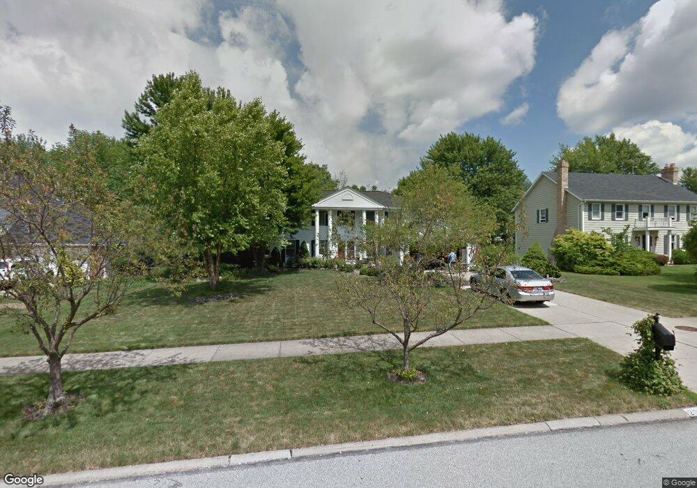
2071 Savannah Pkwy Westlake, OH 44145
Estimated Value: $506,000 - $636,000
4
Beds
3
Baths
3,029
Sq Ft
$188/Sq Ft
Est. Value
About This Home
This home is located at 2071 Savannah Pkwy, Westlake, OH 44145 and is currently estimated at $569,388, approximately $187 per square foot. 2071 Savannah Pkwy is a home located in Cuyahoga County with nearby schools including Dover Intermediate School, Lee Burneson Middle School, and Westlake High School.
Ownership History
Date
Name
Owned For
Owner Type
Purchase Details
Closed on
Jun 10, 1999
Sold by
Sullivan Robert J and Sullivan Mary Ann
Bought by
Lyndrickson Gary A and Lyndrickson Linda K
Current Estimated Value
Home Financials for this Owner
Home Financials are based on the most recent Mortgage that was taken out on this home.
Original Mortgage
$238,450
Outstanding Balance
$62,576
Interest Rate
6.99%
Estimated Equity
$506,812
Purchase Details
Closed on
Sep 14, 1989
Sold by
Gardner Herbert A
Bought by
Sullivan Robert J
Purchase Details
Closed on
Aug 5, 1983
Sold by
Terry Bldrs
Bought by
Gardner Herbert A
Purchase Details
Closed on
May 17, 1983
Sold by
Gardner Herbert A
Bought by
Terry Bldrs
Purchase Details
Closed on
Apr 11, 1983
Bought by
Gardner Herbert A
Purchase Details
Closed on
Jan 1, 1980
Bought by
Central Land Corp
Create a Home Valuation Report for This Property
The Home Valuation Report is an in-depth analysis detailing your home's value as well as a comparison with similar homes in the area
Home Values in the Area
Average Home Value in this Area
Purchase History
| Date | Buyer | Sale Price | Title Company |
|---|---|---|---|
| Lyndrickson Gary A | $251,000 | Chicago Title | |
| Sullivan Robert J | $208,000 | -- | |
| Gardner Herbert A | $138,000 | -- | |
| Terry Bldrs | -- | -- | |
| Gardner Herbert A | $38,000 | -- | |
| Central Land Corp | -- | -- |
Source: Public Records
Mortgage History
| Date | Status | Borrower | Loan Amount |
|---|---|---|---|
| Open | Lyndrickson Gary A | $238,450 |
Source: Public Records
Tax History Compared to Growth
Tax History
| Year | Tax Paid | Tax Assessment Tax Assessment Total Assessment is a certain percentage of the fair market value that is determined by local assessors to be the total taxable value of land and additions on the property. | Land | Improvement |
|---|---|---|---|---|
| 2024 | $8,156 | $172,165 | $34,160 | $138,005 |
| 2023 | $7,193 | $129,820 | $32,100 | $97,720 |
| 2022 | $7,078 | $129,820 | $32,100 | $97,720 |
| 2021 | $7,087 | $129,820 | $32,100 | $97,720 |
| 2020 | $7,153 | $120,190 | $29,720 | $90,480 |
| 2019 | $6,936 | $343,400 | $84,900 | $258,500 |
| 2018 | $6,608 | $120,190 | $29,720 | $90,480 |
| 2017 | $6,316 | $102,480 | $27,020 | $75,460 |
| 2016 | $6,282 | $102,480 | $27,020 | $75,460 |
| 2015 | $5,456 | $102,480 | $27,020 | $75,460 |
| 2014 | $5,456 | $87,370 | $24,120 | $63,250 |
Source: Public Records
Map
Nearby Homes
- 1670 Cedarwood Dr Unit 148
- 1625 Cedarwood Dr Unit 218
- 1510 Alder Ln Unit 7C
- 1480 Cedarwood Dr Unit 21F
- 1316 Cedarwood Dr Unit D3
- 1476 Bobby Ln Unit 7
- 31035 Wilderness Trail
- 29379 Detroit Rd
- 29363 Detroit Rd Unit 5
- 2075 Bassett Rd
- 31000 Logan Ct
- 2647 Piedmont Ct Unit 56
- 31072 Riviera Ln
- 31587 Turtle Cr
- 2847 Rocky Ridge Dr
- 2705 Rocky Ridge Dr
- 2891 Rocky Ridge Dr Unit V/L 173
- V/L Rocky Ridge Dr
- 2962 Forest Lake Dr
- 2662 Rocky Ridge Dr Unit 157
- 2059 Savannah Pkwy
- 2083 Savannah Pkwy
- 2047 Savannah Pkwy
- 2095 Savannah Pkwy
- 2070 Savannah Pkwy
- 2058 Savannah Pkwy
- 90 Ashbourne Dr Unit 90
- 90 Ashbourne Dr
- 100 Ashbourne Dr Unit 7
- 78 Ashbourne Dr
- 78 Ashbourne Dr Unit 82
- 2082 Savannah Pkwy
- 2046 Savannah Pkwy
- 58 Ashbourne Dr
- 2035 Savannah Pkwy
- 2107 Savannah Pkwy
- 50 Ashbourne Dr
- 2094 Savannah Pkwy
- 110 Ashbourne Dr
- 10 Ashbourne Dr