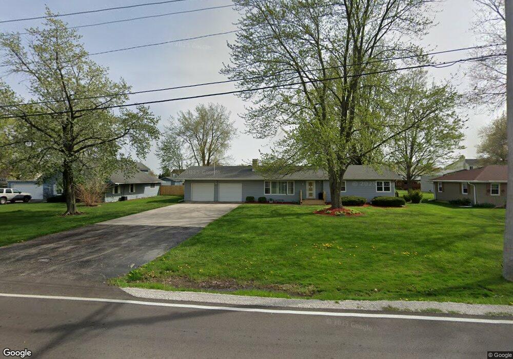
2071 Sheffer Rd Unit 1 Aurora, IL 60502
Indian Creek NeighborhoodEstimated Value: $347,000 - $405,000
3
Beds
2
Baths
1,738
Sq Ft
$216/Sq Ft
Est. Value
About This Home
This home is located at 2071 Sheffer Rd Unit 1, Aurora, IL 60502 and is currently estimated at $375,924, approximately $216 per square foot. 2071 Sheffer Rd Unit 1 is a home located in Kane County with nearby schools including Mabel O Donnell Elementary School, Simmons Middle School, and East Aurora High School.
Ownership History
Date
Name
Owned For
Owner Type
Purchase Details
Closed on
Jun 2, 2003
Sold by
Jones Gerald A and Jones Dolores
Bought by
Jones Gerald A and Jones Dolores F
Current Estimated Value
Purchase Details
Closed on
Nov 1, 2002
Sold by
Heimann Robert L and Heimann Jyme C
Bought by
Jones Gerald A and Jones Dolores
Home Financials for this Owner
Home Financials are based on the most recent Mortgage that was taken out on this home.
Original Mortgage
$148,000
Outstanding Balance
$62,264
Interest Rate
6.08%
Estimated Equity
$313,660
Create a Home Valuation Report for This Property
The Home Valuation Report is an in-depth analysis detailing your home's value as well as a comparison with similar homes in the area
Home Values in the Area
Average Home Value in this Area
Purchase History
| Date | Buyer | Sale Price | Title Company |
|---|---|---|---|
| Jones Gerald A | -- | Chicago Title Insurance Comp | |
| Jones Gerald A | $185,000 | -- |
Source: Public Records
Mortgage History
| Date | Status | Borrower | Loan Amount |
|---|---|---|---|
| Open | Jones Gerald A | $148,000 |
Source: Public Records
Tax History
| Year | Tax Paid | Tax Assessment Tax Assessment Total Assessment is a certain percentage of the fair market value that is determined by local assessors to be the total taxable value of land and additions on the property. | Land | Improvement |
|---|---|---|---|---|
| 2024 | $5,019 | $115,331 | $18,563 | $96,768 |
| 2023 | $4,816 | $103,048 | $16,586 | $86,462 |
| 2022 | $4,640 | $94,022 | $15,133 | $78,889 |
| 2021 | $4,586 | $87,536 | $14,089 | $73,447 |
| 2020 | $4,343 | $81,308 | $13,087 | $68,221 |
| 2019 | $4,265 | $75,334 | $12,125 | $63,209 |
| 2018 | $4,276 | $72,432 | $11,215 | $61,217 |
| 2017 | $4,320 | $67,913 | $10,334 | $57,579 |
| 2016 | $4,439 | $64,613 | $8,858 | $55,755 |
| 2015 | -- | $56,718 | $7,617 | $49,101 |
| 2014 | -- | $53,074 | $7,326 | $45,748 |
| 2013 | -- | $56,681 | $7,221 | $49,460 |
Source: Public Records
Map
Nearby Homes
- 1176 Heathrow Ln
- 1771 Briarheath Dr
- 2752 Preserve Cir Unit 13006
- 2748 Preserve Cir Unit 13005
- 2732 Preserve Cir Unit 13001
- 2892 Preserve Cir Unit 5003
- 2888 Preserve Cir Unit 5002
- 970 Waterside Ct
- 1671 Sheffer Rd
- 1037 Parkhill Cir
- 2314 Reflections Dr Unit C0602
- 0000 N Farnsworth Ave
- 2428 Ridgewood Ct
- 1015 Woodview Ct
- Lot 1 Reckinger Rd
- 1110 Oakhill Dr
- 907 Harley Ct
- 322 4th St
- 1223 Townes Cir Unit 48
- 1050 N Farnsworth Ave Unit 111
- 2061 Sheffer Rd
- 2073 Sheffer Rd Unit 1
- 2040 Stephen St
- 2036 Stephen St
- 2070 Sheffer Rd
- 2044 Stephen St
- 2051 Sheffer Rd
- 901 Foxford Ln
- 901 Foxford Lane Rd
- 2032 Stephen St
- 2028 Stephen St Unit 47B
- 2031 Sheffer Rd Unit 1
- 2052 Stephen St
- 2024 Stephen St Unit 47B
- 2039 Stephen St
- 2047 Stephen St
- 2151 Sheffer Rd
- 2056 Stephen St Unit 47B
- 2035 Stephen St
Your Personal Tour Guide
Ask me questions while you tour the home.