Estimated Value: $221,000 - $247,000
3
Beds
2
Baths
1,129
Sq Ft
$209/Sq Ft
Est. Value
About This Home
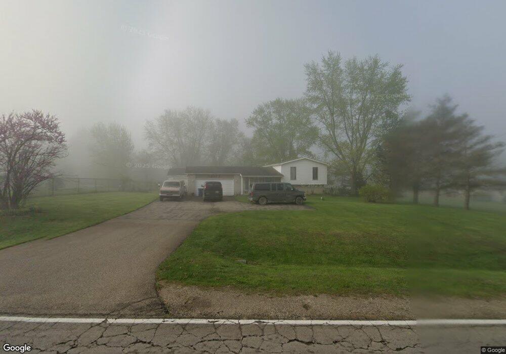
This home is located at 2071 W Reid Rd, Flint, MI 48507 and is currently estimated at $236,224, approximately $209 per square foot. 2071 W Reid Rd is a home located in Genesee County with nearby schools including Carman-Ainsworth High School, Madison Academy - Elementary School, and Discovery Montessori.
Ownership History
Date
Name
Owned For
Owner Type
Purchase Details
Closed on
Sep 11, 2012
Sold by
Austin Michael P
Bought by
Widing Leslie U and Austin Leslie U
Current Estimated Value
Home Financials for this Owner
Home Financials are based on the most recent Mortgage that was taken out on this home.
Original Mortgage
$91,259
Outstanding Balance
$62,939
Interest Rate
3.5%
Mortgage Type
FHA
Estimated Equity
$173,285
Purchase Details
Closed on
May 30, 2008
Sold by
Miller Tyler Lynwood and Miller Barbara A
Bought by
Austin Michael P and Austin Leslie U
Create a Home Valuation Report for This Property
The Home Valuation Report is an in-depth analysis detailing your home's value as well as a comparison with similar homes in the area
Home Values in the Area
Average Home Value in this Area
Purchase History
| Date | Buyer | Sale Price | Title Company |
|---|---|---|---|
| Widing Leslie U | -- | Lighthouse Title Inc | |
| Austin Michael P | $100,000 | Guaranty Title Company |
Source: Public Records
Mortgage History
| Date | Status | Borrower | Loan Amount |
|---|---|---|---|
| Open | Widing Leslie U | $91,259 |
Source: Public Records
Tax History Compared to Growth
Tax History
| Year | Tax Paid | Tax Assessment Tax Assessment Total Assessment is a certain percentage of the fair market value that is determined by local assessors to be the total taxable value of land and additions on the property. | Land | Improvement |
|---|---|---|---|---|
| 2025 | $2,068 | $104,300 | $0 | $0 |
| 2024 | $1,178 | $95,300 | $0 | $0 |
| 2023 | $1,124 | $86,100 | $0 | $0 |
| 2022 | $1,811 | $78,300 | $0 | $0 |
| 2021 | $1,783 | $74,100 | $0 | $0 |
| 2020 | $1,010 | $68,700 | $0 | $0 |
| 2019 | $995 | $64,100 | $0 | $0 |
| 2018 | $1,639 | $61,600 | $0 | $0 |
| 2017 | $1,671 | $59,700 | $0 | $0 |
| 2016 | $1,599 | $54,600 | $0 | $0 |
| 2015 | $1,454 | $48,700 | $0 | $0 |
| 2014 | $991 | $43,300 | $0 | $0 |
| 2012 | -- | $40,100 | $40,100 | $0 |
Source: Public Records
Map
Nearby Homes
- 1395 Windwood Ln
- 1389 Dellmont Dr
- 0 Taylor Dr Unit 50159493
- 7471 Brewer Rd
- 1283 Woodnoll Dr
- 12000 Murray St Unit 67
- 7191 Brittwood Ln
- 6042 Birch Dr
- 3010 Murray St Unit 18
- 7400 Lawrence St
- 3006 Murray St Unit 16
- 35010 Mitchell St Unit 210
- 41003 Williams St Unit 242
- 0000 Torrey Rd
- 00 Torrey Rd
- 22003 Wilson St Unit 128
- 2144 W Hill Rd
- 8019 Bradbury Ln
- 8018 Bradbury Ln
- 7444 Rory St