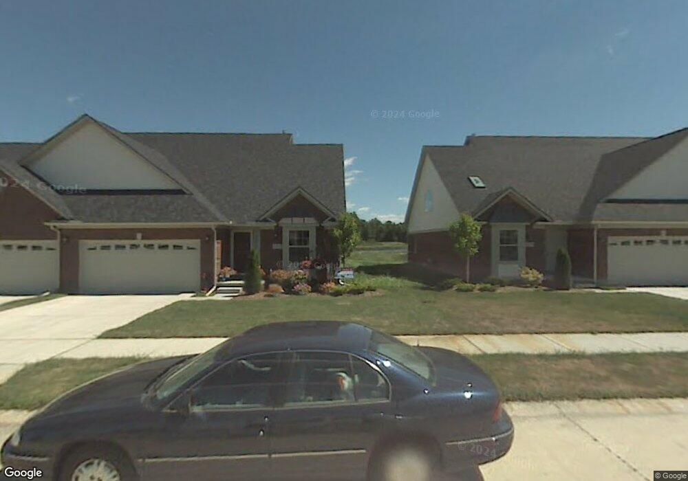
20713 Doves Pointe Dr Unit 86 Romulus, MI 48174
Estimated Value: $225,000 - $293,758
2
Beds
2
Baths
1,866
Sq Ft
$147/Sq Ft
Est. Value
About This Home
This home is located at 20713 Doves Pointe Dr Unit 86, Romulus, MI 48174 and is currently estimated at $274,690, approximately $147 per square foot. 20713 Doves Pointe Dr Unit 86 is a home located in Wayne County with nearby schools including Wegienka Elementary School, Brownstown Middle School, and Patrick Henry Middle School.
Ownership History
Date
Name
Owned For
Owner Type
Purchase Details
Closed on
Jul 31, 2006
Sold by
King Inkster Ii Llc
Bought by
Doves Pointe Llc
Current Estimated Value
Home Financials for this Owner
Home Financials are based on the most recent Mortgage that was taken out on this home.
Original Mortgage
$100,000
Interest Rate
6.85%
Mortgage Type
Purchase Money Mortgage
Create a Home Valuation Report for This Property
The Home Valuation Report is an in-depth analysis detailing your home's value as well as a comparison with similar homes in the area
Home Values in the Area
Average Home Value in this Area
Purchase History
| Date | Buyer | Sale Price | Title Company |
|---|---|---|---|
| Doves Pointe Llc | -- | Regency Title | |
| Bradley Ronald | $65,000 | Title Insurance Company |
Source: Public Records
Mortgage History
| Date | Status | Borrower | Loan Amount |
|---|---|---|---|
| Previous Owner | Doves Pointe Llc | $100,000 |
Source: Public Records
Tax History Compared to Growth
Tax History
| Year | Tax Paid | Tax Assessment Tax Assessment Total Assessment is a certain percentage of the fair market value that is determined by local assessors to be the total taxable value of land and additions on the property. | Land | Improvement |
|---|---|---|---|---|
| 2025 | $1,292 | $131,900 | $0 | $0 |
| 2024 | $1,292 | $107,700 | $0 | $0 |
| 2023 | $1,233 | $93,200 | $0 | $0 |
| 2022 | $2,362 | $86,800 | $0 | $0 |
| 2021 | $2,191 | $84,000 | $0 | $0 |
| 2020 | $2,140 | $82,700 | $0 | $0 |
| 2019 | $2,119 | $80,800 | $0 | $0 |
| 2018 | $1,065 | $75,400 | $0 | $0 |
| 2017 | $2,001 | $119,500 | $0 | $0 |
| 2016 | $2,030 | $73,400 | $0 | $0 |
| 2015 | $4,067 | $72,800 | $0 | $0 |
| 2013 | $3,940 | $41,500 | $0 | $0 |
| 2012 | -- | $54,100 | $8,500 | $45,600 |
Source: Public Records
Map
Nearby Homes
- 20701 Doves Pointe Dr Unit 85
- 20440 Doves Pointe Dr Unit 34
- 27557 Bredow Ave
- 19497 Inkster Rd
- 19497 Inkster Rd
- 28056 Charlemagne St Unit 60
- 19106 Sylvia Ave
- 25609 King Rd
- 22017 Letour St
- 22213 Inkster Rd
- 22701 Beech Daly Rd
- 22061 Cheville St Unit 366
- 22046 Verdun St Unit 289
- 27520 West Rd
- 25679 Sibley Rd
- 00 West Rd
- VAC Sibley Rd
- 25044 Mapleridge Ln
- 22171 Knollwood Dr
- 22293 Georgia Pine Dr
- 20754 Doves Pointe Dr Unit 12
- 20725 Doves Pointe Dr
- 20754 Doves Pointe Dr Unit POINTE
- 20742 Doves Pointe Dr
- 20718 Doves Pointe Dr Unit 15
- 20689 Doves Pointe Dr
- 20765 Doves Pointe Dr Unit 88
- 20776 Doves Pointe Dr
- 20631 Doves Pointe Dr Unit 80
- 20777 Doves Pointe Dr Unit 89
- 20789 Doves Pointe Dr Unit 90
- 20788 Doves Pointe Dr
- 20801 Doves Pointe Dr Unit 91
- 20812 Doves Pointe Dr
- 20800 Doves Pointe Dr
- 26990 Debiasi Dr
- 20789 Hummingbird Dr
- 20834 Doves Pointe Dr
- 26982 Debiasi Dr
- 20846 Doves Pointe Dr