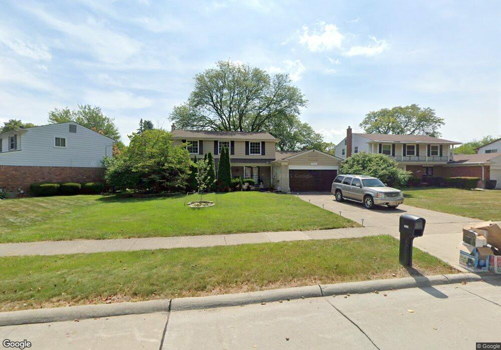
20715 Wayland St Southfield, MI 48076
Estimated Value: $341,178 - $400,000
4
Beds
3
Baths
2,452
Sq Ft
$151/Sq Ft
Est. Value
About This Home
This home is located at 20715 Wayland St, Southfield, MI 48076 and is currently estimated at $369,045, approximately $150 per square foot. 20715 Wayland St is a home located in Oakland County with nearby schools including Alice M. Birney K-8 School, Southfield Christian School, and Yeshivas Darchei Torah.
Ownership History
Date
Name
Owned For
Owner Type
Purchase Details
Closed on
May 24, 2000
Sold by
Savage Trent
Bought by
Morigney Byron K
Current Estimated Value
Home Financials for this Owner
Home Financials are based on the most recent Mortgage that was taken out on this home.
Original Mortgage
$209,000
Interest Rate
8.27%
Mortgage Type
Purchase Money Mortgage
Purchase Details
Closed on
Mar 14, 1997
Sold by
Maxwell Thomas W
Bought by
Savage Trent
Home Financials for this Owner
Home Financials are based on the most recent Mortgage that was taken out on this home.
Original Mortgage
$156,500
Interest Rate
7.82%
Mortgage Type
Purchase Money Mortgage
Create a Home Valuation Report for This Property
The Home Valuation Report is an in-depth analysis detailing your home's value as well as a comparison with similar homes in the area
Home Values in the Area
Average Home Value in this Area
Purchase History
| Date | Buyer | Sale Price | Title Company |
|---|---|---|---|
| Morigney Byron K | $220,000 | -- | |
| Savage Trent | $173,900 | -- |
Source: Public Records
Mortgage History
| Date | Status | Borrower | Loan Amount |
|---|---|---|---|
| Previous Owner | Morigney Byron K | $209,000 | |
| Previous Owner | Savage Trent | $156,500 |
Source: Public Records
Tax History Compared to Growth
Tax History
| Year | Tax Paid | Tax Assessment Tax Assessment Total Assessment is a certain percentage of the fair market value that is determined by local assessors to be the total taxable value of land and additions on the property. | Land | Improvement |
|---|---|---|---|---|
| 2022 | $4,992 | $141,020 | $19,130 | $121,890 |
| 2021 | $4,826 | $118,060 | $19,130 | $98,930 |
| 2020 | $3,702 | $111,940 | $15,300 | $96,640 |
| 2018 | $3,980 | $92,810 | $15,300 | $77,510 |
| 2015 | -- | $71,080 | $0 | $0 |
| 2014 | -- | $61,210 | $0 | $0 |
| 2011 | -- | $57,170 | $0 | $0 |
Source: Public Records
Map
Nearby Homes
- 20780 Wayland St
- 27925 Arlington Dr
- 21140 Winchester St
- 20345 Harbor Ln
- 21330 Winchester St
- 21361 Andover Rd
- 21440 Constitution St
- 20120 Covington Pkwy
- 28450 Tapert Dr
- 27249 Nantucket Dr
- 000 Pontiac Trail
- 20351 Lacrosse Ave
- 27430 Evergreen Rd Unit 36
- 21731 Concord St
- 20141 Lacrosse Ave
- 21901 Concord St
- 28330 Lahser Rd
- 19646 Middlesex Ave
- 19360 W 11 Mile Rd
- 19400 W 11 Mile Rd Unit 12
- 20745 Wayland St
- 20685 Wayland St
- 20599 Wayland St
- 27610 Arlington Ct
- 20785 Wayland St
- 20585 Wayland St
- 27580 Arlington Ct
- 20720 Wayland St
- 27615 Arlington Ct
- 20690 Wayland St
- 20750 Wayland St
- 20575 Wayland St
- 20660 Wayland St
- 20815 Wayland St
- 27550 Arlington Ct
- 20600 Wayland St
- 27585 Arlington Ct
- 20565 Wayland St
- 20590 Wayland St
- 20640 Wayland St