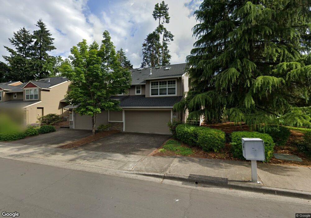
20718 NW Rockspring Ln Beaverton, OR 97006
AmberGlen NeighborhoodEstimated Value: $440,000 - $461,000
2
Beds
2
Baths
1,538
Sq Ft
$294/Sq Ft
Est. Value
About This Home
This home is located at 20718 NW Rockspring Ln, Beaverton, OR 97006 and is currently estimated at $451,520, approximately $293 per square foot. 20718 NW Rockspring Ln is a home located in Washington County with nearby schools including Lenox Elementary School, J.W. Poynter Middle School, and Liberty High School.
Ownership History
Date
Name
Owned For
Owner Type
Purchase Details
Closed on
Sep 22, 2021
Sold by
Meisenheimer Darrel
Bought by
Eastburn Angela and Pinegar Jutta
Current Estimated Value
Home Financials for this Owner
Home Financials are based on the most recent Mortgage that was taken out on this home.
Original Mortgage
$406,125
Outstanding Balance
$369,544
Interest Rate
2.8%
Mortgage Type
New Conventional
Estimated Equity
$81,976
Purchase Details
Closed on
Jun 23, 2015
Sold by
Forker Paul J
Bought by
Meissenheimer Darrel
Home Financials for this Owner
Home Financials are based on the most recent Mortgage that was taken out on this home.
Original Mortgage
$270,697
Interest Rate
3.83%
Mortgage Type
VA
Purchase Details
Closed on
Sep 28, 1998
Sold by
Habitat Northwest Inc
Bought by
Forker Paul J
Home Financials for this Owner
Home Financials are based on the most recent Mortgage that was taken out on this home.
Original Mortgage
$163,800
Interest Rate
6.88%
Create a Home Valuation Report for This Property
The Home Valuation Report is an in-depth analysis detailing your home's value as well as a comparison with similar homes in the area
Home Values in the Area
Average Home Value in this Area
Purchase History
| Date | Buyer | Sale Price | Title Company |
|---|---|---|---|
| Eastburn Angela | $427,500 | Lawyers Title | |
| Meissenheimer Darrel | $265,000 | Wfg Title | |
| Forker Paul J | $172,465 | Fidelity National Title Co |
Source: Public Records
Mortgage History
| Date | Status | Borrower | Loan Amount |
|---|---|---|---|
| Open | Eastburn Angela | $406,125 | |
| Previous Owner | Meissenheimer Darrel | $270,697 | |
| Previous Owner | Forker Paul J | $163,800 |
Source: Public Records
Tax History Compared to Growth
Tax History
| Year | Tax Paid | Tax Assessment Tax Assessment Total Assessment is a certain percentage of the fair market value that is determined by local assessors to be the total taxable value of land and additions on the property. | Land | Improvement |
|---|---|---|---|---|
| 2025 | $4,426 | $270,760 | -- | -- |
| 2024 | $4,300 | $262,880 | -- | -- |
| 2023 | $4,300 | $255,230 | $0 | $0 |
| 2022 | $4,183 | $255,230 | $0 | $0 |
| 2021 | $4,099 | $240,590 | $0 | $0 |
| 2020 | $4,011 | $233,590 | $0 | $0 |
| 2019 | $3,896 | $226,790 | $0 | $0 |
| 2018 | $3,729 | $220,190 | $0 | $0 |
| 2017 | $3,594 | $213,780 | $0 | $0 |
| 2016 | $3,496 | $207,560 | $0 | $0 |
| 2015 | $3,355 | $201,520 | $0 | $0 |
| 2014 | $3,336 | $195,660 | $0 | $0 |
Source: Public Records
Map
Nearby Homes
- 8654 NE Rockspring St
- 2127 NE Cadbury Ave
- 2315 NE Redelfs Way
- 8599 NE Hodes St
- 8686 NE Hyde Park Ln
- 734 NE Adwick Dr
- 881 NE Wheelock Place
- 7959 NE Rockne Way
- 8100 NE Miriam Way
- 1853 NE 101st Ave Unit 102
- 7915 NE Rockne Way
- 680 NE Adwick Dr Unit 5
- 670 NE Adwick Dr
- 963 NE 73rd Ave Unit 141
- 645 NE Garswood Ln
- 1845 NE 101st Ave Unit 201
- 7906 NE Miriam Way
- 637 NE Garswood Ln
- 7902 NE Miriam Way
- 622 NE Garswood Ln
- 8678 NE Rockspring St
- 8686 NE Rockspring St
- 20706 NW Rockspring Ln
- 20742 NW Rockspring Ln
- 20742 NW Rockspring Ln New L
- 20692 NW Rockspring Ln
- 20754 NW Rockspring Ln Unit 29
- 20754 NW Rockspring Ln
- 20680 NW Rockspring Ln
- 20680 NE Rockspring St
- 20783 NW Windstone St
- 20765 NW Windstone St
- 20723 NW Rockspring Ln
- 20801 NW Windstone St
- 20711 NW Rockspring Ln
- 8641 NE Windstone St
- 20735 NW Rockspring Ln
- 20668 NW Rockspring Ln
- 20699 NW Rockspring Ln
- 20747 NW Windstone St