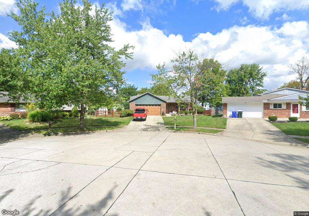
2072 Fincastle Ct Columbus, OH 43235
Brookside Colony NeighborhoodEstimated Value: $303,000 - $384,000
3
Beds
2
Baths
1,213
Sq Ft
$290/Sq Ft
Est. Value
About This Home
This home is located at 2072 Fincastle Ct, Columbus, OH 43235 and is currently estimated at $351,701, approximately $289 per square foot. 2072 Fincastle Ct is a home located in Franklin County with nearby schools including Granby Elementary School, McCord Middle School, and Worthington Kilbourne High School.
Ownership History
Date
Name
Owned For
Owner Type
Purchase Details
Closed on
Jun 24, 1994
Sold by
Smith Christine N
Bought by
Overbee Melvin E and Overbee Jodi L
Current Estimated Value
Home Financials for this Owner
Home Financials are based on the most recent Mortgage that was taken out on this home.
Original Mortgage
$90,900
Interest Rate
6%
Mortgage Type
New Conventional
Purchase Details
Closed on
Sep 19, 1991
Purchase Details
Closed on
Dec 1, 1986
Create a Home Valuation Report for This Property
The Home Valuation Report is an in-depth analysis detailing your home's value as well as a comparison with similar homes in the area
Home Values in the Area
Average Home Value in this Area
Purchase History
| Date | Buyer | Sale Price | Title Company |
|---|---|---|---|
| Overbee Melvin E | $101,000 | -- | |
| -- | -- | -- | |
| -- | $77,500 | -- |
Source: Public Records
Mortgage History
| Date | Status | Borrower | Loan Amount |
|---|---|---|---|
| Closed | Overbee Melvin E | $90,900 |
Source: Public Records
Tax History Compared to Growth
Tax History
| Year | Tax Paid | Tax Assessment Tax Assessment Total Assessment is a certain percentage of the fair market value that is determined by local assessors to be the total taxable value of land and additions on the property. | Land | Improvement |
|---|---|---|---|---|
| 2024 | $5,974 | $97,300 | $25,900 | $71,400 |
| 2023 | $5,712 | $97,300 | $25,900 | $71,400 |
| 2022 | $5,224 | $70,600 | $17,850 | $52,750 |
| 2021 | $4,819 | $70,600 | $17,850 | $52,750 |
| 2020 | $4,642 | $70,600 | $17,850 | $52,750 |
| 2019 | $4,195 | $57,580 | $14,880 | $42,700 |
| 2018 | $4,036 | $57,580 | $14,880 | $42,700 |
| 2017 | $3,883 | $57,580 | $14,880 | $42,700 |
| 2016 | $4,006 | $56,430 | $13,900 | $42,530 |
| 2015 | $4,007 | $56,430 | $13,900 | $42,530 |
| 2014 | $4,006 | $56,430 | $13,900 | $42,530 |
| 2013 | $3,986 | $56,420 | $13,895 | $42,525 |
Source: Public Records
Map
Nearby Homes
- 2056 Fincastle Ct
- 2161 Heatherfield Ave
- 6921 Spruce Pine Dr
- 1930 Shallowford Ave
- 2001 Sawbury Blvd Unit 2001
- 7373 Palmleaf Ln
- 1889 Slaton Ct Unit 1889
- 1721 Worthington Run Dr Unit 1721-1731
- 2392 Dunsworth Dr
- 2220 Surreygate Dr
- 1828 Gardenstone Dr
- 1637 Park Row Dr Unit F
- 2074 Hard Rd
- 1620 Park Row Dr Unit A
- 2456 Sanford Dr
- 2687 Snouffer Rd
- 7734 Henry David Ct
- 2469 Sandstrom Dr
- 2488 Dunstan Dr
- 7385 Cimmaron Station
- 2064 Fincastle Ct
- 2080 Fincastle Ct
- 2075 Queensbridge Dr
- 2083 Queensbridge Dr
- 2091 Queensbridge Dr
- 2067 Queensbridge Dr
- 2097 Queensbridge Dr
- 2059 Queensbridge Dr
- 2103 Queensbridge Dr
- 2081 Fincastle Ct
- 2048 Fincastle Ct
- 2073 Fincastle Ct
- 2111 Queensbridge Dr
- 2051 Queensbridge Dr
- 2055 Fincastle Ct
- 6984 Maybrook St
- 2040 Fincastle Ct
- 2047 Fincastle Ct
- 2041 Queensbridge Dr
- 6976 Maybrook St