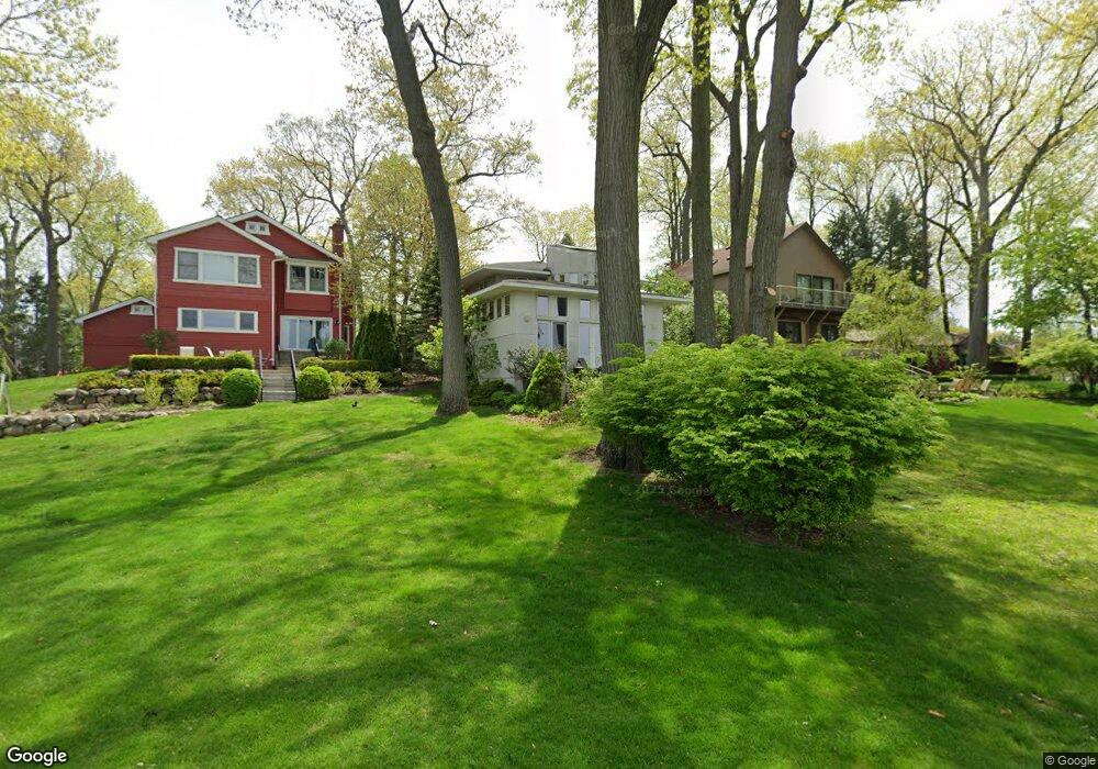
2072 Garland St Sylvan Lake, MI 48320
Estimated Value: $740,758 - $988,000
3
Beds
4
Baths
2,644
Sq Ft
$322/Sq Ft
Est. Value
About This Home
This home is located at 2072 Garland St, Sylvan Lake, MI 48320 and is currently estimated at $852,690, approximately $322 per square foot. 2072 Garland St is a home located in Oakland County with nearby schools including Walt Whitman Elementary School, Pontiac Middle School, and Pontiac High School.
Ownership History
Date
Name
Owned For
Owner Type
Purchase Details
Closed on
Jun 3, 2005
Sold by
Warholak Susan E
Bought by
Warholak Michael and Warholak Susan E
Current Estimated Value
Home Financials for this Owner
Home Financials are based on the most recent Mortgage that was taken out on this home.
Original Mortgage
$180,000
Interest Rate
5.82%
Mortgage Type
Fannie Mae Freddie Mac
Purchase Details
Closed on
Jul 3, 1998
Sold by
Warholak Michael
Bought by
Warholak Susan E
Create a Home Valuation Report for This Property
The Home Valuation Report is an in-depth analysis detailing your home's value as well as a comparison with similar homes in the area
Home Values in the Area
Average Home Value in this Area
Purchase History
| Date | Buyer | Sale Price | Title Company |
|---|---|---|---|
| Warholak Michael | -- | Alpha Title Agency Inc | |
| Warholak Susan E | -- | -- |
Source: Public Records
Mortgage History
| Date | Status | Borrower | Loan Amount |
|---|---|---|---|
| Closed | Warholak Michael | $180,000 |
Source: Public Records
Tax History Compared to Growth
Tax History
| Year | Tax Paid | Tax Assessment Tax Assessment Total Assessment is a certain percentage of the fair market value that is determined by local assessors to be the total taxable value of land and additions on the property. | Land | Improvement |
|---|---|---|---|---|
| 2024 | $9,612 | $396,710 | $0 | $0 |
| 2023 | $9,230 | $362,570 | $0 | $0 |
| 2022 | $9,457 | $351,190 | $0 | $0 |
| 2021 | $9,072 | $337,970 | $0 | $0 |
| 2020 | $9,082 | $337,360 | $0 | $0 |
| 2019 | $9,449 | $326,580 | $0 | $0 |
| 2018 | $9,200 | $282,360 | $0 | $0 |
| 2017 | $9,147 | $274,710 | $0 | $0 |
| 2016 | $9,267 | $258,940 | $0 | $0 |
| 2015 | -- | $270,220 | $0 | $0 |
| 2014 | -- | $228,000 | $0 | $0 |
| 2011 | -- | $210,340 | $0 | $0 |
Source: Public Records
Map
Nearby Homes
- 49 Canal Dr Unit 300-049
- 21 Canal Dr Unit 300-021
- 27 Riverbank Dr Unit 300-127
- 25 Riverbank Dr Unit 300-125
- 14 Riverbank Dr Unit 300-114
- 26 Edna Ave
- 1160 Dorchester Ave
- 1075 Canterbury Dr
- 990 Voorheis Rd
- 1061 Dorchester Ave
- 8 Myra Ave
- 147 Draper Ave
- 1785 Ward Rd
- 1796 Briarcliff St
- 1030 Menominee Rd
- 10 Wenonah Dr
- 1205 Leinbach Ave
- 207 Navajo Ave
- 181 Navajo Ave
- 1775 Woodland Ave
- 2074 Garland St
- 2070 Garland St
- 2076 Garland St
- 2068 Garland St Unit Bldg-Unit
- 2068 Garland St
- 0 Ferndale St
- 2095 Ferndale St
- 2075 Garland St Unit Bldg-Unit
- 2075 Garland St
- 2079 Garland St
- 2070 Ferndale St
- 2085 Garland St
- 2065 Garland St
- 2120 Garland St
- 1338 Avondale St
- 1301 Avondale St
- 2035 Garland St
- 2105 Ferndale St
- 1315 Avondale St
- 2128 Garland St