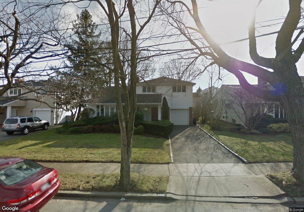
2072 Holland Way Merrick, NY 11566
Estimated Value: $848,000 - $919,981
4
Beds
3
Baths
1,391
Sq Ft
$636/Sq Ft
Est. Value
About This Home
This home is located at 2072 Holland Way, Merrick, NY 11566 and is currently estimated at $883,991, approximately $635 per square foot. 2072 Holland Way is a home located in Nassau County with nearby schools including Burcham Elementary School, Merrick Avenue Middle School, and John F. Kennedy High School.
Ownership History
Date
Name
Owned For
Owner Type
Purchase Details
Closed on
Jul 20, 2018
Sold by
Mintz Sandra F and Mintz Walter M
Bought by
Scchetti Anthony and Cantos Angela
Current Estimated Value
Home Financials for this Owner
Home Financials are based on the most recent Mortgage that was taken out on this home.
Original Mortgage
$471,200
Outstanding Balance
$409,268
Interest Rate
4.6%
Mortgage Type
New Conventional
Estimated Equity
$474,723
Create a Home Valuation Report for This Property
The Home Valuation Report is an in-depth analysis detailing your home's value as well as a comparison with similar homes in the area
Home Values in the Area
Average Home Value in this Area
Purchase History
| Date | Buyer | Sale Price | Title Company |
|---|---|---|---|
| Scchetti Anthony | $589,000 | None Available |
Source: Public Records
Mortgage History
| Date | Status | Borrower | Loan Amount |
|---|---|---|---|
| Open | Scchetti Anthony | $471,200 |
Source: Public Records
Tax History Compared to Growth
Tax History
| Year | Tax Paid | Tax Assessment Tax Assessment Total Assessment is a certain percentage of the fair market value that is determined by local assessors to be the total taxable value of land and additions on the property. | Land | Improvement |
|---|---|---|---|---|
| 2025 | $17,181 | $568 | $252 | $316 |
| 2024 | $3,905 | $565 | $251 | $314 |
| 2023 | $16,140 | $586 | $260 | $326 |
| 2022 | $16,140 | $597 | $265 | $332 |
| 2021 | $16,272 | $589 | $252 | $337 |
| 2020 | $8,306 | $883 | $658 | $225 |
| 2019 | $3,415 | $883 | $518 | $365 |
| 2018 | $4,401 | $1,122 | $0 | $0 |
| 2017 | $9,848 | $1,122 | $658 | $464 |
| 2016 | $14,650 | $1,122 | $658 | $464 |
| 2015 | $4,184 | $1,122 | $658 | $464 |
| 2014 | $4,184 | $1,122 | $658 | $464 |
| 2013 | $3,945 | $1,122 | $658 | $464 |
Source: Public Records
Map
Nearby Homes
- 2956 Judith Dr
- 2072 Brighton Way
- 2884 Bay Dr
- 2863 Harbor Rd
- 2819 Harbor Rd
- 2810 Wynsum Ave
- 2074 Ellen Dr
- 110 Hampton Way
- 72 Lake End Rd
- 1952 Julian Ln
- 2729 Shore Dr
- 2903 Preston Ln
- 1944 Lowell Ln
- 2858 Shore Rd
- 2998 Joyce Ln
- 1945 Byron Rd
- 2466 Army Place
- 2872 Rosebud Ave
- 3101 Lonni Ln
- 1815 Cynthia Ln
- 2066 Holland Way
- 2080 Holland Way
- 2071 Lawry Ln
- 2065 Lawry Ln
- 2060 Holland Way
- 2019 Lawry Ln
- 2071 Holland Way
- 2059 Lawry Ln
- 2065 Holland Way
- 2081 Holland Way
- 2059 Holland Way
- 2054 Holland Way
- 2053 Lawry Ln
- 2090 Holland Way
- 2053 Holland Way
- 2072 Lawry Ln
- 2066 Lawry Ln
- 2072 Oliver Way
- 2897 Hewlett Ave
- 2082 Oliver Way