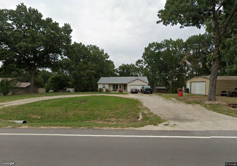
20724 Highway Y Saint Robert, MO 65584
Estimated Value: $189,000 - $254,000
3
Beds
2
Baths
2,464
Sq Ft
$93/Sq Ft
Est. Value
About This Home
This home is located at 20724 Highway Y, Saint Robert, MO 65584 and is currently estimated at $230,121, approximately $93 per square foot. 20724 Highway Y is a home located in Pulaski County with nearby schools including Freedom Elementary School, Waynesville East Elementary School, and Waynesville Sixth Grade Center.
Ownership History
Date
Name
Owned For
Owner Type
Purchase Details
Closed on
May 13, 2011
Sold by
Shepherd Angela M
Bought by
Morgan Justin Daniel and Morgan Valerie J
Current Estimated Value
Purchase Details
Closed on
Oct 7, 2009
Bought by
Mill Pond Properties Llc
Home Financials for this Owner
Home Financials are based on the most recent Mortgage that was taken out on this home.
Original Mortgage
$105,237
Interest Rate
5.16%
Mortgage Type
Credit Line Revolving
Purchase Details
Closed on
Sep 28, 2009
Sold by
Essayons Construction Llc
Bought by
Mill Pond Properties Llc
Home Financials for this Owner
Home Financials are based on the most recent Mortgage that was taken out on this home.
Original Mortgage
$105,237
Interest Rate
5.16%
Mortgage Type
Credit Line Revolving
Purchase Details
Closed on
Mar 31, 2006
Sold by
Leach Marc Anthony and Leach Vickey L
Bought by
Elmore Martin D
Home Financials for this Owner
Home Financials are based on the most recent Mortgage that was taken out on this home.
Original Mortgage
$99,000
Interest Rate
6.22%
Mortgage Type
VA
Create a Home Valuation Report for This Property
The Home Valuation Report is an in-depth analysis detailing your home's value as well as a comparison with similar homes in the area
Home Values in the Area
Average Home Value in this Area
Purchase History
| Date | Buyer | Sale Price | Title Company |
|---|---|---|---|
| Morgan Justin Daniel | -- | -- | |
| Mill Pond Properties Llc | -- | -- | |
| Mill Pond Properties Llc | -- | None Available | |
| Elmore Martin D | -- | None Available |
Source: Public Records
Mortgage History
| Date | Status | Borrower | Loan Amount |
|---|---|---|---|
| Previous Owner | Mill Pond Properties Llc | $105,237 | |
| Previous Owner | Mill Pond Properties Llc | $105,237 | |
| Previous Owner | Elmore Martin D | $99,000 |
Source: Public Records
Tax History Compared to Growth
Tax History
| Year | Tax Paid | Tax Assessment Tax Assessment Total Assessment is a certain percentage of the fair market value that is determined by local assessors to be the total taxable value of land and additions on the property. | Land | Improvement |
|---|---|---|---|---|
| 2024 | $1,022 | $23,482 | $3,785 | $19,697 |
| 2023 | $998 | $23,482 | $3,785 | $19,697 |
| 2022 | $920 | $23,482 | $3,785 | $19,697 |
| 2021 | $910 | $23,482 | $3,785 | $19,697 |
| 2020 | $894 | $22,544 | $0 | $0 |
| 2019 | $880 | $22,192 | $0 | $0 |
| 2018 | $879 | $22,192 | $0 | $0 |
| 2017 | $878 | $21,960 | $0 | $0 |
| 2016 | $834 | $22,190 | $0 | $0 |
| 2015 | -- | $22,190 | $0 | $0 |
| 2014 | $829 | $22,190 | $0 | $0 |
Source: Public Records
Map
Nearby Homes
- 20640 Highway Y
- 0 Laramie Unit MAR25002532
- 20602 Laramie Rd
- 20373 Heritage Rd
- 21011 Homer Rd Unit A & B
- 0 Leaf Ln Unit MAR25008244
- 20715 Hiltner Ln
- 20270 Hyatt Ln
- 20966 Hideaway Ln
- 16960 Lemming Ln
- 20256 Hardcastle Ln
- 20184 Hardcastle Ln
- 21147 Hideaway Ln
- 16475 Hardwood Ln
- TBD State Highway Y Unit Tract E
- 0 State Highway Y
- 131 Sawmill Rd
- TBD Tract 7 Bobwhite Ln
- 21680 N Horizonway
- 140 Sawmill Rd
- 20724 Highway Y
- 20700 Highway Y
- 17045 Hemlock Ln
- 16965 Hemlock Ln
- 20853 Humble Ln
- 16907 Hemlock Ln
- 0 Laramie Unit 901577
- 0 Laramie Unit 12047795
- 0 Laramie Unit 17053143
- 0 Laramie Unit 14054428
- 0 Laramie Unit 14055419
- 0 Laramie Unit 15031743
- 0 Laramie Unit 21083487
- 0Tracts D E F Laramie Rd
- 17050 Hemlock Ln
- 16906 Hemlock Ln
- 16906 Hemlock Ln
- 16958 Hemlock Ln
- 16967 Hoyt
- 17310 Long Ridge