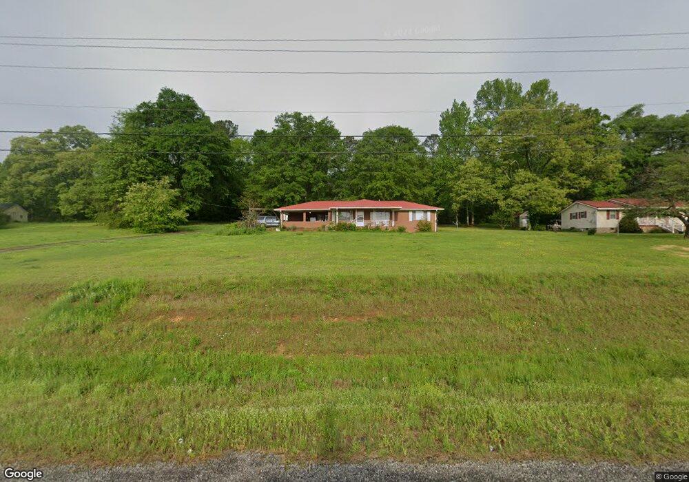
2073 Rome Hwy Cedartown, GA 30125
Estimated Value: $195,255 - $255,000
2
Beds
1
Bath
1,284
Sq Ft
$183/Sq Ft
Est. Value
About This Home
This home is located at 2073 Rome Hwy, Cedartown, GA 30125 and is currently estimated at $235,064, approximately $183 per square foot. 2073 Rome Hwy is a home located in Polk County with nearby schools including Vineyard Harvester Christian Academy.
Ownership History
Date
Name
Owned For
Owner Type
Purchase Details
Closed on
Aug 24, 2009
Sold by
Wood Betty Jo
Bought by
Wood Clifton R
Current Estimated Value
Purchase Details
Closed on
Jul 21, 1999
Sold by
Wood Betty Jo Exec Earl Leon Wood
Bought by
Wood Betty Jo
Purchase Details
Closed on
Jul 20, 1999
Sold by
Wood Earl Leon
Bought by
Wood Betty Jo
Purchase Details
Closed on
May 9, 1973
Bought by
Wood Earl L and Wood Betty
Purchase Details
Closed on
Dec 5, 1964
Sold by
Mize Sam M
Bought by
Wood Earl L and Wood Betty
Purchase Details
Closed on
Oct 5, 1963
Sold by
Fricks Burnice
Bought by
Mize Sam M
Purchase Details
Closed on
Mar 26, 1962
Bought by
Fricks Burnice
Create a Home Valuation Report for This Property
The Home Valuation Report is an in-depth analysis detailing your home's value as well as a comparison with similar homes in the area
Home Values in the Area
Average Home Value in this Area
Purchase History
| Date | Buyer | Sale Price | Title Company |
|---|---|---|---|
| Wood Clifton R | -- | -- | |
| Wood Betty Jo | -- | -- | |
| Wood Betty Jo | -- | -- | |
| Wood Earl L | -- | -- | |
| Wood Earl L | -- | -- | |
| Mize Sam M | -- | -- | |
| Fricks Burnice | -- | -- |
Source: Public Records
Tax History Compared to Growth
Tax History
| Year | Tax Paid | Tax Assessment Tax Assessment Total Assessment is a certain percentage of the fair market value that is determined by local assessors to be the total taxable value of land and additions on the property. | Land | Improvement |
|---|---|---|---|---|
| 2024 | $1,271 | $60,799 | $5,609 | $55,190 |
| 2023 | $972 | $40,975 | $5,609 | $35,366 |
| 2022 | $810 | $34,137 | $3,739 | $30,398 |
| 2021 | $821 | $34,137 | $3,739 | $30,398 |
| 2020 | $822 | $34,137 | $3,739 | $30,398 |
| 2019 | $683 | $25,429 | $3,739 | $21,690 |
| 2018 | $683 | $24,779 | $3,739 | $21,040 |
| 2017 | $674 | $24,779 | $3,739 | $21,040 |
| 2016 | $756 | $27,788 | $6,748 | $21,040 |
| 2015 | $765 | $28,020 | $6,748 | $21,272 |
| 2014 | $770 | $28,020 | $6,748 | $21,272 |
Source: Public Records
Map
Nearby Homes
- 2236 Rome Hwy
- 0 Rome Hwy Unit 10521649
- 232 Stephens Rd
- 31 Meadow Lakes Terrace
- 113 Cherokee Estates Dr
- 90 W Meadow Lakes Blvd
- 88 Sequoyah Ct
- 0 Collins Rd Unit 10627302
- TRACT3 Drummond Rd
- Tract2 Drummond Rd
- 133 Virginia Cir
- 64 Virginia Cir
- 00 Oak Crest Dr
- 600 Miller Rd
- 727 Cherokee Rd
- 828 N College Dr
- 220 Greenbriar Dr
- 217 Cherokee Cir
- 1170 Lake Creek Rd
- LOT 21 Cherokee Cir