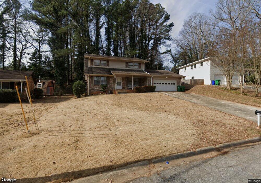
2073 Troutdale Dr Unit 2 Decatur, GA 30032
Chandler NeighborhoodEstimated Value: $263,651 - $354,000
3
Beds
3
Baths
2,078
Sq Ft
$147/Sq Ft
Est. Value
About This Home
This home is located at 2073 Troutdale Dr Unit 2, Decatur, GA 30032 and is currently estimated at $306,413, approximately $147 per square foot. 2073 Troutdale Dr Unit 2 is a home located in DeKalb County with nearby schools including Snapfinger Elementary School, Columbia Middle School, and Columbia High School.
Ownership History
Date
Name
Owned For
Owner Type
Purchase Details
Closed on
Dec 13, 2016
Sold by
Jackson Harold D
Bought by
Jia Llc
Current Estimated Value
Purchase Details
Closed on
May 23, 2003
Sold by
Dennis Terry R
Bought by
Jackson Harold D
Home Financials for this Owner
Home Financials are based on the most recent Mortgage that was taken out on this home.
Original Mortgage
$130,500
Interest Rate
5.68%
Mortgage Type
New Conventional
Create a Home Valuation Report for This Property
The Home Valuation Report is an in-depth analysis detailing your home's value as well as a comparison with similar homes in the area
Home Values in the Area
Average Home Value in this Area
Purchase History
| Date | Buyer | Sale Price | Title Company |
|---|---|---|---|
| Jia Llc | -- | -- | |
| Jackson Harold D | $145,000 | -- |
Source: Public Records
Mortgage History
| Date | Status | Borrower | Loan Amount |
|---|---|---|---|
| Previous Owner | Jackson Harold D | $130,500 |
Source: Public Records
Tax History Compared to Growth
Tax History
| Year | Tax Paid | Tax Assessment Tax Assessment Total Assessment is a certain percentage of the fair market value that is determined by local assessors to be the total taxable value of land and additions on the property. | Land | Improvement |
|---|---|---|---|---|
| 2024 | $5,481 | $115,120 | $21,800 | $93,320 |
| 2023 | $5,481 | $114,920 | $21,800 | $93,120 |
| 2022 | $4,593 | $96,880 | $20,000 | $76,880 |
| 2021 | $4,110 | $85,880 | $20,000 | $65,880 |
| 2020 | $3,577 | $73,720 | $20,000 | $53,720 |
| 2019 | $2,808 | $56,200 | $20,000 | $36,200 |
| 2018 | $2,404 | $48,120 | $5,360 | $42,760 |
| 2017 | $2,510 | $49,200 | $5,360 | $43,840 |
| 2016 | $2,390 | $46,360 | $5,360 | $41,000 |
| 2014 | $2,491 | $47,480 | $5,360 | $42,120 |
Source: Public Records
Map
Nearby Homes
- 2071 Twin Falls Rd
- 3449 Hyland Dr
- 3456 Spring Cir
- 3409 Hyland Dr
- 3485 Spring Cir
- 1894 Twin Falls Rd
- 3415 Homera Place
- 1443 Snapfinger Rd
- 2131 Columbia Dr
- 2202 Troutdale Dr
- 3517 Hyland Dr
- 2074 Oak Park Ln Unit 2074
- 2043 Columbia Dr
- 2236 Chestnut Hill Cir
- 2205 Chestnut Hill Cir
- 2050 Oak Park Ln
- 3664 Broadview Ct
- 1997 Columbia Dr
- 2079 Troutdale Dr
- 2067 Troutdale Dr
- 2104 Twin Falls Rd
- 2110 Twin Falls Rd
- 2085 Troutdale Dr
- 2098 Twin Falls Rd
- 2061 Troutdale Dr
- 2074 Troutdale Dr
- 2090 Twin Falls Rd
- 3483 Crown Point Place
- 2091 Troutdale Dr
- 2082 Troutdale Dr
- 2122 Twin Falls Rd
- 2064 Troutdale Dr
- 2082 Twin Falls Rd
- 0 Crown Point Place Unit 7402042
- 0 Crown Point Place Unit 3190070
- 0 Crown Point Place Unit 8372445
- 0 Crown Point Place
- 2088 Troutdale Dr