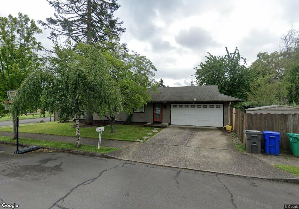
20734 SE Morrison St Gresham, OR 97030
North Central NeighborhoodEstimated Value: $366,000 - $423,000
3
Beds
1
Bath
1,008
Sq Ft
$390/Sq Ft
Est. Value
About This Home
This home is located at 20734 SE Morrison St, Gresham, OR 97030 and is currently estimated at $393,413, approximately $390 per square foot. 20734 SE Morrison St is a home located in Multnomah County with nearby schools including North Gresham Elementary School, Clear Creek Middle School, and Gresham High School.
Ownership History
Date
Name
Owned For
Owner Type
Purchase Details
Closed on
Sep 19, 2025
Sold by
Weed Brett and Guo Yan
Bought by
Scenic Ranch Llc
Current Estimated Value
Purchase Details
Closed on
Feb 15, 2012
Sold by
Pacific Nw Federal Cu
Bought by
Weed Brett and Guo Yan
Home Financials for this Owner
Home Financials are based on the most recent Mortgage that was taken out on this home.
Original Mortgage
$93,000
Interest Rate
3.86%
Mortgage Type
New Conventional
Purchase Details
Closed on
Jul 19, 2011
Sold by
Ahumada Cesar
Bought by
Pacific Nw Federal Credit Union
Purchase Details
Closed on
Dec 23, 2005
Sold by
Henke Heidi M
Bought by
Ahumada Cesar
Home Financials for this Owner
Home Financials are based on the most recent Mortgage that was taken out on this home.
Original Mortgage
$150,800
Interest Rate
6.5%
Mortgage Type
Fannie Mae Freddie Mac
Purchase Details
Closed on
Aug 14, 2003
Sold by
Henke David S
Bought by
Henke Heidi M
Purchase Details
Closed on
Oct 8, 2002
Sold by
Henke David S
Bought by
Henke David S and Henke Heidi M
Home Financials for this Owner
Home Financials are based on the most recent Mortgage that was taken out on this home.
Original Mortgage
$112,000
Interest Rate
6.05%
Mortgage Type
Purchase Money Mortgage
Purchase Details
Closed on
Sep 30, 1998
Sold by
Bullemor Marie T
Bought by
Henke David S and Henke Heidi
Home Financials for this Owner
Home Financials are based on the most recent Mortgage that was taken out on this home.
Original Mortgage
$113,400
Interest Rate
6.88%
Mortgage Type
Purchase Money Mortgage
Purchase Details
Closed on
Nov 1, 1995
Sold by
Bullemor Marie T
Bought by
Bullemor Marie T
Home Financials for this Owner
Home Financials are based on the most recent Mortgage that was taken out on this home.
Original Mortgage
$60,000
Interest Rate
7.58%
Mortgage Type
Purchase Money Mortgage
Create a Home Valuation Report for This Property
The Home Valuation Report is an in-depth analysis detailing your home's value as well as a comparison with similar homes in the area
Home Values in the Area
Average Home Value in this Area
Purchase History
| Date | Buyer | Sale Price | Title Company |
|---|---|---|---|
| Scenic Ranch Llc | -- | None Listed On Document | |
| Weed Brett | $124,000 | Fidelity National Title Or | |
| Pacific Nw Federal Credit Union | $280,907 | Northwest Title | |
| Ahumada Cesar | $188,500 | Chicago Title Insurance Comp | |
| Henke Heidi M | -- | -- | |
| Henke David S | -- | Multiple | |
| Henke David S | $126,000 | Oregon Title Insurance Co | |
| Bullemor Marie T | -- | Stewart Title |
Source: Public Records
Mortgage History
| Date | Status | Borrower | Loan Amount |
|---|---|---|---|
| Previous Owner | Weed Brett | $93,000 | |
| Previous Owner | Ahumada Cesar | $150,800 | |
| Previous Owner | Henke David S | $112,000 | |
| Previous Owner | Henke David S | $113,400 | |
| Previous Owner | Bullemor Marie T | $60,000 |
Source: Public Records
Tax History
| Year | Tax Paid | Tax Assessment Tax Assessment Total Assessment is a certain percentage of the fair market value that is determined by local assessors to be the total taxable value of land and additions on the property. | Land | Improvement |
|---|---|---|---|---|
| 2025 | $3,842 | $188,800 | -- | -- |
| 2024 | $3,678 | $183,310 | -- | -- |
| 2023 | $3,351 | $177,980 | $0 | $0 |
| 2022 | $3,257 | $172,800 | $0 | $0 |
| 2021 | $3,175 | $167,770 | $0 | $0 |
| 2020 | $2,988 | $162,890 | $0 | $0 |
| 2019 | $2,910 | $158,150 | $0 | $0 |
| 2018 | $2,774 | $153,550 | $0 | $0 |
| 2017 | $2,662 | $149,080 | $0 | $0 |
| 2016 | $2,347 | $144,740 | $0 | $0 |
| 2015 | $2,296 | $140,530 | $0 | $0 |
| 2014 | $2,240 | $136,440 | $0 | $0 |
Source: Public Records
Map
Nearby Homes
- 21016 SE Stark St Unit 71
- 21016 SE Stark St Unit 69
- 2013 NW Bella Vista Dr
- 21260 SE Stark St
- 21400 SE Stark St Unit 2
- 1811 NW 19th St
- 1861 NW Wonderview Ave
- 209 SE 214th Ave
- 21532 SE Alder St
- 21033 SE Clay Ct
- 522 SE 199th Ave
- 19776 SE Stark St Unit 147
- 132 SE 214th Ave
- 0 SE Burnside St
- 21525 SE Oak St
- 805 SE 197th Ave
- 21553 SE Ankeny Terrace
- 150 NE 202nd Ave
- 1596 NW Riverview Ave
- 210 SE 218th Ave
- 825 SE 208th Ave
- 806 SE 207th Ave
- 731 SE 208th Ave
- 831 SE 208th Ave
- 808 SE 208th Ave
- 732 SE 207th Ave
- 822 SE 208th Ave
- 844 SE 207th Ave
- 20805 SE Morrison St Unit 20807
- 901 SE 208th Ave
- 828 SE 208th Ave
- 717 SE 208th Ave Unit 719
- 710 SE 207th Ave
- 20832 SE Morrison St
- 906 SE 207th Ave
- 819 SE 209th Ave
- 20825 SE Morrison St
- 739 SE 207th Ave
- 809 SE 207th Ave
- 915 SE 208th Ave
Your Personal Tour Guide
Ask me questions while you tour the home.