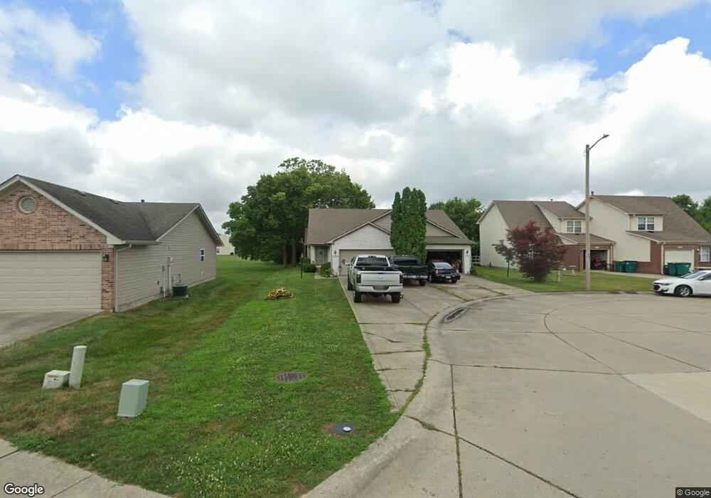
2074 Galaxy Dr Franklin, IN 46131
Estimated Value: $197,000 - $236,000
3
Beds
2
Baths
1,362
Sq Ft
$162/Sq Ft
Est. Value
About This Home
This home is located at 2074 Galaxy Dr, Franklin, IN 46131 and is currently estimated at $220,000, approximately $161 per square foot. 2074 Galaxy Dr is a home located in Johnson County with nearby schools including Northwood Elementary School, Franklin Community Middle School, and Custer Baker Intermediate School.
Ownership History
Date
Name
Owned For
Owner Type
Purchase Details
Closed on
Oct 14, 2016
Sold by
Burkett Parker Steven and Burkett Angela Di
Bought by
Burkett Property Management Llc
Current Estimated Value
Purchase Details
Closed on
Feb 26, 2016
Sold by
Sloan Ventures Llc
Bought by
Burkett Parker Steven and Burkett Angela Di
Home Financials for this Owner
Home Financials are based on the most recent Mortgage that was taken out on this home.
Original Mortgage
$68,000
Interest Rate
3.79%
Mortgage Type
New Conventional
Purchase Details
Closed on
Jul 18, 2008
Sold by
Hubbard Roger R and Hubbard Sharon K
Bought by
Sloan Ventures Llc
Purchase Details
Closed on
Jun 6, 2008
Sold by
Good Shepherd Lutheran Church
Bought by
Hubbard Roger R and Hubbard Sharon K
Create a Home Valuation Report for This Property
The Home Valuation Report is an in-depth analysis detailing your home's value as well as a comparison with similar homes in the area
Home Values in the Area
Average Home Value in this Area
Purchase History
| Date | Buyer | Sale Price | Title Company |
|---|---|---|---|
| Burkett Property Management Llc | -- | None Available | |
| Burkett Parker Steven | -- | None Available | |
| Sloan Ventures Llc | -- | None Available | |
| Hubbard Roger R | -- | None Available |
Source: Public Records
Mortgage History
| Date | Status | Borrower | Loan Amount |
|---|---|---|---|
| Previous Owner | Burkett Parker Steven | $68,000 |
Source: Public Records
Tax History Compared to Growth
Tax History
| Year | Tax Paid | Tax Assessment Tax Assessment Total Assessment is a certain percentage of the fair market value that is determined by local assessors to be the total taxable value of land and additions on the property. | Land | Improvement |
|---|---|---|---|---|
| 2025 | $3,748 | $211,100 | $16,000 | $195,100 |
| 2024 | $3,748 | $169,400 | $16,000 | $153,400 |
| 2023 | $3,278 | $147,300 | $16,000 | $131,300 |
| 2022 | $2,975 | $133,400 | $16,000 | $117,400 |
| 2021 | $2,223 | $99,700 | $6,600 | $93,100 |
| 2020 | $2,257 | $101,200 | $6,600 | $94,600 |
| 2019 | $2,313 | $103,700 | $6,600 | $97,100 |
| 2018 | $1,829 | $98,400 | $6,600 | $91,800 |
| 2017 | $1,680 | $83,500 | $6,600 | $76,900 |
| 2016 | $1,512 | $83,500 | $6,600 | $76,900 |
| 2014 | $1,624 | $81,200 | $13,600 | $67,600 |
| 2013 | $1,624 | $79,300 | $13,600 | $65,700 |
Source: Public Records
Map
Nearby Homes
- 1081 Country Meadow Ct
- 1115 Cobra Dr
- 1134 Spring Meadow Ct
- 1181 Harvest Ridge Cir
- 2087 Mach Ln
- 1804 Acorn Rd
- 1942 Turning Leaf Dr
- 1278 Northcraft Ct
- 315 Schoolhouse Rd
- 1195 S Aberdeen Dr
- 1213 Greenbriar Way
- 1151 N Aberdeen Dr
- 1624 Roberts Rd
- 1338 Swan Dr
- 1664 Woodside Cir
- 1283 Crabapple Rd
- 1618 Woodside Cir
- 2084 Pelican Dr
- 2090 Pelican Dr
- 1343 Crabapple Rd
- 2078 Galaxy Dr
- 2030 Galaxy Dr
- 2080 Galaxy Dr Unit 2086
- 2024 Galaxy Dr
- 2090 Galaxy Dr
- 1075 Spring Meadow Ct
- 2015 Falcon Ct
- 2094 Galaxy Dr
- 2020 Acorn Rd
- 1077 Spring Meadow Ct
- 2014 Acorn Rd
- 2025 Falcon Ct
- 2005 Falcon Ct
- 2012 Acorn Rd
- 2100 Galaxy Dr
- 2075 Galaxy Dr
- 2010 Acorn Rd
- 2003 Falcon Ct
- 2079 Galaxy Dr
- 1074 Spring Meadow Ct