Estimated Value: $455,212 - $543,000
5
Beds
4
Baths
3,952
Sq Ft
$128/Sq Ft
Est. Value
About This Home
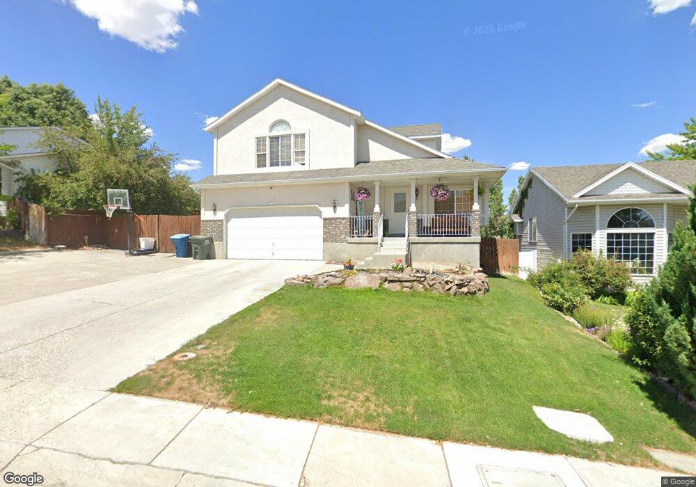
This home is located at 2074 Meadow Ridge Dr, Elko, NV 89801 and is currently estimated at $506,053, approximately $128 per square foot. 2074 Meadow Ridge Dr is a home located in Elko County with nearby schools including Mountain View Elementary School, Adobe Middle School, and Flagview Intermediate School.
Ownership History
Date
Name
Owned For
Owner Type
Purchase Details
Closed on
Jul 9, 2024
Sold by
Crowe Kami H
Bought by
Kami H Crowe Trust and Crowe
Current Estimated Value
Purchase Details
Closed on
Dec 23, 2015
Sold by
Crowe Kami C and Hernandez Kami C
Bought by
Crowe Kami C
Home Financials for this Owner
Home Financials are based on the most recent Mortgage that was taken out on this home.
Original Mortgage
$151,280
Interest Rate
3.92%
Mortgage Type
New Conventional
Purchase Details
Closed on
Jun 18, 2014
Sold by
Alegria Fred
Bought by
Crowe Steve W and Hernandez Kami C
Home Financials for this Owner
Home Financials are based on the most recent Mortgage that was taken out on this home.
Original Mortgage
$291,650
Interest Rate
4.1%
Mortgage Type
New Conventional
Create a Home Valuation Report for This Property
The Home Valuation Report is an in-depth analysis detailing your home's value as well as a comparison with similar homes in the area
Home Values in the Area
Average Home Value in this Area
Purchase History
| Date | Buyer | Sale Price | Title Company |
|---|---|---|---|
| Kami H Crowe Trust | -- | None Listed On Document | |
| Crowe Kami C | -- | Stewart Title Elko | |
| Crowe Steve W | $307,000 | Stewart Title |
Source: Public Records
Mortgage History
| Date | Status | Borrower | Loan Amount |
|---|---|---|---|
| Previous Owner | Crowe Kami C | $151,280 | |
| Previous Owner | Crowe Steve W | $291,650 |
Source: Public Records
Tax History Compared to Growth
Tax History
| Year | Tax Paid | Tax Assessment Tax Assessment Total Assessment is a certain percentage of the fair market value that is determined by local assessors to be the total taxable value of land and additions on the property. | Land | Improvement |
|---|---|---|---|---|
| 2025 | $3,355 | $105,463 | $19,950 | $85,513 |
| 2024 | $3,355 | $102,401 | $14,875 | $87,526 |
| 2023 | $3,058 | $96,976 | $14,875 | $82,101 |
| 2022 | $2,969 | $84,524 | $14,875 | $69,649 |
| 2021 | $2,883 | $82,861 | $14,875 | $67,986 |
| 2020 | $2,798 | $81,422 | $12,250 | $69,172 |
| 2019 | $2,712 | $77,847 | $12,250 | $65,597 |
| 2018 | $2,730 | $78,357 | $12,250 | $66,107 |
| 2017 | $2,699 | $77,481 | $12,250 | $65,231 |
| 2016 | $2,734 | $77,764 | $12,250 | $65,514 |
| 2015 | $2,708 | $76,380 | $12,250 | $64,130 |
| 2014 | $2,619 | $73,403 | $12,250 | $61,153 |
Source: Public Records
Map
Nearby Homes
- TBD Spruce Rd
- 1951 Sierra Dr
- 998 Northside Dr
- 2607 Platinum Dr
- 2043 Sierra Dr
- 2320 N 5th St
- 2206 Clearwater Ct
- 2503 5th St
- 2505 5th St
- 611 Chris Ave
- 072006013 Walnut St
- 3346 Carlson Ave
- 2621 Platinum Dr
- 2623 Platinum Dr
- 0 Interstate 80
- 2612 Platinum Dr
- 202 Forest Ln
- 515 Ash St Unit 1
- 519 Ash St Unit 7
- 523 Ash St Unit 2
- 2070 Meadow Ridge Dr
- 2078 Meadow Ridge Dr
- 215 Aerie Ln
- 2082 Meadow Ridge Dr
- 219 Aerie Ln
- 2077 Meadow Ridge Dr
- 223 Aerie Ln
- 2086 Meadow Ridge Dr
- 2069 Meadow Ridge Dr
- 202 Aerie Ln
- 2065 Meadow Ridge Dr
- 206 Aerie Ln
- 2073 Meadow Ridge Dr
- 2081 Meadow Ridge Dr
- 210 Aerie Ln
- 227 Aerie Ln
- 2090 Meadow Ridge Dr
- 2061 Meadow Ridge Dr
- 203 Raptor Ct
- 2085 Meadow Ridge Dr