Estimated Value: $439,000
2
Beds
1
Bath
1,188
Sq Ft
$370/Sq Ft
Est. Value
About This Home
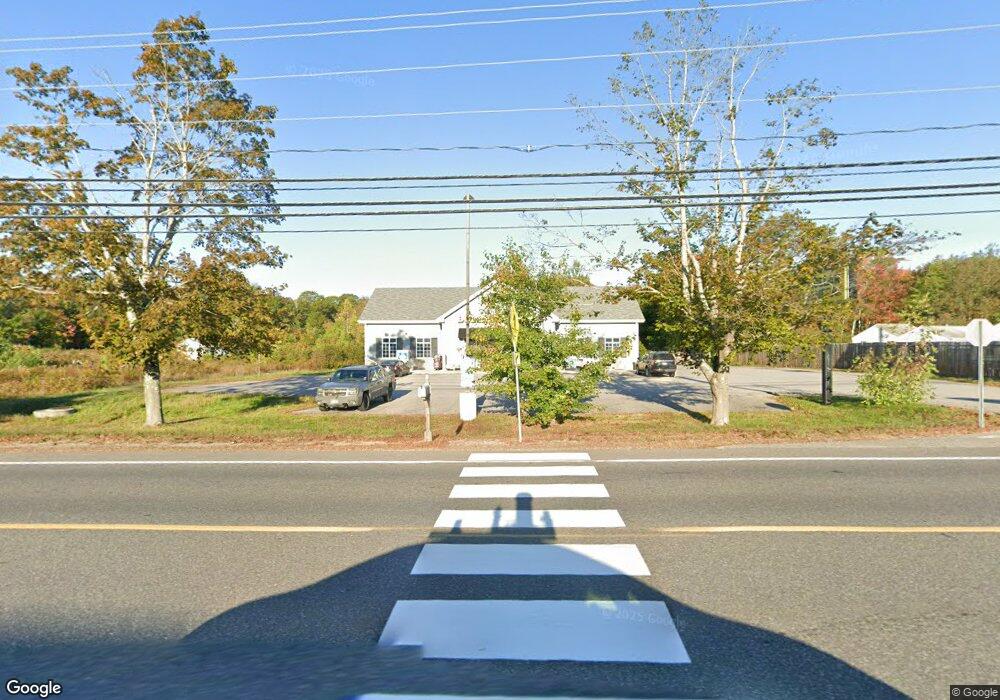
This home is located at 2074 Post Rd, Wells, ME 04090 and is currently estimated at $439,000, approximately $369 per square foot. 2074 Post Rd is a home with nearby schools including Wells Junior High School, Wells Elementary School, and Wells High School.
Ownership History
Date
Name
Owned For
Owner Type
Purchase Details
Closed on
Jun 4, 2018
Sold by
Wells Bts Retail Llc
Bought by
122 Chestnut Llc
Current Estimated Value
Home Financials for this Owner
Home Financials are based on the most recent Mortgage that was taken out on this home.
Original Mortgage
$1,034,414
Outstanding Balance
$882,966
Interest Rate
4.4%
Mortgage Type
Purchase Money Mortgage
Estimated Equity
-$443,966
Purchase Details
Closed on
Aug 29, 2017
Sold by
Multiple Rt and Lsm Inc Tr
Bought by
Wells Bts Retail Llc
Home Financials for this Owner
Home Financials are based on the most recent Mortgage that was taken out on this home.
Original Mortgage
$1,424,000
Interest Rate
4.03%
Mortgage Type
Purchase Money Mortgage
Create a Home Valuation Report for This Property
The Home Valuation Report is an in-depth analysis detailing your home's value as well as a comparison with similar homes in the area
Home Values in the Area
Average Home Value in this Area
Purchase History
| Date | Buyer | Sale Price | Title Company |
|---|---|---|---|
| 122 Chestnut Llc | -- | -- | |
| Wells Bts Retail Llc | -- | -- |
Source: Public Records
Mortgage History
| Date | Status | Borrower | Loan Amount |
|---|---|---|---|
| Open | 122 Chestnut Llc | $1,034,414 | |
| Closed | Wells Bts Retail Llc | $1,424,000 |
Source: Public Records
Tax History
| Year | Tax Paid | Tax Assessment Tax Assessment Total Assessment is a certain percentage of the fair market value that is determined by local assessors to be the total taxable value of land and additions on the property. | Land | Improvement |
|---|---|---|---|---|
| 2025 | $2,917 | $451,580 | $413,240 | $38,340 |
| 2024 | $2,746 | $451,580 | $413,240 | $38,340 |
| 2023 | $2,691 | $451,580 | $413,240 | $38,340 |
| 2022 | $7,587 | $271,910 | $257,870 | $14,040 |
| 2021 | $7,630 | $271,910 | $224,770 | $47,140 |
| 2020 | $5,972 | $271,910 | $257,870 | $14,040 |
| 2019 | $2,833 | $271,910 | $257,870 | $14,040 |
| 2018 | $2,806 | $271,910 | $257,870 | $14,040 |
| 2017 | $2,913 | $286,690 | $272,650 | $14,040 |
| 2016 | $3,292 | $327,190 | $272,650 | $54,540 |
Source: Public Records
Map
Nearby Homes
- 66 Nicholas Dr
- 50 Coles Hill Rd
- Lots 1-6 Pike Rd
- 170 Sylvan Way Unit 44
- 1801 Post Rd Unit 128
- 1801 Post Rd Unit 190
- 1762 Post Rd Unit 206
- 1762 Post Rd Unit 138
- 54 Bypass Rd Unit 107
- TBD Eagle Crest Dr
- 28 Coggeshall Ln
- 1627 Post Rd Unit 5
- 99 Harbor Rd Unit Lot 52
- 99 Harbor Rd Unit Lot 54
- 43 Schooner Way Unit 27
- 15 Heritage Dr Unit 15
- 33 Heritage Dr Unit 10-9
- 64 Anna Robert Cir
- 500 Atlantic Ave Unit 2
- 20 Ray Mary Ln
- 2062 Post Rd
- 2090 Post Rd (Route One) Unit 6B
- 2090 Post Rd (Route One) Unit 10B
- 2090 Post Rd (Route One) Unit 5B
- 2090 Post Rd (Route One) Unit 9B
- 2090 Post Rd (Route One) Unit 4B
- 2090 Post Rd (Route One) Unit 3B
- 2090 Post - Route One Unit 1B
- 2090 Post Rd Unit 3B
- 2090 Post Rd Unit 9B
- 2090 Post Rd Unit 9A
- 2090 Post Rd Unit 8B
- 2090 Post Rd Unit 8A
- 2090 Post Rd Unit 7B
- 2090 Post Rd Unit 4A
- 2090 Post Rd Unit 3A
- 2090 Post Rd Unit 2A
- 2090 Post Rd Unit 1A
- 2090 Post Rd Unit 13B
- 2090 Post Rd Unit 10B
Your Personal Tour Guide
Ask me questions while you tour the home.