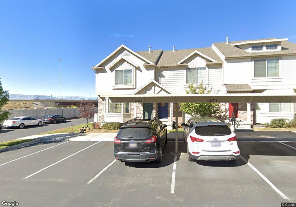
2074 W 1080 N Unit 101 Provo, UT 84604
Rivergrove NeighborhoodEstimated Value: $393,000 - $409,052
4
Beds
4
Baths
2,084
Sq Ft
$194/Sq Ft
Est. Value
About This Home
This home is located at 2074 W 1080 N Unit 101, Provo, UT 84604 and is currently estimated at $404,013, approximately $193 per square foot. 2074 W 1080 N Unit 101 is a home located in Utah County with nearby schools including Westridge Elementary School, Dixon Middle School, and Provo High School.
Ownership History
Date
Name
Owned For
Owner Type
Purchase Details
Closed on
Oct 18, 2021
Sold by
Evans Trevor Adrian Alexander and Ray Kristen
Bought by
Boyles Dalton T
Current Estimated Value
Home Financials for this Owner
Home Financials are based on the most recent Mortgage that was taken out on this home.
Original Mortgage
$368,600
Outstanding Balance
$336,129
Interest Rate
2.8%
Mortgage Type
New Conventional
Estimated Equity
$67,884
Purchase Details
Closed on
May 30, 2013
Sold by
Independence Avenue Llc
Bought by
Maddox Independence Rentals Llc
Home Financials for this Owner
Home Financials are based on the most recent Mortgage that was taken out on this home.
Original Mortgage
$3,005,310
Interest Rate
3.37%
Mortgage Type
Construction
Create a Home Valuation Report for This Property
The Home Valuation Report is an in-depth analysis detailing your home's value as well as a comparison with similar homes in the area
Home Values in the Area
Average Home Value in this Area
Purchase History
| Date | Buyer | Sale Price | Title Company |
|---|---|---|---|
| Boyles Dalton T | -- | Metro National Title | |
| Maddox Independence Rentals Llc | -- | Provo Land Title Co |
Source: Public Records
Mortgage History
| Date | Status | Borrower | Loan Amount |
|---|---|---|---|
| Open | Boyles Dalton T | $368,600 | |
| Previous Owner | Maddox Independence Rentals Llc | $3,005,310 |
Source: Public Records
Tax History Compared to Growth
Tax History
| Year | Tax Paid | Tax Assessment Tax Assessment Total Assessment is a certain percentage of the fair market value that is determined by local assessors to be the total taxable value of land and additions on the property. | Land | Improvement |
|---|---|---|---|---|
| 2025 | $2,137 | $210,595 | $56,300 | $326,600 |
| 2024 | $2,137 | $210,320 | $0 | $0 |
| 2023 | $2,070 | $200,860 | $0 | $0 |
| 2022 | $2,169 | $212,245 | $0 | $0 |
| 2021 | $1,700 | $290,100 | $43,500 | $246,600 |
| 2020 | $1,583 | $253,300 | $38,000 | $215,300 |
| 2019 | $1,503 | $250,000 | $32,500 | $217,500 |
| 2018 | $1,367 | $230,700 | $29,000 | $201,700 |
| 2017 | $1,234 | $114,400 | $0 | $0 |
| 2016 | $1,254 | $108,350 | $0 | $0 |
| 2015 | $1,184 | $103,400 | $0 | $0 |
| 2014 | $463 | $42,130 | $0 | $0 |
Source: Public Records
Map
Nearby Homes
- 2075 W 1080 N
- 2043 W 1100 N
- 1127 Independence Ave
- 962 Independence Ave
- 927 Independence Ave
- 932 N 1760 W
- 1893 Cascade Dr
- 1620 W 1000 N
- 2397 W 1160 N
- 1503 N 1980 W
- 582 N 2310 W
- 1574 W 1400 N
- 2216 W 480 N
- 2316 W 510 N
- 1616 N 2100 W
- 1475 Arthur Dr Unit 7A
- 1471 W 1460 N
- 392 N 2150 W
- 1682 N 2250 W
- 1679 N 2250 W
- 2070 W 1080 N
- 2066 W 1080 N Unit 103
- 2066 W 1080 N
- 2058 W 1080 N
- 2054 W 1080 N
- 2050 W 1080 N
- 2071 W 1080 N Unit 94C
- 2071 W 1080 N
- 2075 W 1100 N
- 2067 W 1080 N Unit 95
- 2075 W 1080 N Unit 93
- 2071 W 1100 N
- 2079 W 1100 N
- 2046 W 1080 N
- 2063 W 1080 N Unit 96
- 2067 W 1100 N
- 2067 W 1100 N Unit 2067
- 2059 W 1080 N
- 2059 W 1080 N Unit 97B
- 2059 W 1100 N Unit 124